Refine your search
Filtered by:
- Category,
- Item Type
- List
- Grid
A subscription to the Price Guide is required to view results for auctions ten days or older. Click here for more information
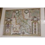

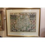
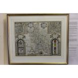
A John Speed map of 'Buckingham both Shyre and Shire town described', 38.5cm by 51.5cm, framed
A John Speed map of 'Buckingham both Shyre and Shire town described', 38.5cm by 51.5cm, framed
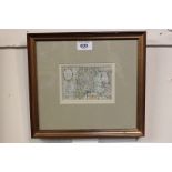
An Abraham Ortelius map of Scotland, Scotiae Tabula, in double sided frame with Latin text verso,
An Abraham Ortelius map of Scotland, Scotiae Tabula, in double sided frame with Latin text verso, 36cm by 48cm
Two framed 18th century maps of Scotland and Ireland, 'The Kingdome of Scotland' and 'The Kingdome
Two framed 18th century maps of Scotland and Ireland, 'The Kingdome of Scotland' and 'The Kingdome of Irland', both in double sided frame, verso w...
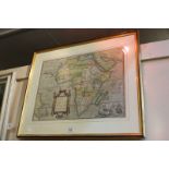
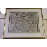
An Abraham Ortelius map of Africa, Africae Tabula Nova, in double sided frame with Latin text verso,
An Abraham Ortelius map of Africa, Africae Tabula Nova, in double sided frame with Latin text verso, 38cm by 51cm
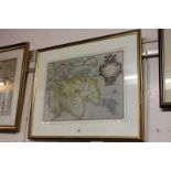
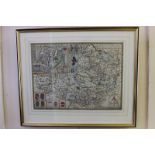
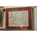
A 17th century John Speed hand coloured map of Surrey, described and divided into Hundreds, dated
A 17th century John Speed hand coloured map of Surrey, described and divided into Hundreds, dated 1610, 38cm by 50.5cm, the double aspect frame sh...
A 17th century John Speed (Johan Speede) hand coloured map of 'The West Ridings of Yorkeshyre with
A 17th century John Speed (Johan Speede) hand coloured map of 'The West Ridings of Yorkeshyre with the most famous and fayre citie Yorke described...
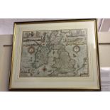
A 17th century John Speed (Johan Speede) hand coloured map of 'The Kingdom of Great Britaine and
A 17th century John Speed (Johan Speede) hand coloured map of 'The Kingdom of Great Britaine and Ireland', engraved by J Hondius, dated 1653, the ...
A 17th century John Speed (Johan Speede) hand coloured map of 'Somerset-Shire, described and into
A 17th century John Speed (Johan Speede) hand coloured map of 'Somerset-Shire, described and into Hundreds devided, with the plott of the farmers ...
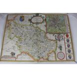
A 17th century John Speed (Johan Speede) hand coloured map of 'Buckingham both Shyre and Shire towne
A 17th century John Speed (Johan Speede) hand coloured map of 'Buckingham both Shyre and Shire towne described', dated 1610, the double aspect fra...
A 17th century John Speed (Johan Speede) hand coloured map of 'The West Ridinge of Yorkeshyre with
A 17th century John Speed (Johan Speede) hand coloured map of 'The West Ridinge of Yorkeshyre with the most famous and fayre citie Yorke described...
A late 18th century framed map of Holland by Antonio Zatta, 'Le Provincie di Zelanda, Utrecht,
A late 18th century framed map of Holland by Antonio Zatta, 'Le Provincie di Zelanda, Utrecht, Gheldria, E Brabante Ollandese con la parte meridio...