Refine your search
Sale Section
- Antiquarian Literature and History (104)
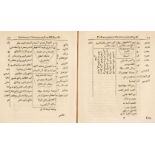
- Arabic and Non-Western Manuscripts (9)
- Art Reference (14)
- Bookbinding Equipment and Materials (32)
- British Topography (31)
- Decorative Prints (39)
- General Literature (14)
- General Stock (50)
- Historical Autographs, Documents and Ephemera (62)
- Maps (85)
- Natural History (10)
- Science & Medicine (3)
- The Bookbindery of Faith Shannon MBE (40)
- The David Smith Print Collection Part V (29)
- Travel & Exploration (28)
Estimate
Category
- Books & Periodicals (291)
- Maps (85)
- Prints (81)
- Arms, Armour & Militaria (16)
- Tools (11)
- Watercolours (9)
- Furniture (7)
- Islamic Works of Art (6)
- Ceramics (5)
- Stamps (5)
- Classic Cars, Motorcycles & Automobilia (4)
- Kitchenalia (4)
- Coins (3)
- Musical Instruments & Memorabilia (3)
- Collectables (2)
- Models, Toys, Dolls & Games (2)
- Russian Works of Art (2)
- Sculpture (2)
- Vintage Fashion (2)
- Bank notes (1)
- Chinese Works of Art (1)
- Drawings & Pastels (1)
- Glassware (1)
- Salvage & Architectural Antiques (1)
- Scientific Instruments (1)
- Silver & Silver-plated items (1)
- Sporting Memorabilia & Equipment (1)
- Textiles (1)
- Writing Instruments (1)
- List
- Grid
A subscription to the Price Guide is required to view results for auctions ten days or older. Click here for more information

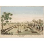
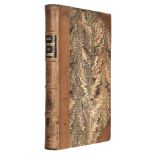
Allom (Thomas, illustrator). China in a Series of Views, displaying the Scenery, Architecture, and Social Habits, of that Ancient Empire ... WIth ...
* Angas (George French, 1822-86). A collection of fourteen views from South Australia Illustrated, Thomas McLean, 1846-47, 14 fine hand-coloured m...
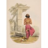
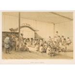
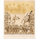
Belnos (Mrs S[ophia] C[harlotte]). The Sundhya or the Daily Prayers of the Brahmins. Illustrated in a Series of Original Drawings from Nature, dem...
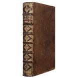
Broelmann (Stephan). Epideigma, sive specimen historiae vet[eris] omnis et purae, florentis. atq. amplae civitatis ubiorvm, et eorum ad Rhenum Agr...
Browne (Edward G.) A Year Amongst the Persians. Impressions as to the life, character, and thought of the people of Persia, received during Twelve...
Catlow (Agnes and Maria E.) Sketching Rambles; or, Nature in the Alps and Apennines, 2 volumes, 1st edition, London: James Hogg and Sons, [1861], ...
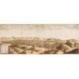
* [Chardin, Jean, 1643-1713]. Tauris (i.e. Tabriz, Iran), from Voyages en Perse et autres Indes de l'Orient, 1711, hand-coloured engraved panorama...
Cunynghame (Sir Arthur Augustus Thurlow). A Glimpse at the Great Western Republic, 1st edition, London: Richard Bentley, 1851, [6] 337 pp., half-t...
* Daumont (Jean Francois, 1740-1775). Prospectus Lacus et Pagi Sinensis - Un Lac et Village de la Cochinchine, Paris, circa 1760, hand-coloured en...
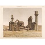
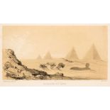
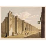
* Egypt. 10 engraved views on 8 sheets from Description de l'Egypte, 1820-29, 10 hand-coloured engraved views on 8 sheets by Baltard, Testard, Lou...
Estourmel (Joseph, comte d'). Journal d'un voyage en orient, 2 volumes, 1st edition, Paris: Crapelet, 1844, viii 338, [4] 566 [1], half-titles, er...

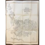
France. Donnet (Alexis). Carte topographique minéralogique et Statistique de la France réduite de celle de Cassini, a l'échelle de 1/388,800..., P...
Freeman-Mitford (A.B.) The Attaché at Peking, 1st edition, London: Macmillan and Co., 1900, folding plan, advertisement leaf, endpapers spotted, b...
Gell (Sir William). The Itinerary of Greece; containing One Hundred Routes in Attica, Boeotia, Phocis, Locris, and Thessaly, 1st edition, London: ...
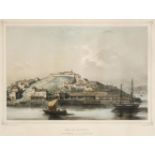
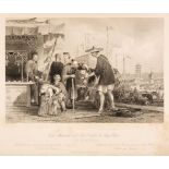
* Brazil. Three views of Rio de Janeiro: Baie Don Manuel, Cale de débarquement; L'Ile des Couleuvres; & Les Noirs au Marché, by Adolphe d'Hastrel ...
Hawks (Francis L.). Narrative of the Expedition of an American Squadron to the China Seas ..., 1856
Hawks (Francis L.). Narrative of the Expedition of an American Squadron to the China Seas and Japan ... under the command of Commodore M.C. Perry ...
Henwood (William Rory). Report on the Metalliferous Deposits of Kumaon and Gurhwal in North-Western India, 1st edition, Calcutta: Thomas Jones, "C...
Herbelot (Barthelémy d'). Bibliothèque orientale, ou dictionaire universel contenant généralement tout ce qui regard la connoissance des peuples d...
Hottinger (Johann Heinrich). Promtuarium; sive, Bibliotheca orientalis: exhibens catalogum, sive, centurias aliquot, tam authorum, quam librorum H...
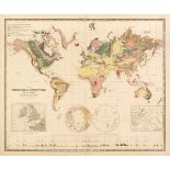
Johnston. (Alexander Keith). The Physical Atlas of Natural Phenomena, A New and Enlarged Edition, William Blackwood & Sons, 1856, title contents l...
Langlès (Louis-Mathieu). Monuments anciens et modernes de l'Hindoustan, décrits sous le double rapport archaeologique et pittoresque, et précédés ...
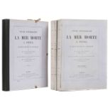
Luynes (Honoré Paul Joseph d'Albert, duc de). Voyage d'exploration à la mer Morte, à Petra, et sur la rive gauche du Jourdain. Œuvre posthume publ...

Mariti (Giovanni, editor). Istoria della guerra accesa nella Soria l'anno 1771. Dalle armi di Aly-Bey dell'Egitto e continovazione del successo a ...
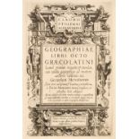
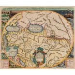
Mercator (Gerard) - Ptolemaeus (Claudius). Geographiae libri octo Graeco-Latini, Amsterdam: Cornelis Nicolai (i.e. Claesz) & Jodocus Hondius, 1605...
* [Murphy, James Cavanah, 1760-1814]. A collection of 37 plates from The Arabian Antiquities of Spain, circa 1815, 37 engraved plates, including 9...
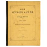
Ransonnet-Villez (Eugen von). Reise von Kairo nach Tor, zu den Korallenbänken des rothen Meeres, Vienna: Carl Ueberreuter, 1863, [vi], 34pp., 2 ha...
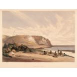
* Salt (Henry, 1780-1827). Sandy Bay Valley in the Island of St. Helena, 1809, hand-coloured aquatint on heavy wove paper with J Whatman watermark...
![Stanford (Edward [publisher]). Stanford's Compendium of Geography and Travel, 5 volumes, 1882-85](https://portal-images.azureedge.net/auctions-2021/srdom10167/images/89af595d-c323-4ac9-bae9-acef00fca37c.jpg?w=155&h=155)
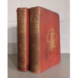
Stanford (Edward [publisher]). Stanford's Compendium of Geography and Travel, 5 volumes, 1882-85
Stanford (Edward [publisher]). Stanford's Compendium of Geography and Travel, 5 volumes, (Asia, by Augustus H. Keane, 1882, North America, by F. V...
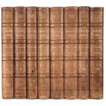
![Andrew Reid & Sons [publisher]. A History of Northumberland, 15 volumes, Newcastle-Upon-Tyne,](https://portal-images.azureedge.net/auctions-2021/srdom10167/images/eb89acd4-717f-4948-b296-acef00fca41b.jpg?w=155&h=155)
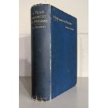
Andrew Reid & Sons [publisher]. A History of Northumberland, 15 volumes, Newcastle-Upon-Tyne,
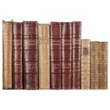
Andrew Reid & Sons [publisher]. A History of Northumberland, 15 volumes, Newcastle-Upon-Tyne, 1983-1940, numerous monochrome illustrations & maps,...
Ashmole (Elias). The Antiquities of Berkshire, 3 volumes, W. Mears and J. Hooke, 1723, printed title to each volume, lacking portrait of the autho...
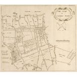
Badeslade (Thomas & William Henry Toms). Chorographia Britanniae. Or a set of Maps of all the Counties in England and Wales, London, 1742, engrave...
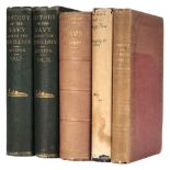
![Barrett (William). The History and Antiquities of the City of Bristol ..., [1789], and others](https://portal-images.azureedge.net/auctions-2021/srdom10167/images/db193d45-5eac-4cb3-86ff-acfc00ddd5c0.jpg?w=155&h=155)
Barrett (William). The History and Antiquities of the City of Bristol ..., [1789], and others
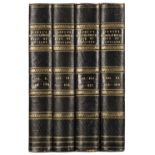
Barrett (William). The History and Antiquities of the City of Bristol ..., Bristol: William Pine, [1789], folding engraved map, with short closed ...
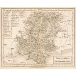
Bickham (George). The British Monarchy or, A New Chorographical Description of all the Dominions Subject to the King of Great Britain: Comprehendi...
Camden (William). Brittania: or, a Chorographical Description of the Flourishing Kingdoms of England, Scotland and Ireland, and the Islands Adjace...
Cruchley (G.F., publisher). Cruchley's County Atlas of England & Wales shewing all the Railways & Stations with their names, also the Turnpike Roa...
Depping. (George Bernhard). L'Angleterre ou Description historique et topographique du Royaume-Uni de la Grand-Bretagne, six volumes, 3rd edition,...
Dodsley (Robert & John Cowley). The Geography of England: Done in the Manner of Gordon's Geographical Grammar, 1st edition, London: Printed for R....
Dugdale (William). The History of Imbanking and Draining of divers Fens and Marshes, both in Foreign Parts and in this Kingdom, and of improvement...
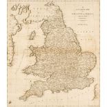
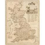
Ellis (John). Ellis's English Atlas: or, a compleat chorography of England and Wales: in fifty-four maps. Containing more particulars than any oth...
![Fisher, Son & Co. Fisher's County Atlas of England and Wales, [1845]](https://portal-images.azureedge.net/auctions-2021/srdom10167/images/b9fe2f22-426d-422d-8ba9-acf0011fd6ce.jpg?w=155&h=155)
Fisher, Son & Co. Fisher's County Atlas of England and Wales. Compiled from authentic surveys, and corrected to the present time. With a topograph...
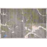
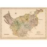
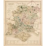
Geological map. Geological Survey of England and Wales, Sheet 24, Yorkshire, Ordnance Map Office, Southampton, 1854, Geological Information publis...
Grose (Francis). The Antiquities of England and Wales, 8 vols., London: Hooper & Wigstead, circa 1797, engraved frontispiece and title to each, 56...
Hall (Sidney). [A New British Atlas Comprising a series of 54 Maps, Constructed from the most recent Surveys, published Chapman & Hall, 1834 or la...
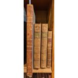
Hodgson (John). A History of Northumberland, part 2 vols. 1-3 & part 3 vols. 1-3, Newcastle 1820-40
Hodgson (John). A History of Northumberland, in three Parts, (comprising Part I, Part II volumes 1-3 & Part III volumes 1-3), Newcastle 1820-40, 5...
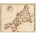
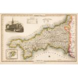
Lewis (Samuel). [An Atlas comprising Maps of the Several Counties, divided into Unions and of the Islands of Guernsey, Jersey and Man; with a Map ...
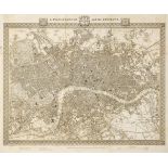
Lewis (Samuel). A Topographical Dictionary of England, 4 volumes, London: S. Lewis and Co., 1831, folding engraved plan of London, 44 engraved map...
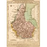
Morris & Co. Commercial Directory and Gazetteer of Somersetshire with Bristol, Nottingham, Hounds Gate, 1872, numerous advertisements, original ma...
Ormerod (George). The History of the County Palatine and City of Chester, 2nd edition, revised and enlarged by Thomas Helsby, 3 volumes in 6, Lond...
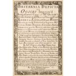
Owen (John & Bowen Emanuel). Britannia Depicta or Ogilby Improv'd..., 4th edition, Thomas Bowles 1731, printed title, four leaves containing an in...
Pigot (James). Composite British Atlas, London: James Pigot, circa 1832, 42 engraved maps, hand-coloured in outline, including folding map titled ...
Pilkington (James). A View of the Present State of Derbyshire; with an account of its most remarkable antiquities, 2 volumes, 2nd edition, Derby &...
Russell (P. & Owen Price). England Displayed. Being a New, Complete, and Accurate Survey and Description of the Kingdom of England, and Principali...

Sacheverell (William). An Account of the Isle of Man, its inhabitants, language, soil, remarkable curiosities..., 1st edition, J. Hartley, 1702, a...

Seyer (Samuel). Memoirs Historical and Topographical of Bristol and Its Neighbourhood, 2 volumes, Bristol, printed for the author by John Mathew G...
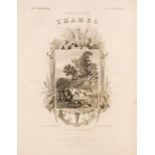
Tombleson, (William & Fearnside William Gray). Tombleson's Thames, Tombleson & Co. & Creuzbaner & Co. circa 1850, lacking title page but retaining...
Walker (J. & C.) British Atlas, Comprising separate Maps of every County in England, each Riding in Yorkshire and North & South Wales, showing the...
Wallis (James). Wallis's New British Atlas containing a Complete Set of County Maps, divided into hundreds in which are carefully delineated all t...
![Wallis (James). Wallis's New Pocket Edition of the English Counties, c.1812-[14]](https://portal-images.azureedge.net/auctions-2021/srdom10167/images/0f9307a1-609d-40d6-85a7-acf0011fdbd8.jpg?w=155&h=155)
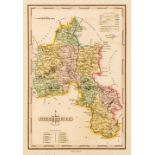
Wallis (James). Wallis's New Pocket Edition of the English Counties or Travellers Companion in which are carefully laid down all the Direct & Cros...
Wallis (James). Wallis's New Pocket Edition of the English Counties or Travellers Companion in which are carefully laid down all the Direct & Cros...

Blunt (Wilfrid & William T. Stearn, editors). Captain Cook's Florilegium. A Selection of Engravings from the Drawings of Plants Collected by Josep...