Filtered by:
- Sale Section
- List
- Grid
A subscription to the Price Guide is required to view results for auctions ten days or older. Click here for more information
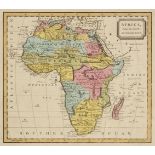

Africa. A collection of 27 maps of the continent, mostly 19th century, engraved maps including examples by Barlow, Rapkin, Topham, Arrowsmith, Cha...
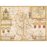
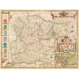
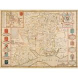
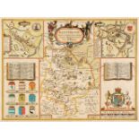
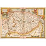
Bedfordshire. Speed (John), Bedford Shire and the Situation of Bedford described, with the armes of those Honorable Familyes that have borne ye ti...
Berkshire. Hollar (Wenceslaus), A New Map of Barkshire with all the Hundreds, Parkes and other Places thereunto belonging, John Overton, circa 167...
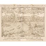
Braun (Georg & Hogenberg Franz). Orivetum vulgo Orvieto Thusciae, Noblissimae Italiae Regionis Opp. [on sheet with] Lavretum, Agri Recenaten in It...
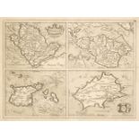
British Islands. Mercator (G. & Hondius J.). Anglesey, Garnesay, Jarsay & Wight Vectis, 1620
British Islands. Mercator (G. & Hondius J.). Anglesey, Garnesay, Jarsay & Wight Vectis olim, circa 1620, four uncoloured engraved maps on one shee...
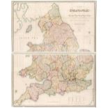
British Isles. Blaeu (Johannes), Anglia Regnum, Amsterdam, circa 1662, engraved map with contemporary outline colouring, slight spotting and dust ...
British Isles. Ortelius (Abraham), Angliae, Scotiae et Hiberniae sive Britannicar: Insularum Descriptio, Antwerp [1608], uncoloured engraved map o...
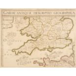
British Isles. Sanson (Nicolas), Galliae Antiquae Descriptio Geographica, 1641 or later, engraved map of the southern half of the British Isles wi...
British Isles. Walker (J & C), Map of the British Isles showing the Cities, Boroughs & Market Towns, the Principal Villages, Railways, Mail & Turn...
* Canal Maps. A collection of eight canal maps, mostly circa 1770, engraved linear canal maps, 7 originally published in 'The Gentleman's Magazine...
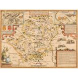
Carmarthenshire. Speed (John), Caermarden Both Shyre and Towne described, John Sudbury & George Humble, [1627], hand-coloured engraved map, inset ...
![Cary (John). Cary's New Map of England and Wales with part of Scotland, 1794 [1804]](https://portal-images.azureedge.net/auctions-2021/srdom10167/images/9541cd28-bf43-4f88-a1f3-acef00fd5166.jpg?w=155&h=155)
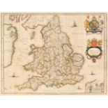
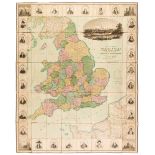
Cary (John). Cary's New Map of England and Wales with part of Scotland on which are carefully laid down all the Direct and Principal Cross Roads, ...
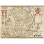
Cole (George & Roper John). A collection of 65 county maps, [1816 and later], hand-coloured English and Welsh engraved county maps, occasional dup...
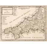
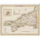
Cornwall. Five maps of Cornwall, 18th & 19th century, including Morden (Robert). Cornwell, circa 1701, uncoloured engraved map, old folds, 165 x 2...
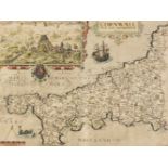
* Cornwall. Saxton (C & Kip W.), Cornwall olim pars Danmoniorum, circa 1610, hand-coloured engraved map, inset view of Launceston, 305 x 400 mm, m...
Dorset. Saxton (Christopher & Lea Philip), Dorsetshire described by C. Saxton. Corrected and Amended with many Additions as Roads &c by P. Lea, ci...
* England & Wales. Bowen (Emanuel), A New and Accurate map of England & Wales, Describing in a distinct & more correct manner, than any other map ...
England & Wales. Dower (J.). A New Map of England & Wales Divided into Counties, Parliamentary Divisions & Dioceses shewing the Principal Roads, R...
England & Wales. Seaton (Robert), This New Map of England & Wales, with the adjacent Countries, Compiled by Surveyors Employed in the Ordnance Dep...
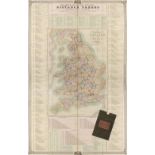
England & Wales. Walker (J & C), A New Map of England and Wales, with part of Scotland showing the Mail Coach, Turnpike & Railroads, Canals &c. 18...
Essex. Greenwood (C & J), Map of the County of Essex, from an actual survey made in the year 1824..., Greenwood, Pringle & Co. July 1st 1825, larg...
Essex. Speed (John), Essex devided into Hundreds, with the most Antient and fayre Towne Colchester Described and other memorable Monuments observe...
Frankfurt. Munster (Sebastian). Frankfurt an der Oder..., circa 1568, uncoloured woodblock city plan, additional French title above map, slight ma...
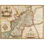
Gloucestershire. Saxton (Christopher), Glocestriae sive Claudiocestriae Comitat (Claudy Caesaris Nomine ad huc Celebrat) Verus Tipus atq Effigies....
Hampshire. A collection of approximately 65 maps, 17th - 20th century, engraved and lithographic regional and county maps, town, canal, hunting an...
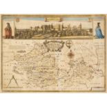
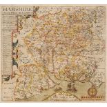
Hampshire. Speed (John), Hantshire described and devided, Thomas Bassett & Richard Chiswell [1676], hand-coloured engraved map, an inset town plan...
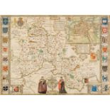
Hertfordshire. Speed (John), Hartfordshire Described, The Sittuations of Hartford and the most ancient Towne St. Albons with such memorable action...
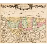
Holy Land. Ottens (R. & J.), Het Beloofde Landt Israels. Terra Sancta..., Amsterdam, circa 1765
Holy Land. Ottens (Reiner & Joshua), Het Beloofde Landt Israels. Terra Sancta sive Promissionis, olim Palestina..., Amsterdam, circa 1765, engrave...
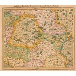
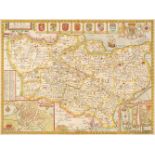
* Hungary. (Munster (Sebastian), Landtafel des Ungerlands, Polands, Reussen, Littaw, Walachen und Bulgaren, Basel [1550 or later], hand-coloured w...
Huntingdonshire. Speed (John), Huntingdon both Shire and Shire Towne with the Ancient Citie Ely Described, 1st edition, George Humble [1611], hand...
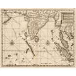
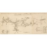
Indian Ocean. De Bruyn (Cornelius) Route Exacte de Gamron à Batavia et de Batavia à Gamron, originally published in "Travels into Muscovy, Persia,...
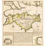
Isle of Wight. A collection of thirty maps, 18th & 19th century, engraved and lithographic maps, including De Fer (Nicolas). L'Isle de Wight..., c...
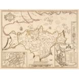
Isle of Wight. Speed (John), Wight Island, Thomas Bassett & Richard Chiswell, [1676 or later], engraved map with sparse contemporary outline colou...
* Jerusalem. Adrichom (Christian van), Jerusalem, et suburbia eius, sicut tempore Christi floruit cum locis in quibus Christus passus est quae rel...
Kent. Speed (John), Kent with her Cities and Earles Described and Observed, Thomas Bassett & Richard Chiswell, [1676], hand-coloured engraved map,...
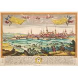
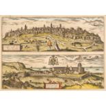
Konigsberg (Kaliningrad). Ten engraved views, mostly 16th - 18th century, including Werner (Friedrich Bernard). Regius Mons Königsberg, [1735], ha...
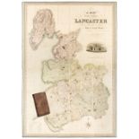
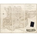
Lancashire. Hennet (G.), A Map of the County Palatine of Lancaster Divided into Hundreds and Parishes from an accurate survey made in the years 18...

Leicestershire. Speed (John), Leicester both Countye and Citie described, The Honorable Famylies that have had the titles of Earls thereof with ot...
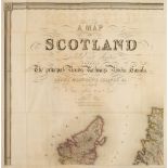
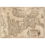
Lewis (Samuel). A Topographical Dictionary of Scotland..., with Historical and Statistical Descriptions: Embellished with a Large Map of Scotland....
Lincolnshire. Speed (John), The Countie and Citie of Lincolne Described with the Armes of them that have bene Earles thereof since the conquest, T...
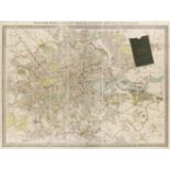
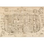
London. Philip (George & Son, publisher), Philips New Library Map of London and its Environs, circa 1895, large lithographic map, sectionalised an...
* Manchester. Dean (R. & W. publishers), A Plan of Manchester and Salford, 1809, hand-coloured engraved map, compass rose and decorative cartouche...
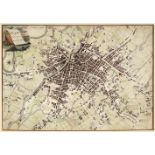
Manchester. Laurent (C.). A Topographical Plan of Manchester and Salford with the adjacent parts; shewing also the different allotments of land pr...
Maps. A collection of 38 British county, regional and country maps, town plans and charts, 17th - 19th century, including Bowen (Emanuel). An Accu...
Moule (Thomas). Moule's English Counties, 30 parts (only), G. Virtue, 1831, descriptive text and 30 engraved county maps and town plans, some maps...
Newsmaps. US Government (publisher), prepared and distributed by Army Orientation Course, War department, 102 periodicals, a broken run, 1942 - 46...
Norfolk. Saxton (Christopher & Lea Philip), Norfolk described by C. Saxton, Corrected and Amended with many Additions of Roads &c. by P. Lea, circ...
Norfolk. Saxton (Christopher), Norfolciae comitatus continens in se Oppida Mercatoria 26, Pagos et Villas625, Una cum singulis Hundredis et Flumin...
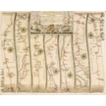
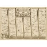
Ogilby (John). Six road maps, all relating to Wales - The Road from Welshpool com Montgomery to Carnarvon in North Wales, The Road from Monmouth t...
Ogilby (John). The Road from Bristoll to Worcester, [1675 or later], uncoloured engraved road map (complete on one sheet), 310 x 445 mm,Qty: (1)NO...
Ogilby (John). The Road from Hereford to Leicester, [1675 or later], uncoloured engraved strip road map (complete on one sheet), slight water stai...

Ogilby (John). The Road from Ipswich com Suffolk to Norwich and thence to Cromer, The Road from Kings-Lyn to Norwich Continued to Yarmouth in Norf...
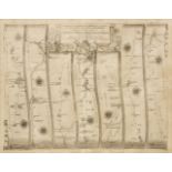
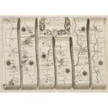
Ogilby (John). The Road from London to Boston in Lincolnsh. The Road from London to Flamborough Head com Ebor [and] The Road from London to Oakeha...
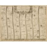
Ogilby (John). The Road from London to Buckingham continued to Banbury in com Oxon [and] The Continuation of the extended Road from Buckingham to ...
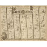
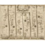
Ogilby (John). The Road from London to Holy-head co. Anglesey North Wales, The Continuation of the Road from London to Holy head, The Continuation...
Ogilby (John). The Road from London to St. Davids in com Pembroke, [1675 or later], uncoloured engraved strip road map, slight marginal water stai...
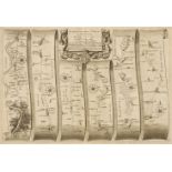
Ogilby (John). The Road from St Davids com Pembroke to Holywell com Flint [and] The Continuation of the Road from St Davids to Holywell, [1675 or ...
* Oxfordshire. Speed (John), Oxfordshire described with ye Citie and the Armes of the Colledges of ye famous University, Thomas Bassett & Richard ...

* Poland. Blauvitz (Christoph), N - Ro I. Diese Carte zeiget uns dass Hoch Freiherrl. Fidei Comiss guth Praub mit dem herschafftlichen Schlob und ...
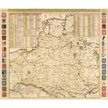
* Poland. Chatelain (Henri Abraham), Carte de Pologne avec la Chronologie des Rois et des Ducs de Lithuanie..., circa 1714, hand-coloured engraved...