Filtered by:
- Category,
- Item Type
- List
- Grid
A subscription to the Price Guide is required to view results for auctions ten days or older. Click here for more information
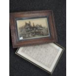

An 18th century map engraving, road from London to Carlisle, and a 19th century Osborne plaque of
An 18th century map engraving, road from London to Carlisle, and a 19th century Osborne plaque of Chester
An illustrated Geographical sketch map for the County of Lancashire 1836
Yorkshire Topography. Morant, A. W. (ed.) - The History and Antiquities of the Deanery of Craven, in
Yorkshire Topography. Morant, A. W. (ed.) - The History and Antiquities of the Deanery of Craven, in the County of York. Leeds: Joseph Dodgson, 18...
![Map. South Lancashire [East & West divisions]. 1842/43. Scale of one inch to a Statute Mile.](https://portal-images.azureedge.net/auctions-2019/sr1810303/images/a067da6f-4995-439e-9d6c-aad200e78ef4.jpg?w=155&h=155)
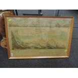
Map. South Lancashire [East & West divisions]. 1842/43. Scale of one inch to a Statute Mile.
Map. South Lancashire [East & West divisions]. 1842/43. Scale of one inch to a Statute Mile. Measures total: 159cm x 100cm. Presented in two parts...
Map. Ordnance Survey of Great Britain: Lancashire. 1 inch scale. 1852. In 3 parts. South, Central
Map. Ordnance Survey of Great Britain: Lancashire. 1 inch scale. 1852. In 3 parts. South, Central and North divisions. Published by Lieut. Col. Ha...
Teesdale's Map of Lancashire. A Map of the County Palatine of Lancaster, Divided into Hundreds and
Teesdale's Map of Lancashire. A Map of the County Palatine of Lancaster, Divided into Hundreds and Parishes from an Accurate Survey made in the Ye...
Antiquarian. Barclay, Rev. James - A complete and universal dictionary of the English language
Antiquarian. Barclay, Rev. James - A complete and universal dictionary of the English language comprehending the explanation, pronunciation, origi...