


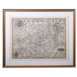
John Speed 17th century engraved map of Africa, engraved by Abraham Goos, English text verso, plate 40 x 52cm
34 item(s)
Filtered by:
- Primary Category,
- Creator / Brand
- Elenco
- Grid
-
34 item(s)/page

Lotto 846
John Speed 17th century engraved map - Britain as it was Devided in the Tyme of the English Saxons
John Speed 17th century engraved map - Britain as it was Devided in the Tyme of the English Saxons especially during their Heptarchy, sold by Bass...

John Speed - 17th century engraved map - The Kingdom of China, sold by Baskett and Chiswell, English text verso, plate 40 x 51cm

John Speed - 17th century engraved map of Asia, sold by Baskett and Chiswell, with English text verso, plate 40 x 51cm

John Speed - 17th century engraved map of Europ and the chiefe Cities contayned therin ..., pen inscriptions to the margins, English text verso, p...

John Speed 17th century engraved map of The British Isles, English text verso, plate 41 x 50cm

Lotto 89
JOHN SPEED coloured 1610 copper engraved map - entitled in cartouche 'Caermarden, Both Shyre and
JOHN SPEED coloured 1610 copper engraved map - entitled in cartouche 'Caermarden, Both Shyre and Town described', with inset plan of Carmarthen to...

John Speed - 17th century engraved Map of America, dated 1626 (but 1676), sold by Baskett and Chiswell, pen inscriptions to margin, English text v...

John Speed 17th century engraved map of The Romane Empire, English text verso, plate 41 x 50cm

Lotto 475
A QUANTITY OF 17TH, 18TH AND 19TH CENTURY WELSH AND ENGLISH MAPS, to include a John Speed map of
A QUANTITY OF 17TH, 18TH AND 19TH CENTURY WELSH AND ENGLISH MAPS, to include a John Speed map of Wales with counties either side circa 1610, John ...

Lotto 412
John Speed (British,1552-1629) Cumberland, handcoloured engraved map, circa 1627, 42x53cm, framed
412John Speed (British,1552-1629) Cumberland, handcoloured engraved map, circa 1627, 42x53cm, framed
John Speed (British,1552-1629) Cumberland, handcoloured engraved map, circa 1627, 42x53cm, framed and glazed.

Lotto 651
John Speed (1552-1629), a coloured map of Jamaica and Barbados, sold by Thomas Basset in Fleet
John Speed (1552-1629), a coloured map of Jamaica and Barbados, sold by Thomas Basset in Fleet Street, and Richard Chiswell in St Paul's Churchya...

Lotto 27
SPEED, John:
SPEED, John: The Isle of Man Exactly described...Described by Tho. Durham Ano. 1595, performed by John Speed Anno 1610. [1676], Bassett & Chis...

John Speed 17th century engraved map of Bermuda, sold by Baskett and Chiswell, plate 40 x 53cm, English text verso

Lotto 54
SPEED, John:
SPEED, John: Bohemia Newly described by John Speed Anno Dom. 1626 . c.1676. Not coloured, 42.5 x 55cm

Collection of John Speed Welsh maps, all circa 1627, Anglesey, Denbighshire, Flintshire, Montgomeryshire, Caernarvon, Cardiganshire, Radnor, Brekn...

John Speed 17th century engraved map of Greece, sold by Baskett and Chiswell, English text verso, plate 41 x 50cm

John Speed - 17th century engraved map of Tartary, sold by Baskett and Chiswell, English text verso, plate 39 x 50cm

Lotto 424
JOHN SPEED, BRITISH, 1552 - 1629, ENGRAVING WITH HAND COLOURING Titled ‘The Kingdome of England’
JOHN SPEED, BRITISH, 1552 - 1629, ENGRAVING WITH HAND COLOURING Titled ‘The Kingdome of England’ map, with drawn societal figures and detailed ca...

Lotto 652
John Speed (1552-1629), 'Dorsetshyre', a hand-coloured engraved map, with a plan of Dorchester, text
John Speed (1552-1629), 'Dorsetshyre', a hand-coloured engraved map, with a plan of Dorchester, text to verso, dated '1610', 38.5cm by 51cm, in...

Lotto 155
Antique Map of Kent by the famous Cartographer John Speed, unframed approximately 53 x 40cm
Antique Map of Kent by the famous Cartographer John Speed, unframed approximately 53 x 40cm

Two framed antique maps of the Channel Islands One in monochrome by John Speed, 39cm x 52cm , the other hand coloured, 40cm x 48cm. (2)

Lotto 421
JOHN SPEED: Hand coloured and engraved map of Huntington, both Shire and Shire Towne with the
JOHN SPEED: Hand coloured and engraved map of Huntington, both Shire and Shire Towne with the Ancient Citie of Ely described, 1662 Framed and glaz...
DURHAM, The Bishoprieke and Citie of Durham. Hand coloured map, by John Speed, attractively f&g, circa 1610, with English text in the verso, 37.5c...

Lotto 2112
Map: An engraved and hand coloured map titled The Countie of Nottingham described The Shire Townes
Map: An engraved and hand coloured map titled The Countie of Nottingham described The Shire Townes Situation and the Earls Ther Of observed, after...

John Speed - Hand-coloured county map of Staffordshire, with town plans of Stafford and Lichfield, Bassett & Chiswell (1676), 39cm x 51.5cm, frame...

Lotto 688
John Speed (1552-1629), hand coloured map of Merionethshire, sold by George Humble, text verso, 39 x
John Speed (1552-1629), hand coloured map of Merionethshire, sold by George Humble, text verso, 39 x 51cm

John Speed - 17th century Map of Herefordshire, with some hand colouring, sold by Roger Rea (1665), English text verso, plate 40 x 51cm

Lotto 381
Two miniature maps by John Speed,
John Speed, Oxfordshire, hand coloured miniature map, 8.5x12cm, and Hartford Shire, miniature hand coloured map, 8.5x12cm. Qty: 2

Lotto 92
John Speed, a 17th Century map of 'The Countie Pallatine of Lancaster', hand coloured, 16" x 21" (41
John Speed, a 17th Century map of 'The Countie Pallatine of Lancaster', hand coloured, 16" x 21" (41 x 53cm), along with a map of Cheshire publish...

Lotto 15
John Norden and John Speed - 'Sussex Described and Divided' (Map of the County), engraving with
John Norden and John Speed - 'Sussex Described and Divided' (Map of the County), engraving with later hand-colouring, probably 17th Century, 15.25...

Lotto 325
After John Speed (English, 1552-1629). Breknoke, both shyre and towne described, AD1610, coloured en
After John Speed (English, 1552-1629). Breknoke, both shyre and towne described, AD1610, coloured engraving, with a view of the town of Breknoke (...

Lotto 329
John Speed (1552-1629). A map of Barkshire with a view of Windsor, hand coloured engraving, 40cm x 5
John Speed (1552-1629). A map of Barkshire with a view of Windsor, hand coloured engraving, 40cm x 52cm.

Lotto 392
John Speed,
John Speed, The Countie of Westmorland and Kendale the Chief Towne Described with the Armes of much Nobles as have been Earles of either of them, ...