Perfeziona la tua ricerca
Filtered by:
- Sale Section
- Elenco
- Grid
Questo banditore ha scelto di non pubblicare i risultati. Contattalo direttamente per qualsiasi domanda.
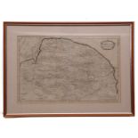
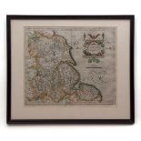
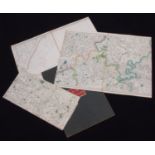
![JOAN BLAEU: NORTFOLCIA - NORFOLKE [NORFOLK], engraved hand coloured map, circa 1645, approx size](https://portal-images.azureedge.net/auctions-2018/srkey10218/images/564ba603-2579-4408-aeb6-37abcdb6147d.jpg?w=155&h=155)

JOAN BLAEU: NORTFOLCIA - NORFOLKE [NORFOLK], engraved hand coloured map, circa 1645, approx size
JOAN BLAEU: NORTFOLCIA - NORFOLKE [NORFOLK], engraved hand coloured map, circa 1645, approx size 375 x 490mm, framed and glazed, the whole approx ...
ROBERT MORDEN: NORFOLK, engraved map, circa 1695, approx size 370 x 570mm, framed and glazed, the
ROBERT MORDEN: NORFOLK, engraved map, circa 1695, approx size 370 x 570mm, framed and glazed, the whole approx size 530 x 740mm
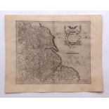
JAN JANSSON: NORFOLCIAE DESCRIPTIO - THE DESCRIPTION OF NORFOLK, hand coloured engraved map, [
JAN JANSSON: NORFOLCIAE DESCRIPTIO - THE DESCRIPTION OF NORFOLK, hand coloured engraved map, [Amsterdam, 1636 or later], approx size 380 x 490mm, ...
![JOAN BLAEU: NORTFOLCIA - NORFOLKE [NORFOLK], engraved hand coloured map, circa 1645, approx size](https://portal-images.azureedge.net/auctions-2018/srkey10218/images/c799bcf6-ba5a-47ef-899d-5a13659e1ca5.jpg?w=155&h=155)
JOAN BLAEU: NORTFOLCIA - NORFOLKE [NORFOLK], engraved hand coloured map, circa 1645, approx size
JOAN BLAEU: NORTFOLCIA - NORFOLKE [NORFOLK], engraved hand coloured map, circa 1645, approx size 375 x 490mm, framed and glazed, the whole approx ...
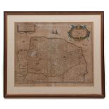
![JAN JANSSON: NORTFOLCIA; VERNACULE NORFOLKE [NORFOLK], engraved hand coloured map, [Amsterdam, circa](https://portal-images.azureedge.net/auctions-2018/srkey10218/images/cdc8de7e-6817-420e-905b-e3186fbc4d5e.jpg?w=155&h=155)
JAN JANSSON: NORTFOLCIA; VERNACULE NORFOLKE [NORFOLK], engraved hand coloured map, [Amsterdam, circa
JAN JANSSON: NORTFOLCIA; VERNACULE NORFOLKE [NORFOLK], engraved hand coloured map, [Amsterdam, circa 1646], approx size 380 x 490mm, framed and gl...
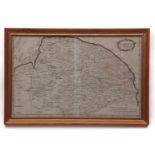
![JOAN BLAEU: NORTFOLCIA - NORFOLKE [NORFOLK], engraved hand coloured map, circa 1645 or later, app](https://portal-images.azureedge.net/auctions-2018/srkey10218/images/c0f7ee29-eb1d-4709-a57a-d8bdc91ebcd6.jpg?w=155&h=155)
JOAN BLAEU: NORTFOLCIA - NORFOLKE [NORFOLK], engraved hand coloured map, circa 1645 or later, app
JOAN BLAEU: NORTFOLCIA - NORFOLKE [NORFOLK], engraved hand coloured map, circa 1645 or later, approx size 375 x 495mm, framed and glazed, the whol...
![MICHAEL DRAYTON: NORFOLCKE [NORFOLK AND NORTH PART OF SUFFOLK], hand coloured engraved map, circa](https://portal-images.azureedge.net/auctions-2018/srkey10218/images/0d559b6c-dc84-4003-a3e5-38e84f269238.jpg?w=155&h=155)
MICHAEL DRAYTON: NORFOLCKE [NORFOLK AND NORTH PART OF SUFFOLK], hand coloured engraved map, circa
MICHAEL DRAYTON: NORFOLCKE [NORFOLK AND NORTH PART OF SUFFOLK], hand coloured engraved map, circa 1622, approx size 245 x 310mm, framed and glazed...
![SAXTON/KIP: NORFOLCIAE COMITATUS [NORFOLK], hand coloured engraved map, circa 1610, approx 265 x](https://portal-images.azureedge.net/auctions-2018/srkey10218/images/a19f8f38-34fa-415b-e3c4-ee3e5a6bb622.jpg?w=155&h=155)
SAXTON/KIP: NORFOLCIAE COMITATUS [NORFOLK], hand coloured engraved map, circa 1610, approx 265 x
SAXTON/KIP: NORFOLCIAE COMITATUS [NORFOLK], hand coloured engraved map, circa 1610, approx 265 x 380mm, framed and glazed, the whole approx size 3...
T BADESLADE AND W H TOMS: A MAP OF NORFOLK N EAST FROM LONDON, hand coloured engraved map, 1742,
T BADESLADE AND W H TOMS: A MAP OF NORFOLK N EAST FROM LONDON, hand coloured engraved map, 1742, approx size 150 x 150mm, framed and glazed, the w...
ROBERT MORDEN: NORFOLK, engraved map, circa 1695, approx size 365 x 570mm, framed and glazed, the
ROBERT MORDEN: NORFOLK, engraved map, circa 1695, approx size 365 x 570mm, framed and glazed, the whole approx size 440 x 655mm
GERARD MERCATOR: EBORACUM LINCOLNIA, DERBIA, STAFFORDIA, NOTINGHAMIA, LECESTRIA, RUTLANDIA, ET
GERARD MERCATOR: EBORACUM LINCOLNIA, DERBIA, STAFFORDIA, NOTINGHAMIA, LECESTRIA, RUTLANDIA, ET NORFOLCIA, engraved hand coloured map [1595], appro...
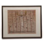
JOHN OGILBY: THE ROAD FROM LONDON TO NORWICH IN NORFOLK, hand coloured engraved road strip map,
JOHN OGILBY: THE ROAD FROM LONDON TO NORWICH IN NORFOLK, hand coloured engraved road strip map, 1675, approx size 350 x 410mm, paper toned, framed...
![JOHN OGILBY: THE ROAD FROM KINGS-LYN [KINGS LYNN] TO NORWICH CONTINUED TO YARMOUTH IN NORFOLK,](https://portal-images.azureedge.net/auctions-2018/srkey10218/images/e13b8798-b6e1-44e1-8017-accea4334559.jpg?w=155&h=155)
JOHN OGILBY: THE ROAD FROM KINGS-LYN [KINGS LYNN] TO NORWICH CONTINUED TO YARMOUTH IN NORFOLK,
JOHN OGILBY: THE ROAD FROM KINGS-LYN [KINGS LYNN] TO NORWICH CONTINUED TO YARMOUTH IN NORFOLK, hand coloured engraved road strip map, circa 1675, ...
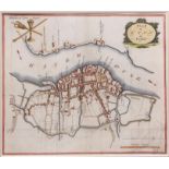
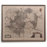
![BRAUN AND HOGENBERG: NORDOVICUM, ANGLIAE CIVITAS, hand coloured engraved plan of Norwich, [1616],](https://portal-images.azureedge.net/auctions-2018/srkey10218/images/c89ebcc6-a385-4fc7-95bf-3d6381f3b8ad.jpg?w=155&h=155)
BRAUN AND HOGENBERG: NORDOVICUM, ANGLIAE CIVITAS, hand coloured engraved plan of Norwich, [1616],
BRAUN AND HOGENBERG: NORDOVICUM, ANGLIAE CIVITAS, hand coloured engraved plan of Norwich, [1616], Latin text verso, approx size 290 x 420mm, frame...
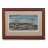
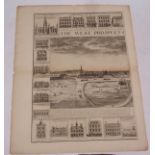
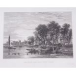
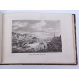
THE SOUTH-EAST PROSPECT OF THE CITY OF NORWICH, hand coloured copper engraving, circa 1790, approx
THE SOUTH-EAST PROSPECT OF THE CITY OF NORWICH, hand coloured copper engraving, circa 1790, approx size 155 x 290mm, close trimmed to the lined bo...
FRANCIS WALKER: NORWICH CATHEDRAL, large etching, published by Thomas McLean circa 1905, approx size
FRANCIS WALKER: NORWICH CATHEDRAL, large etching, published by Thomas McLean circa 1905, approx size 700 x 480mm, framed and glazed, the whole app...
Hand coloured town plan of Norwich, published by P Youngman, 1826, approx size 205 x 150mm,
Hand coloured town plan of Norwich, published by P Youngman, 1826, approx size 205 x 150mm, mounted + another similar town plan of Kings Lynn PLAN...
GERARD MERCATOR: EBORACUM, LINCOLNIA, DERBIA, STAFFORDIA, NOTINGHAMIA, LECESTRIA, RUTLANDIA, ET
GERARD MERCATOR: EBORACUM, LINCOLNIA, DERBIA, STAFFORDIA, NOTINGHAMIA, LECESTRIA, RUTLANDIA, ET NORFOLCIA [EASTERN ENGLAND], engraved map, circa 1...
![JOAN BLAEU: NORTFOLCIA - NORFOLKE [NORFOLK], engraved hand coloured map, circa 1645 or later, app](https://portal-images.azureedge.net/auctions-2018/srkey10218/images/e0b8996a-179e-4ca3-bea2-44ad00811b18.jpg?w=155&h=155)
JOAN BLAEU: NORTFOLCIA - NORFOLKE [NORFOLK], engraved hand coloured map, circa 1645 or later, app
JOAN BLAEU: NORTFOLCIA - NORFOLKE [NORFOLK], engraved hand coloured map, circa 1645 or later, approx size 375 x 490mm, unframed and unmounted, Spa...
AFTER JOHN BUTCHER, ENGRAVED BY R POLLARD: A NORTH WEST VIEW OF THE JETTY AT YARMOUTH, hand coloured
AFTER JOHN BUTCHER, ENGRAVED BY R POLLARD: A NORTH WEST VIEW OF THE JETTY AT YARMOUTH, hand coloured engraved aquatint, circa 1801 or later, appro...
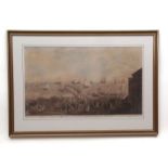
J CORBRIDGE: THE WEST PROSPECT OF THE TOWN OF GREAT YARMOUTH IN NORFOLK, engraved panoramic
J CORBRIDGE: THE WEST PROSPECT OF THE TOWN OF GREAT YARMOUTH IN NORFOLK, engraved panoramic prospect, circa 1726, engraved John Harris, printed fo...
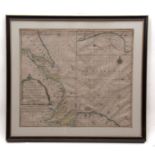
G VAN KEULEN: A NEW-ENCREASING COMPASS MAP OF PART OF THE EAST-COAST OF ENGLAND; EXTENDING FROM
G VAN KEULEN: A NEW-ENCREASING COMPASS MAP OF PART OF THE EAST-COAST OF ENGLAND; EXTENDING FROM ECKLES TO FLAMBOROUGH-HEAD; CONTAINING THE RIVER O...
![GREENVILLE COLLINS: NORFOLK PARS [CLEY AND BLAKENEY], hand coloured engraved sea chart/plan, circa](https://portal-images.azureedge.net/auctions-2018/srkey10218/images/e2f5b561-c122-43b6-cdac-9fe864b01cf3.jpg?w=155&h=155)
GREENVILLE COLLINS: NORFOLK PARS [CLEY AND BLAKENEY], hand coloured engraved sea chart/plan, circa
GREENVILLE COLLINS: NORFOLK PARS [CLEY AND BLAKENEY], hand coloured engraved sea chart/plan, circa 1690, approx size 275 x 440mm, framed and glaze...
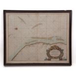
GREENVILLE COLLINS: YARMOUTH AND THE SANDS ABOUT IT, hand coloured engraved sea chart, 1693, large
GREENVILLE COLLINS: YARMOUTH AND THE SANDS ABOUT IT, hand coloured engraved sea chart, 1693, large decorative cartouche lower right, approx size 4...
![GREENVILLE COLLINS: NORFOLK PARS [CLEY AND BLAKENEY], engraved sea chart/plan, circa 1690, approx](https://portal-images.azureedge.net/auctions-2018/srkey10218/images/02220e7f-5560-4fc2-b09c-b334c4907ddf.jpg?w=155&h=155)
GREENVILLE COLLINS: NORFOLK PARS [CLEY AND BLAKENEY], engraved sea chart/plan, circa 1690, approx
GREENVILLE COLLINS: NORFOLK PARS [CLEY AND BLAKENEY], engraved sea chart/plan, circa 1690, approx size 450 x 570mm, framed and glazed, the whole a...
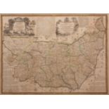
EMANUEL BOWEN: AN ACCURATE MAP OF THE COUNTY OF SUFFOLK DIVIDED INTO ITS HUNDREDS, hand coloured
EMANUEL BOWEN: AN ACCURATE MAP OF THE COUNTY OF SUFFOLK DIVIDED INTO ITS HUNDREDS, hand coloured engraved map, circa 1760, for T Bowles, John Bowl...
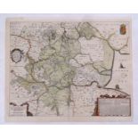
![SAXTON/KIP: SUFFOLCIAE COMITATUS [SUFFOLK], hand coloured engraved map, circa 1610, approx size](https://portal-images.azureedge.net/auctions-2018/srkey10218/images/ed3cf3b3-80b4-46b7-ff55-87222e6b7bc8.jpg?w=155&h=155)
SAXTON/KIP: SUFFOLCIAE COMITATUS [SUFFOLK], hand coloured engraved map, circa 1610, approx size
SAXTON/KIP: SUFFOLCIAE COMITATUS [SUFFOLK], hand coloured engraved map, circa 1610, approx size 275 x 375mm, framed and glazed, the whole approx s...
THOMAS MOULE: CAMBRIDGESHIRE, engraved hand coloured map circa 1850, approx 260 x 200mm, framed
THOMAS MOULE: CAMBRIDGESHIRE, engraved hand coloured map circa 1850, approx 260 x 200mm, framed and glazed + 4 other hand coloured and engraved Mo...
JOHN CARY: SUFFOLK, engraved part hand coloured map, 1805, approx 390 x 500mm
JOAN BLAEU: REGIONES INUNDATAE IN FINIBUS COMITATUS NORFOLCIAE, SUFFOLCIAE, CANTABRIGIAE... [THE
JOAN BLAEU: REGIONES INUNDATAE IN FINIBUS COMITATUS NORFOLCIAE, SUFFOLCIAE, CANTABRIGIAE... [THE FENS], hand coloured engraved map, circa 1645, ap...
H HONDICUS: A GENERAL PLOTT AND DESCRIPTION OF THE FENNES AND SURROUNDED GROUNDS IN THE SIXE
H HONDICUS: A GENERAL PLOTT AND DESCRIPTION OF THE FENNES AND SURROUNDED GROUNDS IN THE SIXE COUNTIES OF NORFOLKE, SUFFOLKE, CAMBRIDGE, WITH IN TH...
J C STADLER AFTER J FARRINGTON: VIEW AT LYNN, coloured aquatint experiment, published circa 1805,
J C STADLER AFTER J FARRINGTON: VIEW AT LYNN, coloured aquatint experiment, published circa 1805, approx size 260 x 280mm, framed and glazed, the ...
THE OLD BANK HOUSE AT LYNN, hand coloured engraving, 1864, approx size 250 x 350mm, framed and
THE OLD BANK HOUSE AT LYNN, hand coloured engraving, 1864, approx size 250 x 350mm, framed and glazed, the whole approx size 310 x 410mm
Packet: containing 13 19th century innings etc, various views, Norfolk Halls including C PACK:
Packet: containing 13 19th century innings etc, various views, Norfolk Halls including C PACK: BLICKLING HALL, hand coloured and mounted; M ARMSTR...
ORDNANCE MAPS - NO 1 - NORFOLK, PART OF SUFFOLK, CAMBRIDGESHIRE, AND LINCOLNSHIRE; ORDNANCE MAPS
ORDNANCE MAPS - NO 1 - NORFOLK, PART OF SUFFOLK, CAMBRIDGESHIRE, AND LINCOLNSHIRE; ORDNANCE MAPS NO 2 - SUFFOLK, PART OF NORFOLK, CAMBRIDGESHIRE, ...
ORDNANCE MAP OFFICE (PUBLISHED): LARGE MAP OF EASTERN ENGLAND, circa 1865, comprising sheets 49-
ORDNANCE MAP OFFICE (PUBLISHED): LARGE MAP OF EASTERN ENGLAND, circa 1865, comprising sheets 49-53; 63-67; 68-71, all backed onto linen in three s...
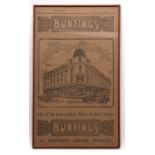
A BUNTINGS OF NORWICH DEPARTMENT STORE ADVERTISING POSTER, 1920, BUNTINGS - THE HOUSE FOR VALUE -
A BUNTINGS OF NORWICH DEPARTMENT STORE ADVERTISING POSTER, 1920, BUNTINGS - THE HOUSE FOR VALUE - LUNCHEONS, TEAS, MUSIC - ONE OF THE MOST MODERN ...
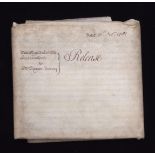
AN EXTENSIVE 1781 VELLUM RELEASE, THE RT HON LORD WALPOLE TO ELEAZOR DAVY, nine membranes, signed by
AN EXTENSIVE 1781 VELLUM RELEASE, THE RT HON LORD WALPOLE TO ELEAZOR DAVY, nine membranes, signed by nine relevant parties including Horatio Walpo...
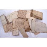
PACKET circa 30 vellum and paper Norfolk documents etc, 1728-1838, including a few re Sir William
PACKET circa 30 vellum and paper Norfolk documents etc, 1728-1838, including a few re Sir William Robert Kemp
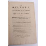
WILLIAM DUGDALE: THE HISTORY OF IMBANKING AND DRAINING OF DIVERS FENS AND MARSHES, BOTH IN FOREIGN
WILLIAM DUGDALE: THE HISTORY OF IMBANKING AND DRAINING OF DIVERS FENS AND MARSHES, BOTH IN FOREIGN PARTS AND IN THIS KINGDOM, AND OF THE IMPROVEME...
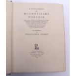
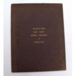
CHRISTOPHER HUSSEY (INTRODUCTION): A SUPPLEMENT TO BLOMEFIELD'S NORFOLK, London, Clement Ingleby,
CHRISTOPHER HUSSEY (INTRODUCTION): A SUPPLEMENT TO BLOMEFIELD'S NORFOLK, London, Clement Ingleby, 1929, limited edition (226/350), numbered, large...
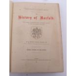
R HINDRY MASON: THE HISTORY OF NORFOLK: FROM ORIGINAL RECORDS AND OTHER AUTHORITIES PRESERVED IN
R HINDRY MASON: THE HISTORY OF NORFOLK: FROM ORIGINAL RECORDS AND OTHER AUTHORITIES PRESERVED IN PUBLIC AND PRIVATE COLLECTIONS, London, 1884, 1st...
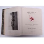
WILLIAM THOMAS PIKE: EAST ANGLIA IN THE 20TH CENTURY: CONTEMPORARY BIOGRAPHIES, Brighton, W T Pike &
WILLIAM THOMAS PIKE: EAST ANGLIA IN THE 20TH CENTURY: CONTEMPORARY BIOGRAPHIES, Brighton, W T Pike & Co, 1912, 1st edition, frontis + numerous ill...
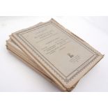
SAMUEL WOODWARD: NINE MAPS OF NORFOLK AND NORWICH, ND, circa 1831, 9 hand coloured litho maps, lacks
SAMUEL WOODWARD: NINE MAPS OF NORFOLK AND NORWICH, ND, circa 1831, 9 hand coloured litho maps, lacks engraved portfrontispiece, no title page or l...
HOLCOMBE INGLEBY AND OTHERS: A SUPPLEMENT TO BLOMEFIELD'S NORFOLK, introduction Christopher
HOLCOMBE INGLEBY AND OTHERS: A SUPPLEMENT TO BLOMEFIELD'S NORFOLK, introduction Christopher Hussey, London, Clement Ingleby, [1929], limited editi...
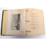
JAMES STARK AND J W ROBBERDS: PICTURESQUE VIEWS ON AND NEAR THE EASTERN COAST OF ENGLAND, COMPRISING
JAMES STARK AND J W ROBBERDS: PICTURESQUE VIEWS ON AND NEAR THE EASTERN COAST OF ENGLAND, COMPRISING THE ROMANTIC SCENERY OF THE YARE, THE WAVENEY...
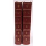
WILLIAM PAGE & H ARTHUR DOUBLEDAY (EDITED): THE VICTORIA HISTORY OF THE COUNTY OF NORFOLK, 1901-1906
H ARTHUR DOUBLEDAY: THE VICTORIA HISTORY OF THE COUNTY OF NORFOLK, 1901-1906, 2 x 1st edition, 2 volumes, 66 illustrations + 8 folding maps as cal...
WILLIAM PAGE (EDITED): THE VICTORIA HISTORY OF THE COUNTY OF SUFFOLK, 1911, 1907, volumes 1 and 2,
WILLIAM PAGE (EDITED): THE VICTORIA HISTORY OF THE COUNTY OF SUFFOLK, 1911, 1907, volumes 1 and 2, subscriber's copies, Norman Scarfe's copies (19...
NEIL WALKER AND THOMAS CRADDOCK: THE HISTORY OF WISBECH, AND THE FENS, Wisbech, Richard Walker,
NEIL WALKER AND THOMAS CRADDOCK: THE HISTORY OF WISBECH, AND THE FENS, Wisbech, Richard Walker, 1849, 1st edition, large paper copy, folding map +...
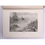
WILLIAM A DUTT: THE NORFOLK BROADS, illustrated Frank Southgate, London, 1903, 1st edition, 48
WILLIAM A DUTT: THE NORFOLK BROADS, illustrated Frank Southgate, London, 1903, 1st edition, 48 coloured plates + 29 black and white illustrations ...
W WHITTINGHAM, LYNN (PUBLISHED): A NEW AND COMPLETE HISTORY OF NORFOLK; COLLECTED FROM THE MOST
W WHITTINGHAM, LYNN (PUBLISHED): A NEW AND COMPLETE HISTORY OF NORFOLK; COLLECTED FROM THE MOST CELEBRATED HISTORIAN; CONTAINING, AN ACCURATE DESC...
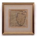
![[HENRY MANSHIP]: A BOOKE OF THE FOUNDACION AND ANTIQUITYE OF THE TOWNE OF GREATE YERMOUTHE: FROM THE](https://portal-images.azureedge.net/auctions-2018/srkey10218/images/7cc7f853-d622-4956-fbc4-643a3edeb234.jpg?w=155&h=155)
[HENRY MANSHIP]: A BOOKE OF THE FOUNDACION AND ANTIQUITYE OF THE TOWNE OF GREATE YERMOUTHE: FROM THE
[HENRY MANSHIP]: A BOOKE OF THE FOUNDACION AND ANTIQUITYE OF THE TOWNE OF GREATE YERMOUTHE: FROM THE ORIGINAL MANUSCRIPT WRITTEN IN THE TIME OF QU...
![[MOSTYN JOHN ARMSTRONG]: THE HISTORY AND ANTIQUITIES OF THE COUNTY OF NORFOLK: CONTAINING AN ACCOUNT](https://portal-images.azureedge.net/auctions-2018/srkey10218/images/09abe7f8-6775-4b67-9be1-73de0c46bf3e.jpg?w=155&h=155)
[MOSTYN JOHN ARMSTRONG]: THE HISTORY AND ANTIQUITIES OF THE COUNTY OF NORFOLK: CONTAINING AN ACCOUNT
[MOSTYN JOHN ARMSTRONG]: THE HISTORY AND ANTIQUITIES OF THE COUNTY OF NORFOLK: CONTAINING AN ACCOUNT OF THE HUNDRED OF HUMBLEYARD, Norwich, Steven...
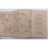
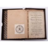
NATHANIEL KENT: GENERAL VIEW OF THE AGRICULTURE OF THE COUNTY OF NORFOLK; WITH OBSERVATIONS FOR
NATHANIEL KENT: GENERAL VIEW OF THE AGRICULTURE OF THE COUNTY OF NORFOLK; WITH OBSERVATIONS FOR THE MEANS OF ITS IMPROVEMENT, DRAWN UP, FOR THE CO...
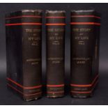
AUGUSTUS J C HARE: THE STORY OF MY LIFE, London, George Allen, 1896, 1st edition, 3 volumes, uniform
AUGUSTUS J C HARE: THE STORY OF MY LIFE, London, George Allen, 1896, 1st edition, 3 volumes, uniform original publisher's cloth gilt (3)
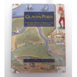
JONATHAN HOOTON: THE GLAVEN PORTS - A MARITIME HISTORY OF BLAKENEY, CLEY AND WIVETON IN NORTH
JONATHAN HOOTON: THE GLAVEN PORTS - A MARITIME HISTORY OF BLAKENEY, CLEY AND WIVETON IN NORTH NORFROLK, [1996], 1st edition, signed and numbered (...
CHARLES JOHN PALMER: THE PERLUSTRATION OF GREAT YARMOUTH, WITH GORLESTON AND SOUTHTOWN, Great
CHARLES JOHN PALMER: THE PERLUSTRATION OF GREAT YARMOUTH, WITH GORLESTON AND SOUTHTOWN, Great Yarmouth, George Nall, 1872-1875, 1st edition, 3 vol...
JOSEPH LAMBERT: TWENTY-FOUR VIEWS, DISPLAYING THE BEAUTIES OF YARMOUTH AND ITS ENVIRONS - ENGRAVED
JOSEPH LAMBERT: TWENTY-FOUR VIEWS, DISPLAYING THE BEAUTIES OF YARMOUTH AND ITS ENVIRONS - ENGRAVED IN THE LINE MANNER, Yarmouth, F Skill, 1821-182...
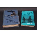
ROY CLARK: BLACK SAILED TRADERS, THE KEELS AND WHERRIES OF NORFOLK AND SUFFOLK, London, 1961, 1st
ROY CLARK: BLACK SAILED TRADERS, THE KEELS AND WHERRIES OF NORFOLK AND SUFFOLK, London, 1961, 1st edition, original cloth gilt, dust-wrapper (worn...
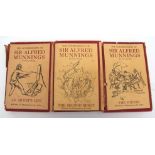
SIR ALFRED MUNNINGS: AN ARTIST'S LIFE - THE SECOND BURST - THE FINISH, 1950-1952, 1st editions, 3
SIR ALFRED MUNNINGS: AN ARTIST'S LIFE - THE SECOND BURST - THE FINISH, 1950-1952, 1st editions, 3 volumes, original cloth, dust-wrappers (tatty) (...