Perfeziona la tua ricerca
Filtered by:
- Sale Section
- Elenco
- Grid
A subscription to the Price Guide is required to view results for auctions ten days or older. Click here for more information
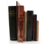

Small quantity of books relating to the Northamptonshire Regiment including History of the Northamptonshire Regiment 1742-1932, Lieut-Col Russell ...
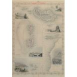
A V Bird, The Paintings of Norman Lighton for Roberts Birds of South Africa, signed by the author and artist, from a numbered edition of 300, cape...
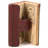
The Almanack Explained 1830.
The Almanack Explained 1830, Printed for the Company of Stationers, leather covers, 6cm x 4cm. ...[more]
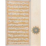
Small illustrated Koran manuscript, Indian, probably 16th Century, 8.5x6.5cm, mounted and framed; and four botanical prints, various sizes. ...[m...
John Ogilby and others, four maps
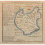
John Ogilby, The Road from Hereford to Leicester, double sided, 19 x 12cm; The Road from Exeter to Truro, with a map of Cornwall; Victorian map, B...
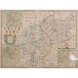
Philip Lea and Christopher Saxton, Warwick and Leicester Shires, hand-coloured map of counties, 39 x 53cm. ...[more]
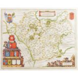
Johannes Blaeu, Leicestrensis
Johannes Blaeu, Leicestrensis, hand-coloured county map, 41 x 52cm. ...[more]
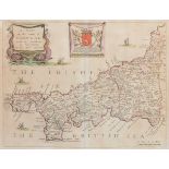
Richard Blome, Mapp of The County of Cornwal, hand-coloured county map, 25 x 32cm. ...[more]
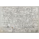
Emanuel Bowen, Leicester Shire, hand-coloured county map from The Universal Magazine, 19 x 21cm; Badeslade's Map of Leicester-Shire; and Map of th...
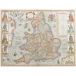
Christopher Saxton, The Kingdome of England, hand-coloured illustrative map, 40 x 53cm. ...[more]
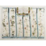
John Ogilby, The Road from London to Darby, hand-coloured ribbon map, 31 x 43cm. ...[more]
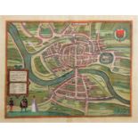
Georg Braun & Franz Hogenberg, Brightstowe [Bristol], hand-coloured plan, 36 x 43cm. ...[more]
Pieter van dan Keere, Leicester Shire, small county map, uncoloured, 9 x 13cm and two similar, Rutlande Shire and Lancastria (3). ...[more]
John Speed, Leicester, Both Countye and Citie Described ..., hand-coloured county map, visible 37 x 50cm; and two engraved sheets from Nichols' Co...
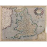
Gerhard Mercator, Anglia Regnum
Gerhard Mercator, Anglia Regnum, hand-coloured map of England and Wales, 37 x 49cm ...[more]