Filtered by:
- Categoria
- Elenco
- Grid
A subscription to the Price Guide is required to view results for auctions ten days or older. Click here for more information
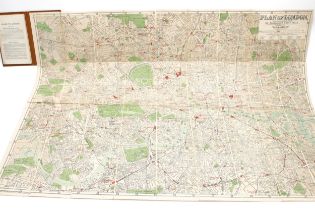

Alexander Gross, Plan of London, divided into half mile squares, 4 inch map laid on canvas,
Alexander Gross, Plan of London, divided into half mile squares, 4 inch map laid on canvas, published by Geographia Ltd, London
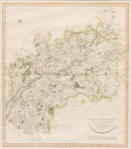
Cary, John, A New Map of Gloucestershire, engraved and coloured, 56cm x 50cm, published London
Cary, John, A New Map of Gloucestershire, engraved and coloured, 56cm x 50cm, published London September 28 1801
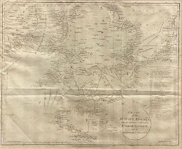
John Russell, an engraved map, Chart of the British Channel with the Opposite Coast of the United
John Russell, an engraved map, Chart of the British Channel with the Opposite Coast of the United Kingdom and the Republic of France, 34cm x 41.5c...
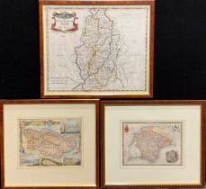
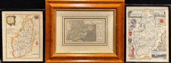
Robert Morden (1650 - 1703), after, a two-page coloured map, Nottinghamshire, 36.5cm x 44cm;
Robert Morden (1650 - 1703), after, a two-page coloured map, Nottinghamshire, 36.5cm x 44cm; Thomas Moule, Devonshire; Kent (3)
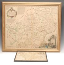
Thomas Kitchin (1719 - 1784), a two-page engraved and coloured map, A New and Improved Map of
Thomas Kitchin (1719 - 1784), a two-page engraved and coloured map, A New and Improved Map of Hartfordshire, From the Best Surveys & Intelligence,...
Thomas Kitchin, a map, Nottinghamshire, 23.5cm x 19cm; others, Nottingham; Essex (3)