Filtered by:
- Category,
- Item Type
- List
- Grid
A subscription to the Price Guide is required to view results for auctions ten days or older. Click here for more information

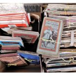
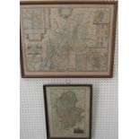
Two boxes containing a quantity of vintage and other Ordinance survey maps etc (2)
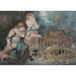
Late 18th century coloured engraving of children feeding chickens, 35 x 39.5cm, in moulded gilt
Late 18th century coloured engraving of children feeding chickens, 35 x 39.5cm, in moulded gilt frame, together with two 19th century coloured eng...
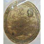
An early 19th century embroidered needlework map of England and Wales on silk, of oval form,
An early 19th century embroidered needlework map of England and Wales on silk, of oval form, signed Rhoda Haigh? 51cm max, framed
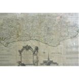
Thomas Kitchin - Black and white engraved map of Sussex divided into its hundreds, 43 x 52cm, framed
Thomas Kitchin - Black and white engraved map of Sussex divided into its hundreds, 43 x 52cm, framed
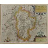
17th century coloured engraved map of Gloucestershire, with date 1610, sold by Thomas Bassett in
17th century coloured engraved map of Gloucestershire, with date 1610, sold by Thomas Bassett in Fleet Street, 41 x 54cm approx, together with a f...
A coloured engraved map of Bedfordshire after Christopher Saxton, 29 x 35.5cm approx visible sheet
A coloured engraved map of Bedfordshire after Christopher Saxton, 29 x 35.5cm approx visible sheet size, framed
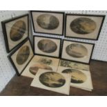
William Gilpin (British 1724-1804) - Collection of engraved plates, mostly of oval form, showing
William Gilpin (British 1724-1804) - Collection of engraved plates, mostly of oval form, showing views on the picturesque theme, max oval 16.5cm, ...
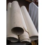
A collection of unframed and rolled early 20th century ordnance survey maps of the Painswick
A collection of unframed and rolled early 20th century ordnance survey maps of the Painswick areas, dating from 1923, 1937, etc