Filtered by:
- Category,
- Item Type
- List
- Grid
A subscription to the Price Guide is required to view results for auctions ten days or older. Click here for more information
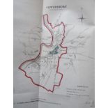

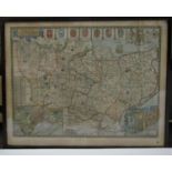
Proposed Division of the Country of Gloucestershire with hand coloured maps, 1832
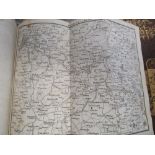
John Cary - Carys New Itinerary of the Great Roads Throughout England and Wales, 1819, with maps
John Cary - Carys New Itinerary of the Great Roads Throughout England and Wales, 1819, with maps ...[more]
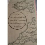
John Cary - Carys New Itinerary of the Roads Measured from London c.1801 ...[more]
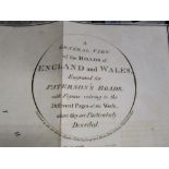
Paterson - Lt Col - A New and accurate description of Roads in England and Wales - 14th edition,
Paterson - Lt Col - A New and accurate description of Roads in England and Wales - 14th edition, with maps, 1809 ...[more]
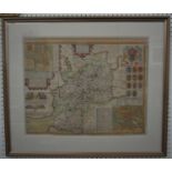
John Speed (British 1552-1629) - Hand coloured engraved map of Gloucestershire sold by John
John Speed (British 1552-1629) - Hand coloured engraved map of Gloucestershire sold by John Sudbury and George Humble, in double sided glazed fram...
John Speed (British 1552-1629) - Hand coloured engraved map of Kent sold by George Humble, 42 x 54.
John Speed (British 1552-1629) - Hand coloured engraved map of Kent sold by George Humble, 42 x 54.5cm approx visible sheet size, together with a ...
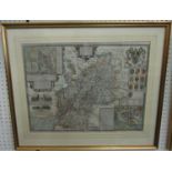
John Speed (British 1552-1629) - A 17th century hand coloured engraved map of Gloucestershire -
John Speed (British 1552-1629) - A 17th century hand coloured engraved map of Gloucestershire - Contrived into 33 several hundreds, etc, sold by T...