Filtered by:
- Category,
- Item Type
- List
- Grid
A subscription to the Price Guide is required to view results for auctions ten days or older. Click here for more information
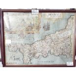

William Kip - 17th century coloured engraved map of Cornwall, 30 x 40.5cm, framed
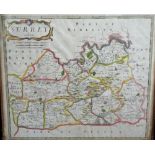
Richard Blome (1635-1705) - Coloured engraved map of Yorkshire, 20 x 28.5cm approx max, Robert
Richard Blome (1635-1705) - Coloured engraved map of Yorkshire, 20 x 28.5cm approx max, Robert Morden (1650-1703) - Coloured engraved map of Surre...
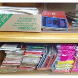
A collection of mixed Ordnance Survey maps including examples by Bartholomew's, Ordnance Survey 1-
A collection of mixed Ordnance Survey maps including examples by Bartholomew's, Ordnance Survey 1-inch Tourist Map, etc (two shelves)
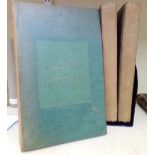
Three volumes of The Description of Pembrokeshire by George Owen of Henllys, Lord of Kemes, published London 1892, with foldout black and white ma...
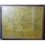
Bacon's new chart of the world, circa 1900, showing total estimated population of the principal
Bacon's new chart of the world, circa 1900, showing total estimated population of the principal countries, flags of the world, universal chime cha...
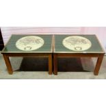
A pair of low occasional tables, the brass framed rectangular tops with inset printed maps and
A pair of low occasional tables, the brass framed rectangular tops with inset printed maps and raised on square cut and moulded supports