15
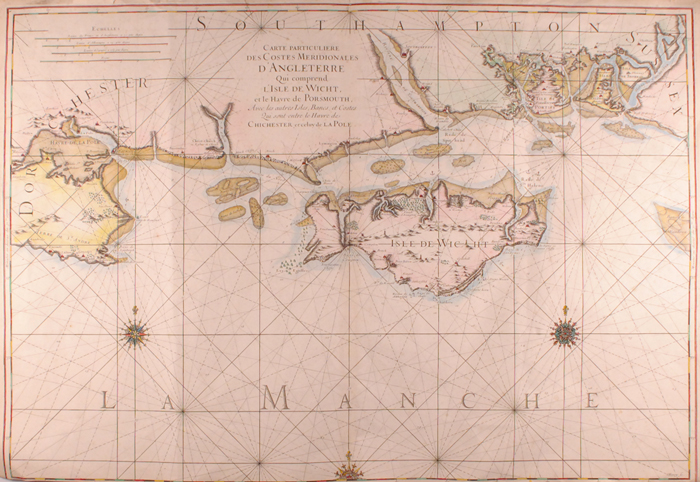
Circa 1700. Isle of Wight, Poole & Portsmouth Harbours hand coloured map by Berey. Carte

Description
Circa 1700. Isle of Wight, Poole & Portsmouth Harbours hand coloured map by Berey.
Carte particuliere des Costes Meridionales d`Angleterre Qui comprend l`Isle de Wight et le Havre de Porsmouth. Avec les autres Isles, Bancs, et Costes Qui sont entre le Havre de Chichester et ce luy de La Pole.
L
Measurements: 24 by 36in., 60 by 90cm.
Auction Details
Shipping
T&Cs & Important Info
Ask seller a question
Circa 1700. Isle of Wight, Poole & Portsmouth Harbours hand coloured map by Berey.
Carte particuliere des Costes Meridionales d`Angleterre Qui comprend l`Isle de Wight et le Havre de Porsmouth. Avec les autres Isles, Bancs, et Costes Qui sont entre le Havre de Chichester et ce luy de La Pole.
L
Measurements: 24 by 36in., 60 by 90cm.
History, Literature and Collectibles
Sale Date(s)
Venue Address
38 Molesworth Street
Dublin 2
.
Ireland
General delivery information available from the auctioneer
The buyer will be responsible for all removal, storage and insurance charges in respect of any lot which has not been collected within fourteen days of the date of sale.
Important Information
Buyers Premium: 25% including VAT (20.3% + 23%VAT)
Shipping:
Whytes do not handle this themselves but will recommend a suitable company who can collect your purchases on your behalf and pack and despatch them to you once they have been paid for.
Shipping:
Whytes do not handle this themselves but will recommend a suitable company who can collect your purchases on your behalf and pack and despatch them to you once they have been paid for.