16
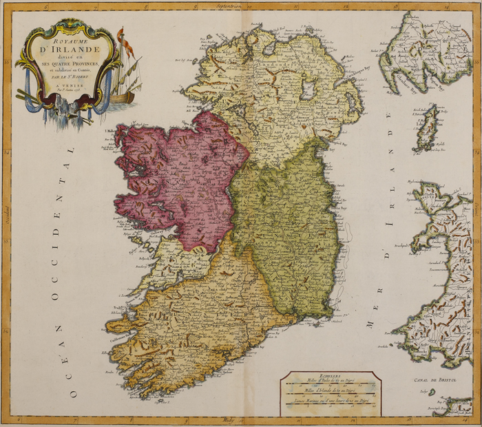
1778: Ireland Royaume D`Irlande" map by Francois Santini" Intaglio, handcoloured, framed. Venice

Description
1778: Ireland Royaume D`Irlande" map by Francois Santini"
Intaglio, handcoloured, framed. Venice printed map of Ireland divided into its four provinces and subdivided into its counties. By Santini after Vaugondy.
L
Measurements: 19 by 21.5in., 47.5 by 53.75cm.
Auction Details
Shipping
T&Cs & Important Info
Ask seller a question
1778: Ireland Royaume D`Irlande" map by Francois Santini"
Intaglio, handcoloured, framed. Venice printed map of Ireland divided into its four provinces and subdivided into its counties. By Santini after Vaugondy.
L
Measurements: 19 by 21.5in., 47.5 by 53.75cm.
History, Literature and Collectibles
Sale Date(s)
Venue Address
38 Molesworth Street
Dublin 2
.
Ireland
General delivery information available from the auctioneer
The buyer will be responsible for all removal, storage and insurance charges in respect of any lot which has not been collected within fourteen days of the date of sale.
Important Information
Buyers Premium: 25% including VAT (20.3% + 23%VAT)
Shipping:
Whytes do not handle this themselves but will recommend a suitable company who can collect your purchases on your behalf and pack and despatch them to you once they have been paid for.
Shipping:
Whytes do not handle this themselves but will recommend a suitable company who can collect your purchases on your behalf and pack and despatch them to you once they have been paid for.