Filtered by:
- Category,
- Creator / Brand
- List
- Grid
A subscription to the Price Guide is required to view results for auctions ten days or older. Click here for more information


5 Antique Maps – 1) “Stanford’s Map of Eastern China, Japan and Korea, 1898”, 2) Part Ireland,
5 Antique Maps – 1) “Stanford’s Map of Eastern China, Japan and Korea, 1898”, 2) Part Ireland, published by Wm Allen, 32 Dame St, 3) Eason’s War M...
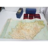
“BARTHOLOMEW’S Reduced Survey Quarter Inch Maps of Scotland, specially prepared for motorists,
“BARTHOLOMEW’S Reduced Survey Quarter Inch Maps of Scotland, specially prepared for motorists, tourists and cyclists”, mounted in cloth (7 in case...

3 framed Shares Certificates, one Marconi Wireless Telegraph Company, 1912, one Garland Steamship Corporation, 1921 and one Kreuger, and 2 small ...

4 Books – Moore’s Irish Melodies (1875), School Atlas 1888, Philips’ Handy Atlas of the Counties
4 Books – Moore’s Irish Melodies (1875), School Atlas 1888, Philips’ Handy Atlas of the Counties of Ireland, colour illust’d, 1885 and Eire Depart...
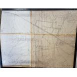
1950’s Ordnance Survey Map of the Dublin suburbs of Sandyford to Leopardstown and Walters Land, 78cm
1950’s Ordnance Survey Map of the Dublin suburbs of Sandyford to Leopardstown and Walters Land, 78cm x 100cm, 1.25 scale, framed (provenance: I H ...