Refine your search
Filtered by:
- Sale Section,
- Item Type
- List
- Grid
A subscription to the Price Guide is required to view results for auctions ten days or older. Click here for more information
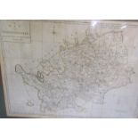

A map of Hertfordshire engraved from an actual survey with improvements. London engraved for J
A map of Hertfordshire engraved from an actual survey with improvements. London engraved for J Harrison, 115 Newgate Street. July 4th 1788 with ...
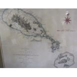
An accurate map of the Islands of St. Christophers & Nevis in the West Indies by an officer with the
An accurate map of the Islands of St. Christophers & Nevis in the West Indies by an officer with the position of the English and French fleets, Fe...
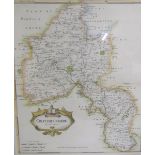
A Robert Morden map of Oxfordshire with a scale of miles, sold by Abel Swale Aronsham and John
A Robert Morden map of Oxfordshire with a scale of miles, sold by Abel Swale Aronsham and John Churchil. Framed and glazed 43cms x 37cms.
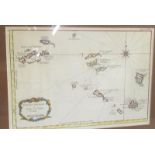
A map Petites Antilles Ou Isles du Vent being Tome I. 82. Framed and glazed 23cms x 33cms.
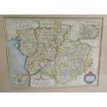
A Christopher Saxton and Philip Lea map of Merioneth and Montgomery with inset town plans of
A Christopher Saxton and Philip Lea map of Merioneth and Montgomery with inset town plans of Montgomery and Harlich. Framed and glazed 35cms x 45...
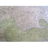
An 18th Century Thos. Bawles/Homann map of London, England and Environs with inset panorama of
An 18th Century Thos. Bawles/Homann map of London, England and Environs with inset panorama of London Westminster. Framed and glazed 53cms x 59cm...
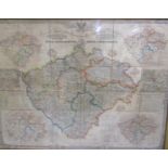
A 19th Century coloured map of Bohemia c.1850 General-Diberlichts-Karte Des Konigreiches Bohmen -
A 19th Century coloured map of Bohemia c.1850 General-Diberlichts-Karte Des Konigreiches Bohmen - coloured paper on linen originally folded, now f...