Filtered by:
- Category,
- Creator / Brand
- List
- Grid
A subscription to the Price Guide is required to view results for auctions ten days or older. Click here for more information
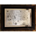

A Royal Geographical Society silver map, framed and glazed, 52cm x 71cm
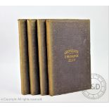
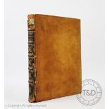
LYCESTER (P), HISTORICAL ANTIQUITIES IN TWO BOOKS, the first treating in general of Great Britain and Ireland, the second containing particular re...
MORGNA (J), trans, A COMPLEAT HISTORY OF THE PRACTICAL SATES OF BARBARY, viz Algiers, Tripoli,
MORGNA (J), trans, A COMPLEAT HISTORY OF THE PRACTICAL SATES OF BARBARY, viz Algiers, Tripoli, Tunis, Morocco, 1st edition, with two folding maps,...
BAKEWELL (R), AN INTRODUCTION TO GEOLOGY, 3rd ed, with engraved folding frontis plate and six other folding plates and maps - two hand coloured, l...
CRUCHLEYS REDUCED ORDNANCE MAP OF ENGLAND AND WALES, four large folding linen backed maps comprising Shropshire and surrounding counties(30, 31, 3...
FADEN (W), A MAP OF ENGLAND, WALES AND SCOTLAND, folding linen backed map with hand colouring,
FADEN (W), A MAP OF ENGLAND, WALES AND SCOTLAND, folding linen backed map with hand colouring, in original slip case, dated August 12th 1801, 74.5...
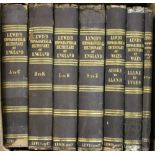
LEWIS (S), TOPOGRAPHICAL DICTIONARY OF ENGLAND AND WALES, six vols, with supplementary atlas volume complete with country map, plan of London and ...
MOGG (E), PATTERSONS ROADS,
MOGG (E), PATTERSONS ROADS, being an entirely original and accurate description of all the direct and principle cross roads in England and Wales, ...
MOORE (J), A NARRATIVE OF THE CAMPAIGN OF THE BRITISH ARMY IN SPAIN, commanded by this excellency Lieut - General Sir John Moore, 2nd edition, eng...
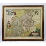
Jan Jansson, Engraved map with later hand colouring, Salopiensis (Shropshire), 48cm x 57.5cm, Framed and glazed
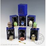
A collection of seven Atlas Edition decorative eggs, each within boxes (7)
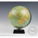
A 1950's Philips 10 inch Challenge Globe, on square base, 31cm high CONDITION REPORT: Crazed throughout with some browning down the join lines of ...