Filtered by:
- Sale Section,
- Item Type
- List
- Grid
A subscription to the Price Guide is required to view results for auctions ten days or older. Click here for more information


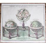
Jean Baptiste Homann, 18th century engraving with hand colouring, Sphaerarum Artificalium Typica Repraesentatio - Celestial, terestrial and Armill...
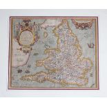
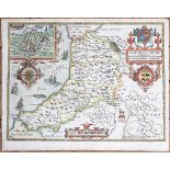
Abraham Ortelius, 16th / 17th century engraving with hand colouring, Angliae Regniflo retissimi Nova Description Auctore Humfredo Lhuyd Den Bygien...

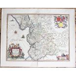
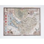
Johannes Janssonius (Jansson), 17th century engraving with later hand colouring, Lancastria Palatinatus - Map of Lancashire, 47cm x 59cm, Unframed
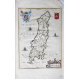
Willem Janszoon Blaeu, 17th century engraving with hand colouring, Mona - Map of the Isle of Man,
Willem Janszoon Blaeu, 17th century engraving with hand colouring, Mona - Map of the Isle of Man, 51.5cm x 30cm, Unframed
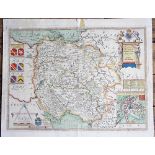
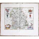
Christopher Saxton, 17th century engraving with later hand colouring, The County of Hereford,
Christopher Saxton, 17th century engraving with later hand colouring, The County of Hereford, a map, 44cm x 54cm, Unframed
Willem Janszoon Blaeu, 18th century engraving with hand colouring, Comitatus Caernarvoniensis - Map of Caernarvonshire, North Wales and Anglesey, ...
George Rollos, 18th century engraving with hand colouring, An Accurate map of the county of Anglesey, 23cm x 36cm, Unframed
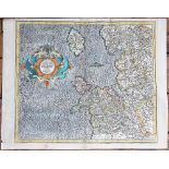
Geraradus Mercator, 17th century engraving with later hand colouring, West Morlandia Lancastra Cestria Caernarvan..., Map of North Wales, Anglesey...
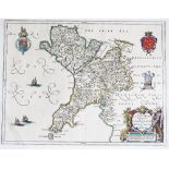
John Speed, 17th century engraving with later hand colouring, Cardigan Shyre, - a Map of Cardiganshire / Ceredigion, with inset plan of Cardigan, ...
John Speed, 17th century engraving, Caernarvon both Shire and Shire Town, Map of Caernarvonshire,
John Speed, 17th century engraving, Caernarvon both Shire and Shire Town, Map of Caernarvonshire, with town plans of Caernarvon and Bangor, 42.5cm...
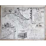
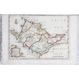
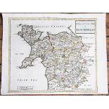
John Speed, 17th century engraving, A map of Flintshire, Wales with town plan and vignettes of St Asaph and St Winifreds Well, - also shows Whitch...
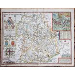
John Speed, 17th century engraving with later hand colouring, Map of Shropshire, 42cm x 53cm,
John Speed, 17th century engraving with later hand colouring, Map of Shropshire, 42cm x 53cm, Unframed

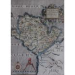
Richard Blome, 17th century engraving with later hand colouring, A General Mapp of South Wales,
Richard Blome, 17th century engraving with later hand colouring, A General Mapp of South Wales, With seven armorial sponsors, 35cm x 46cm, Unframe...
Willem Janszoon Blaeu, 17th century engraving with hand colouring, Comitatus salopiensis Anglice Shrop Shire - map of Shropshire, 56cm x 65cm, Unf...
John Speed, 17th century engraving with later hand colouring, Map of The Countye Palatine of Chester - Cheshire, with vignette plan of Chester and...
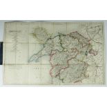
Robert Morden, 18th century engraving with later hand colouring, A New and Correct Map of North Wales, 38.5cm x 51cm, Unframed
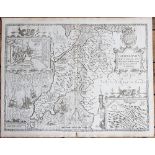
John Ogilby, 17th century engraving with later hand colouring, A Map of London to Holyhead showing Chester, 38cm x 48cm, Unframed
Christopher Saxton, 17th century engraving with later hand colouring, A map of Anglesey - conntatus olim Mona Insula Druidum Sedes Britannice Tir ...
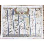
J & C Walker, 19th century map of north Wales, 24 section hand coloured engraved map mounted onto linen, in folding cover(size)
Richard Blome, Late 17th century engraving with later hand colouring, A map of Shropshire, 21cm x 26cm, Framed and glazed, with a watercolour by N...