Filtered by:
- Sale Section,
- Creator / Brand
- List
- Grid
A subscription to the Price Guide is required to view results for auctions ten days or older. Click here for more information
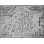

John Speed, Uncoloured 17th century engraving, A map of Montgomeryshire with inset plan of Montgomery, 39.5cm x 51.5cm, Unframed
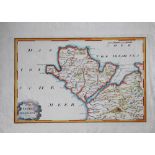
An 18th century hand coloured engraving of Anglesey and North Wales, 29cm x 40cm, Unframed
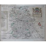
Willem Janszoon Blaeu, 18th century engraving with hand colouring, Comitatus Brechiniae - map of Brecknockshire, 52cm x 62cm, Unframed
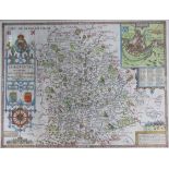
Johannes Janssonius (Jansson), 17th century engraving with later hand colouring, Principatus Walliae, - a map of North Wales, 50cm x 60cm, Unframed
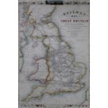
John Rapkin, Hand coloured engraving, Railway Map of Great Britain, showing the railways completed, 55cm x 37cm, Unframed
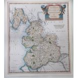
Robert Morden, 17th century engraving with later hand colouring, The County Palatine of Lancaster,
Robert Morden, 17th century engraving with later hand colouring, The County Palatine of Lancaster, a map of Lancashire, 43cm x 37cm, Framed and gl...
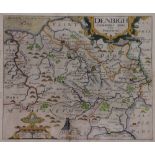
Christopher Saxton and William Kip, 17th century engraving with later hand colouring, Denbigh Comitatus pars olim Ordovicum, 38cm x 34cm, Framed...
A Map of the County of Warwick within its Hundreds, Engraving with later hand colouring, 19.
A Map of the County of Warwick within its Hundreds, Engraving with later hand colouring, 19.5cm x 21cm, Framed and glazed, with a small late 17th ...
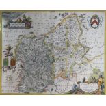
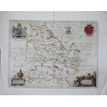
Johannes Janssonius (Jansson), 17th century engraving with later hand colouring, Salopoensis Comitatus cum Staffordiensis - Map of Shropshire and ...
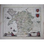
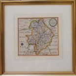
John Speed, 17th century engraving with later hand colouring, A map of Shropshire described,
John Speed,17th century engraving with later hand colouring, A map of Shropshire described, the situations of Shrowesbury described - with arms, c...
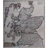
Frederik de Wit, 17th century engraving with alter hand colouring, Scotia Regnum - a map of Scotland, 59cm x 51.5cm, Framed and glazed
Richard Blome, Late 17th century engraving with later hand colouring, A map of Shropshire, 21cm x 26cm, Framed and glazed, with a watercolour by N...