Filtered by:
- Category,
- Item Type
- List
- Grid
A subscription to the Price Guide is required to view results for auctions ten days or older. Click here for more information
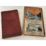

1901 ed. of Ward, Lock & Co's red guide to Llandudno & Northern Wales. Together with 1933 P & A Campbell Bristol Channel Guide including maps, pho...
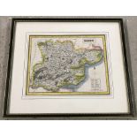
A framed and glazed hand tinted map of Essex . Map size 18cm x 23cm approx.
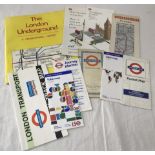
A selection of London Transport maps and leaflets dating from the 1950's - 2000's. To include H.C.Beck version dated Jan 1953.
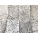
Ordnance Survey Map, 1:2500 showing Maidenhead GWR station and branch junction for Wycombe trains.
Ordnance Survey Map, 1:2500 showing Maidenhead GWR station and branch junction for Wycombe trains. Printed 1933, originally surveyed 1874.
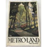
"Metro-Land" guide book issued by Metropolitan Railway with photos, colour pictures and maps.
"Metro-Land" guide book issued by Metropolitan Railway with photos, colour pictures and maps. 1932 edition with cover image by Michael Reilly. App...
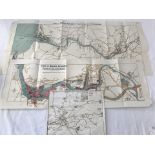
Port of Bristol Authority 1928 landscape style plans of their Bristol networks, 3 items. City docks 1:500 scale, Bristol/Avonmouth area 3":1 mile ...
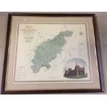
A large framed and glazed print of a map of Northampton. From an actual survey made in the years 1825-1826. Approx 72.5 x 60 cm