Refine your search
Sale Section
Estimate
Category
- List
- Grid
This auctioneer has chosen to not publish their results. Please contact them directly for any enquiries.
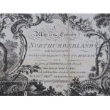

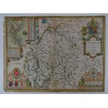
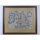
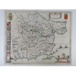
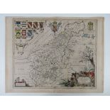
Northumberland hand coloured map on cloth, 'Taken from an actual survey and laid down from a scale from an inch to a mile' by Andrew Armstrong (17...
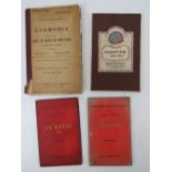
Argentiere (near Chamonix) Gilbert White published by Edward Stanford Ltd London, a twenty section map on cloth by Henri, Joseph et Charles Vallot...
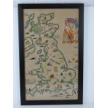
A WWII sampler being a map of the United Kingdom inc war ships in the English Channel and coat of arms to upper right, framed and glazed, sight si...
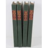
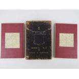
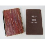
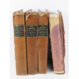
Lewis' map of England and Wales; a set of four leather bound and gilded map books being N-E Division, S-E Division, N-W Division and S-W Division,...
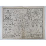
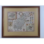
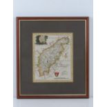
West Morland and Kendale inc chief towns and the Arms of honourable families, hand coloured book segment map 'performed by John Speede' measuring ...
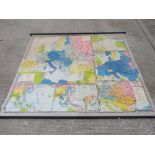
Two 1960s German schoolroom wall maps produced in Berlin and showing WWI and WWII borders, each measuring approx 207cm wide.
Bedfordshire and the situation of Bedford with the Arms of honourable families, book segment map 'performed by John Speed' measuring approx 54 x 4...

The road from London to the Lands End in Cornwall with Arms of notable families upon in five segments having the road from London to Newhaven in S...
Surrey Sheet XXXI Second Edition 1897 by Edward Stanford covering Godalming and Chiddingfold, fifty-six sections on cloth and measuring 182 x 123c...
A set of four segmented maps being Sussex, Hertfordshire, Kent and Middlesex, engraved by F Bryer, published by Kelly & Co London, each in fifteen...
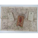
Ordinance map of Essex and Suffolk being two cloth bound fold-out maps in leather covered box,
Ordinance map of Essex and Suffolk being two cloth bound fold-out maps in leather covered box, engraved at the Ordinance Map Office Southampton, t...
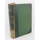
Johnstons Atlas of the War 1855; a set of six fold-out maps in leather binding.
'The Invasions of England and Ireland with al their Civill Wars Since the Conquest by John Speed
'The Invasions of England and Ireland with al their Civill Wars Since the Conquest by John Speed c1627', a hand coloured book section map having t...
Northamptonshire, a hand coloured map 'Performed by John Speed and are two by fold by George Humbell in Pope's Head Alley', sight size 50.5 x 37.5...
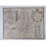
The Countie of Nottingham 'the shire townes situation' and the Arms of honourable families, book segment map 'performed by John Speede' measuring ...
Cloth bound map of Surrey in sixteen sections numbered upper right 'NoVIII', sleeve marked 'Sold by W Faden Geographer to the King, Charing Cross'...
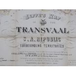
Jeppes Map of the Transvaal S.A.Republic and surrounding Territories; Pretoria SA Republic 1899', Lithographed by Wurster, Randegger & Cie. (J.Sch...
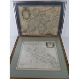
Two hand coloured maps being; Northamptonshire by Robert Morden, sold by Abel Swale and Ownsham and John Churchill, sight size 41 x 35.5cm, framed...
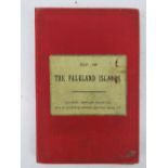
The Falkland Islands published London by Edward Stanford in eighteen sections on cloth measuring 66.
The Falkland Islands published London by Edward Stanford in eighteen sections on cloth measuring 66.5 x 52.5cm.
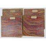
Dugdale's England and Wales cloth bound containing various engraving and hand coloured maps, two part-sets. Nine items.
A quantity of assorted ordinance survey maps; three in twenty-one sections, being Cromer post 1912, Pwllheli post 1907, Brighton post 1911. Three ...
Essex and the situation of Essex with the Arms of honourable families, hand coloured book segment map, all measuring approx 55 x 43cm.
Two post war Michelin road maps having been overprinted with details of mine areas, broken bridges and destroyed towns includes North Coast of Fra...
Two maps of Argentina; a topographical map of the Santa Fe Province dated 1883 in forty-eight sections on cloth, appears to have been varnished to...
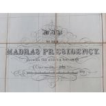
Map of the Madras Presidency dated 1926 by the Central Survey Office Madras in forty-two sections on cloth measuring 150 x 98cm. Having list of st...
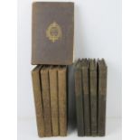
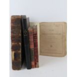
Lewis's Topographical Dictionary of England in four volumes, published 1831, bindings slightly a/f.
The Harmsworth Atlas and Gazetteer Containing 500 Maps and Diagrams in Colour, published London, part leather bound spine slightly a/f, measuring ...
Three reprinted map sheet sets inc; 'Topographical map of the county of Berks by John Rocque' printed 1973, 'London &.c. Actually survey'd and a p...
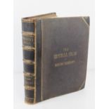
The Imperial Atlas of Modern Geography published London 1860 by Blackie & Son Glasgow and Edinburgh. Half leather bound measuring approx 39 x 33 x...
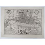
Londinum Feracissimi Angliae Regni metropolis; Map of London with Tudor and City Arms to upper left and right respectively, illustrated figures of...
Madras c1913 in twenty one sections on cloth measuring 89 x 54.5cm. Together with three District Maps For The Use of Touring Officers c1912, each ...
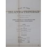
Trinidad by G W Bacon & Co; a single book containing two twenty-section maps on cloth measuring 150 x 129.5cm dated 1912 'Revised and brought up t...
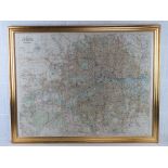
Bacon's large print map of London and suburbs, hand coloured, framed and mounted, overall 101 x 79.5cm. Together with a 2009 reprinted copy of Sta...
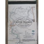
The Oarsmans and Anglers strip map of the River Thames from the Source to London Bridge published London by Edward Stanford, undated pre WWI and m...
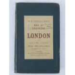
Environs of London by W H Smith & Son London, undated but having owner's details A Harris 1894 to cover and measuring 75 86cm. ...[more]
A quantity of Ordinance Survey maps for France and Belgium, First Edition Albert noted, c1911-1917, ten items, each measuring approx 89 x 65.5cm.
Northamptonshire and the situation of Northampton with the Arms of honourable families, hand coloured book segment map, all measuring approx 58 x ...
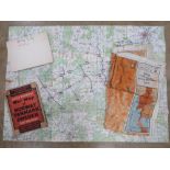
Pilot's map printed on silk being India/Burma, together with a WWII map showing the advance of the Allies to Lumeburg entitled 'Map 'P'' and a Dai...
The Library Reference Atlas by John Bartholomew published 1890, leather bound, spine a/f, together with Kelly's Directory of Oxfordshire 1935, a q...
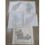
Five hand coloured maps being Northamptonshire (x2), each engraved by J Cary, Bedfordshire engraved by J Cary, Bedford and Berkshire. c1801-1808, ...
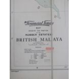
The Financial Times map showing the position of the Rubber Estates in British Malaya in twenty sections on cloth published London by G J Richardso...
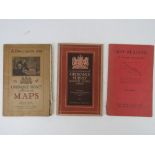
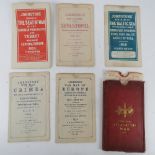
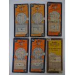
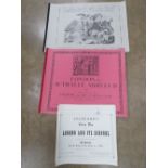
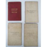
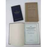
'A Description of Ordinance Survey Large Scale Maps', a c1920s edition, together with a 1955 edition. Also 'Map Reading' by Thomas Pickles publish...
Surrey, drawn and engraved by J Archer for Dugdales England and Wales Delineated, hand coloured, sight size 24 x 19.5cm, framed and glazed.
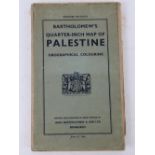
Bartholomew 1/4-inch map of Palestine orographical colouring published Edinburgh inc plan of Jerusalem, vegetation map of Modern Palestine, secti...
Two coal field maps; Scotland by W and AK Johnston in thirty-two sections on cloth, measuring 89 x 81cm. Together with Yorkshire 1914, eighteen se...
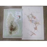
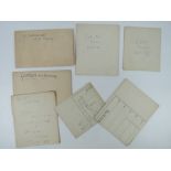
A 1962 map of Ceylon tea estates measuring 76 x 50.5cm. Together with a Plan of the New Almaden Mine, a Geological Map of the New Almaden Mining D...
Six Ashanti Goldfields Corporation mine plans and prospects inc three Obuasi and Main Fissur plans dated 1957, 1958 and 1962, three Cote d'Or Fiss...
A quantity of geological maps inc two 1960/1961 French/Canadian mine maps, New Zealand 1958 and London and Thames Valley 2nd Edition 1947, Wiscons...
An 1826 edition 'New Universal Atlas' published by G&J Cary London, containing a quantity of hand coloured world maps, binding a/f. ...[more]
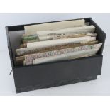
A large selection of geographical topographical land use and other maps.
A German c1920s Atlas together with a quantity of mid-late 20thC Atlas books. Six items.
La Ferrassie; German archaeological site map (Savignac-de-Miremont, in the Dordogne department, France) dated 1907 in the scale of 1:50 having han...
A 1961 Royal Geographical Society reproduction of Early Maps of the British Isles AD1000-AD1579 in folio, together with three reproduction maps of...
A quantity of assorted paper maps inc some 1940 War Revision sheets for Tunbridge Wells and Brighton, a post war map of Berlin showing American, R...
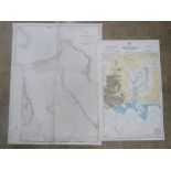
A quantity of Naval maps c1948 inc The Great Bahama Bank sheet IV measuring approx 101 x 76.5cm, North Western Approaches to the British Islands, ...
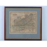
Northamptonshire, a hand coloured map, sight size 16 x 20cm framed and glazed.
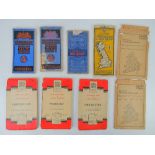
Bartholomews mounted on cloth and other Ordnance Survey maps; Oban District sheet II, Mid-Scotland sheet 45, Pembroke Sheet II, Automobile Map of ...