Refine your search
Sale Section
Remove filter- Militaria (1)
- Objets D'Art, Works of Art, Bijouterie, Gold Coins (5)
Estimate
Category
Remove filter- Maps (6)
Filtered by:
- Sale Section,
- Category
- List
- Grid
A subscription to the Price Guide is required to view results for auctions ten days or older. Click here for more information
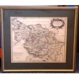

A late-17th century hand-coloured map engraving of the West Riding of York Shire by Robert Morden,
A late-17th century hand-coloured map engraving of the West Riding of York Shire by Robert Morden, the engraving 36cm x 42cm, parcel-gilt framed a...
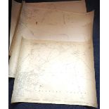
Six early 20th Century (Edition of 1922) Oxfordshire Ordnance Maps detailing Chipping Norton and
Six early 20th Century (Edition of 1922) Oxfordshire Ordnance Maps detailing Chipping Norton and the surrounding environs etc., each approx. 74cm ...
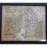
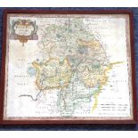
Christopher Saxton/William Kip; an early 17th century hand-coloured map engraving, WARWICI - Comitatus A Cor Nauiis Olim Inhabitatus, 32cm x 40cm,...
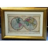
A limited edition colour map engraving, Mappemonde; plate size 32cm x 53cm; gilt framed and glazed to conservation standard
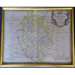
ROBERT MORDEN, a late-17th / early-18th century hand-coloured map engraving, Bedford Shire; originally from an atlas; gilt-framed and glazed; 31.5...
Robert Morden, an early 18th century coloured map engraving, 'Warwick Shire'; 37.5cm x 43cm; framed and glazed