Refine your search
Filtered by:
- Sale Section,
- Category
- List
- Grid
A subscription to the Price Guide is required to view results for auctions ten days or older. Click here for more information
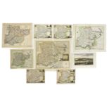

C35 loose MAPS OF ESSEX (18th. & 19th. Century), including: Harrison: View accurate & correct map of Essex, 1787 (Folio, hand coloured) with a tea...
MAP: Homann, Johann Baptist:
MAP: Homann, Johann Baptist: Prospect Grundris und Gegent der Königl. Schwed. Vestung Stralsund, wie solche den 15 July A. 1715 von den Nordischen...
MAP- BLAEU: SUFFOLCIA Vernacule Suffolke. No date, c1648. Hand coloured and mounted, with Dutch text to verso. (495x370mm) ...[more]
MAP: Ancient Durham Map,
MAP: Ancient Durham Map, hand coloured. Ca. 1665.375 x 495mm ...[more]
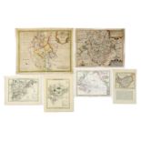
C50 loose COUNTY MAPS (18th. & 19th. Century, many hand coloured), including: MORDEN: Bark shire; Bedfordshire (4 copies); Huntingdonshire; Buckin...
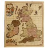
MAP- Frederick De. Wit:
MAP- Frederick De. Wit: NOVISSIMA PRAE CETERISALIIS ACCURATISSIMA REGNORUM ANGLIAE SCOTIAE HIBERNIAE. Ca. 1690, hand coloured and laid down (560x4...
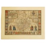
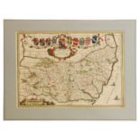
MAP: SPEED, John:
MAP: SPEED, John: Cambridgshire described with the devision of the hundreds, the townes situation with the Armes of the Colleges of that famous Un...
MAP: SPEED, John:
MAP: SPEED, John: Anglesey, antiently called Mona described, hand coloured.405 x 535mm ...[more]
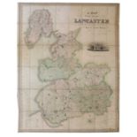
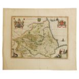
MAP - HENNET, G
MAP- HENNET, G. BINGLEY, James (Engr): A Map Of The County Palatine Of Lancaster Divided Into Hundreds And Parishes From An Accurate Survey Made I...
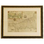
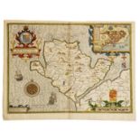
MAP- SAXTON, C & WILLIAM KIP:
MAP- SAXTON, C & WILLIAM KIP: Cornwall olim pars Danmoniorum. No date, c1673. Hand coloured and with an inset view (390x290mm), mounted, framed an...
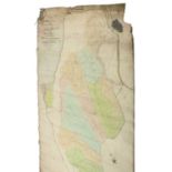
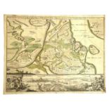
MAPS/Marshland- Utting, J: 1-
MAPS/Marshland- Utting, J: 1- Plan of the survey & levels of the sewers, drains, bridges, tunnels & sluices in the parishes of the county of Marsh...
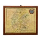
A hand coloured map of Wiltshire,
A hand coloured map of Wiltshire, by Robert Morden, 36 x 43cmCondition ReportBrowning to paper, creasing to centre with a small area of damage. Ri...
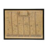
After John Ogilby
After John Ogilby,17th/18th century, 'The Continuation of the Road from London to Barwick', engraved and hand coloured road map, framed,33 x 45.5c...