Filtered by:
- Category,
- Item Type
- List
- Grid
A subscription to the Price Guide is required to view results for auctions ten days or older. Click here for more information
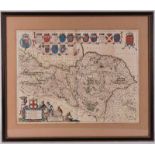

17th Century map of The North Riding of Yorkshire Ducatus Eboracensis Pars Borealis by Johannes
17th Century map of The North Riding of Yorkshire Ducatus Eboracensis Pars Borealis by Johannes Blaeu, pub Amsterdam c1662 38.5cm x 50cm, framed a...
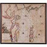
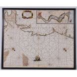
17th Century Chart of the coast of Ireland and Scotland with the Isle of Lewis by Johannes Van
17th Century Chart of the coast of Ireland and Scotland with the Isle of Lewis by Johannes Van Keulen (1654-1715) pub Amsterdam c1700 50.5cm x 58c...
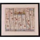
Oglby 17th Century strip map The Road From Welshpool, Montgomery to Carmarthen in North Wales,
Oglby 17th Century strip map The Road From Welshpool, Montgomery to Carmarthen in North Wales, 34cm x 42cm, framed and glazed ...[more]
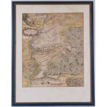
A rare17th Century military map plan of the Battle of Blenheim, pub A Roper c1705, 3 to the mile
A rare17th Century military map plan of the Battle of Blenheim, pub A Roper c1705, 3 to the mile 43.5cm x 36cm, framed and glazed ...[more]
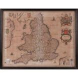
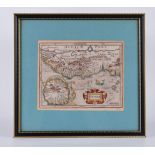
17th Century map of England Anglia Regnum, pub Amsterdam c1646 by Jan Jansson, 39cm x 50cm, framed
17th Century map of England Anglia Regnum, pub Amsterdam c1646 by Jan Jansson, 39cm x 50cm, framed and glazed ...[more]
17th Century Sea Chart showing the Yorkshire coast by Jacob and Casper Lootsman (Jacobz) De Cust Van Engeland Tusschen Wells en't Eyland Cogge, in...
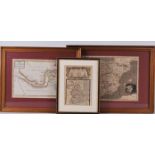
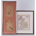
Three 18th Century and later book maps ...[more]
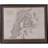
18th Century map of Sweden with Finland by T Bowen c1780, 31cm x 41.5cm, framed and glazed ...[more]
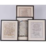
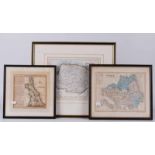
Four 18th century county maps ...[more]
Maps: A chart of "The Streights {sic} of Llangellan, from Awnsham Churchills 1704, & two others (3)
A chart of "The Streights {sic} of Llangellan, from Awnsham Churchills 1704 publication "A Collection of Voyages and Travels". This engraving most...
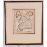
A 17th century book map of Lancashire 20cm x 18cm, framed and glazed ...[more]

Yorkshire Interest: Nooks and Corners of Yorkshire by J.S Fletcher, publisher Eveleigh Nash, The
Yorkshire Interest: Nooks and Corners of Yorkshire by J.S Fletcher, publisher Eveleigh Nash, The Rivers, Mountains and Sea Coast of Yorkshire by J...
A collection of mid 20th century and earlier Ordnance Survey maps plus some earlier book plate maps,
A collection of mid 20th century and earlier Ordnance Survey maps plus some earlier book plate maps, various locations
An 18th century strip map from Carlisle to Lancaster, taken from a book and in two window slip
An 18th century strip map from Carlisle to Lancaster, taken from a book and in two window slip mount, framed and glazed; together with a George II...
A 17th century map of Guinea; Edited by Jodocus Hondius (1563-1612), 1613 from Atlas Minor. Edition : Amsterdam, 1613, XVIIe Century, French editi...