Filtered by:
- Category,
- Item Type
- List
- Grid
A subscription to the Price Guide is required to view results for auctions ten days or older. Click here for more information
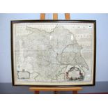

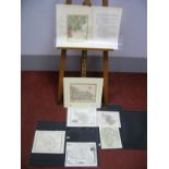
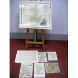
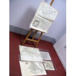
BOWEN (EMAN) An Accurate Map of the County of York Divided by It's Ridings, hand coloured map,
BOWEN (EMAN) An Accurate Map of the County of York Divided by It's Ridings, hand coloured map, framed and glazed, 57 x 74cm.
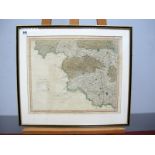
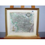
TEESDALE (HENRY) West Riding of Yorkshire, hand coloured map, framed and glazed, 34 x 41cm.
MORDEN (ROBERT) The North Riding of Yorkshire, map, 38 x 43cm; Another; The East Riding of Yorkshire, map, 38 x 43cm. (2)
MORDEN (ROBERT) Britannia Saxonica, map, 44 x 39cm; NEELE Great Britain and Ireland, map 16.5 x
MORDEN (ROBERT) Britannia Saxonica, map, 44 x 39cm; NEELE Great Britain and Ireland, map 16.5 x 12cm; Two Others, of England and Wales. (4)
CAREY (JOHN) Part of the West Riding of Yorkshire, hand coloured map, 26.5 x 21cm; Seven Other Maps,
CAREY (JOHN) Part of the West Riding of Yorkshire, hand coloured map, 26.5 x 21cm; Seven Other Maps, of West Yorkshire and It's Towns. (8)
AFTER CHRISTOPHER SAXTON (Act.1540-1610) Eboracensis: West Riding, XVIII Century engraved map, later
AFTER CHRISTOPHER SAXTON (Act.1540-1610) Eboracensis: West Riding, XVIII Century engraved map, later hand-coloured, 26.5 x 31cm.
OGOLBY (JOHN) A Road Map From London to Rye in Sussex, 29 x 45cm; Another, London to Lands End, hand
OGOLBY (JOHN) A Road Map From London to Rye in Sussex, 29 x 45cm; Another, London to Lands End, hand coloured, 33 x 48cm. (2)
CARY (JOHN) Buckinghamshire Divided into Hundreds, 1801, hand coloured map, 53 x 48cm; Another,
CARY (JOHN) Buckinghamshire Divided into Hundreds, 1801, hand coloured map, 53 x 48cm; Another, Handii Sumptibus Henrici, 1632, Port of Lincolnshi...
MALL (H) A Map of Nottinghamshire, hand coloured, 35 x 23cm; GREENWOOD (C & J) Map of the County
MALL (H) A Map of Nottinghamshire, hand coloured, 35 x 23cm; GREENWOOD (C & J) Map of the County of Cambridge, 1834, hand coloured and five other...
BOWEN (EMANUEL) An Accurate Map of Buckinghamshire, hand coloured, 71 x 51cm; SAXON (CHRISTOPHORUS) Map of Cambridge, 29 x 33cm; Four Others. (6)
![Cary [John]: Cary's Traveller's Companion, or a Delineation of the Turnpike Roads of England and](https://portal-images.azureedge.net/auctions-2017/srsh10184/images/e86f883d-b237-4290-f2c0-17f9ab647371.jpg?w=155&h=155)
Cary [John]: Cary's Traveller's Companion, or a Delineation of the Turnpike Roads of England and
Cary [John]: Cary's Traveller's Companion, or a Delineation of the Turnpike Roads of England and Wales, printed for G and J Cary Engravers, 86 St....
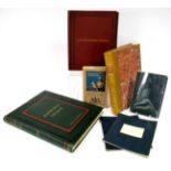
The History of Conisborough Castle, with Glimpses of Ivanhoe-Land, compiled by Henry Ecroyd Smith,
The History of Conisborough Castle, with Glimpses of Ivanhoe-Land, compiled by Henry Ecroyd Smith, printed for the subscriber, Robert White, Works...
![Dunston [G., M.I.M.E]: The Rivers of Axholme, with a History of the Navigable Rivers and Canals of](https://portal-images.azureedge.net/auctions-2017/srsh10184/images/098d8803-f22e-4d7d-9fd1-8f59a037877f.jpg?w=155&h=155)
Dunston [G., M.I.M.E]: The Rivers of Axholme, with a History of the Navigable Rivers and Canals of
Dunston [G., M.I.M.E]: The Rivers of Axholme, with a History of the Navigable Rivers and Canals of the District, pub. A. Brown & Sons, London, 190...