Refine your search
Filtered by:
- Category,
- Item Type
6 items
- List
- Grid
A subscription to the Price Guide is required to view results for auctions ten days or older. Click here for more information
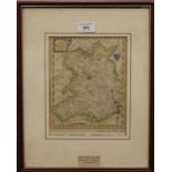

An 18th century map of Shropshire, framed and glazed. 17 x 21.5 cm.
Lot 280
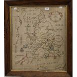
An 18th century needlework map of England and Wales, dated 1785, framed and glazed. 51.5 x 59.5 cm.
An 18th century needlework map of England and Wales, dated 1785, framed and glazed. 51.5 x 59.5 cm.
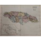
A collection of maps of the West Indies, including Jamaica from Stanford's London Folio Atlas
Lot 707
W and A.
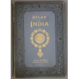
W and A.K Johnston Atlas of India, 1894 Atlas of India, containing sixteen maps and complete index
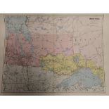
A collection of maps of North America from Stanford's London Folio Atlas
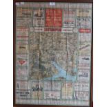
A 1920's advertising calendar/map of Southampton District, framed and glazed. 56.5 x 77 cm. ...[more]