Filtered by:
- Category,
- Item Type
- List
- Grid
A subscription to the Price Guide is required to view results for auctions ten days or older. Click here for more information
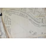

ORDNANCE SURVEY MAPS, seven maps Zincographed and Published by the Ordnance Survey Office, Southampton in 1888 or 1889 of Birmingham and its Envir...

THREE BOXES OF RAILWAY BOOKS AND ORDNANCE SURVEY BOOKS, to include over one hundred Ordnance
THREE BOXES OF RAILWAY BOOKS AND ORDNANCE SURVEY BOOKS, to include over one hundred Ordnance Survey maps and Bartholomew World Travel maps, eight ...

POSTCARDS, three albums containing approximately 312 postcards, album one features early 20th
POSTCARDS, three albums containing approximately 312 postcards, album one features early 20th century images of topographical views, land marks, p...

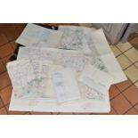
MAPS, one box containing over 100 Ordnance Survey maps (some duplicates) and others and a Baedekers AA map of Germany (1 box)

TWO BOXES OF OVER ONE HUNDRED MAPS, to include Ordnance Survey, Batholomew's map, National Grid, AA,
TWO BOXES OF OVER ONE HUNDRED MAPS, to include Ordnance Survey, Batholomew's map, National Grid, AA, etc (2 boxes)

BOOKS, MAPS & DVDS, five boxes containing approximately eighty book titles in hardback and paperback
BOOKS, MAPS & DVDS, five boxes containing approximately eighty book titles in hardback and paperback format, one hundred DVD titles and fifty Ordn...
NINE 1-250,000 SCALE ORDNANCE SURVEY MAPS OF FRANCE DATED 1938, comprising sheets 3a, 7, 7a & 13a,
NINE 1-250,000 SCALE ORDNANCE SURVEY MAPS OF FRANCE DATED 1938, comprising sheets 3a, 7, 7a & 13a, 8, 13, 14, 15 & part of 9, 20 and 21, maps are ...