Filtered by:
- Lots with images only,
- Category
- List
- Grid
A subscription to the Price Guide is required to view results for auctions ten days or older. Click here for more information
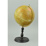

A 'GEOGRAPHICA' 10'' TERRESTRIAL GLOBE, on a turned wooden stand, height approximately 46cm (
A 'GEOGRAPHICA' 10'' TERRESTRIAL GLOBE, on a turned wooden stand, height approximately 46cm (condition: discolouration, some splits in the paper, ...
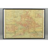
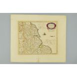
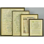
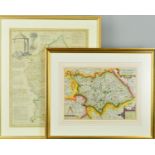
A FRAMED GREAT WESTERN RAILWAY MAP, previously folded, has wear and minor damage to some of the
A FRAMED GREAT WESTERN RAILWAY MAP, previously folded, has wear and minor damage to some of the folds and edges, other marking and wear, dates fro...
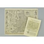
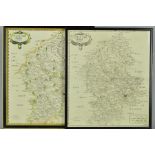
YATES (WILLIAM), a map of the County of Stafford from An Actual Survey Begun in the year 1769 and
YATES (WILLIAM), a map of the County of Stafford from An Actual Survey Begun in the year 1769 and Finished in 1775 published according to Act of P...
GREENWOOD, (C), Map of the County of Stafford from Actual Survey made in The Years 1819 and 1820,
GREENWOOD, (C), Map of the County of Stafford from Actual Survey made in The Years 1819 and 1820, published by W. Fowler. C. Greenwood & Co, Londo...
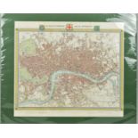
WALKER (JOHN & CHARLES) 'A PLAN OF LONDON AND ITS ENVIRONS', from Lewis' 'Topographical Dictionary, after R. Creighton', the engraving with later ...
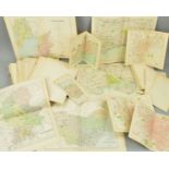
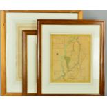
MAPS, unframed, a quantity of late 19th Century folded maps and town plans from publications
MAPS, unframed, a quantity of late 19th Century folded maps and town plans from publications including The Royal Atlas of England and Wales, Phili...
OGILBY (JOHN), TWO ROAD MAPS, 'The Continuation of The Road from London to Holy head Plate 2d
OGILBY (JOHN), TWO ROAD MAPS, 'The Continuation of The Road from London to Holy head Plate 2d Commencing at Towcester.... and Extending to The Cit...
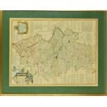
STAFFORDSHIRE, GREENWOOD (C & J), A 'Map of The County of Stafford from an actual survey made in the
STAFFORDSHIRE, GREENWOOD (C & J), A 'Map of The County of Stafford from an actual survey made in the years 1818 and 1819', published by Greenwood ...
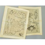
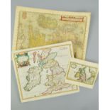
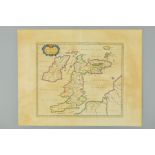
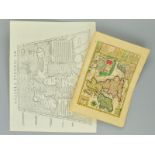
BRITISH ISLES, ORTELIUS (ABRAHAM), 'Britannicarum Insularum Vetus Descriptio' and 'Cum Privilegio
BRITISH ISLES, ORTELIUS (ABRAHAM), 'Britannicarum Insularum Vetus Descriptio' and 'Cum Privilegio Imp. Reg. et Cancellariae Brabantiae decennali',...
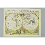
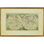
WORLD, WELLS (EDWARD), 'A NEW MAP of THE TERRAQUEOUS GLOBE according to the latest Discoveries and
WORLD, WELLS (EDWARD), 'A NEW MAP of THE TERRAQUEOUS GLOBE according to the latest Discoveries and most general Divisions of it into CONTINENTS an...
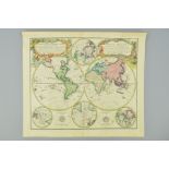
WORLD, HOMANN (JOHANN BAPTIST), 'PLANIGLOBII TERRESTRIS Universalis Utrumq Hemisphaerium Orient et
WORLD, HOMANN (JOHANN BAPTIST), 'PLANIGLOBII TERRESTRIS Universalis Utrumq Hemisphaerium Orient et Occidentale repraesentans... MAPPE-MONDE qui r...
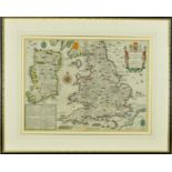
ENGLAND & WALES, HOLE (WILLIAM), 'ENGLALOND ANGLIA ANGLOSAXONUM HEPTARCHIA', early 17th Century
ENGLAND & WALES, HOLE (WILLIAM), 'ENGLALOND ANGLIA ANGLOSAXONUM HEPTARCHIA', early 17th Century engraved map, hand coloured, unframed, paper size ...
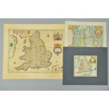
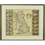
ENGLAND, SAXTON (CHRISTOPHER) & SPEED (JOHN), 'THE KINGDOME OF ENGLAND', engraved map, uncoloured,
ENGLAND, SAXTON (CHRISTOPHER) & SPEED (JOHN), 'THE KINGDOME OF ENGLAND', engraved map, uncoloured, eight costume portraits and a catalogue of 'all...
BRITISH ISLES, ORTELIUS (ABRAHAM), 'ANGLIAE SCOTIAE HIBERNIAE SIVE BRITANNICAR INSULARUM DESCRIPTIO', a late 16th Century engraved map, hand colou...
EUROPE, LEA (PHILLIP) & OVERTON (HENRY), 'A New Mapp of Europe Divided into it's Principall KINGDOMS
EUROPE, LEA (PHILLIP) & OVERTON (HENRY), 'A New Mapp of Europe Divided into it's Principall KINGDOMS And Provinces by Phillip Lea at ye Atlas and ...
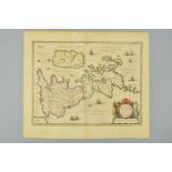
BRITISH ISLES, JANSSON (JAN), ENGRAVED BY VAN DER KEERE (PIETER) AFTER ORTELIUS (ABRAHAM) INSULARUM BRITANNICARUM Acurata Delineatio ex Geographic...
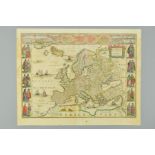
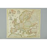
EUROPE, BLAEU (WILLEM) 'EUROPA RECENS DESCRIPTA', a mid 17th Century engraved map, hand coloured,
EUROPE, BLAEU (WILLEM) 'EUROPA RECENS DESCRIPTA', a mid 17th Century engraved map, hand coloured, unmounted and unframed, features nine vignettes ...
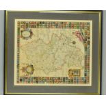
ENGLISH COUNTIES, MERCATOR (GERHARD) EBORACUM, LINCOLNIA, DERBIA, STAFFORDIA, NOTINGHAMIA, LECESTRIA, RUTLANDIA ET NORFOLCIA, a mid 17th Century e...
BRITISH ISLES, JANSSON (JAN) 'MAGNAE BRITANNIAE et HIBERNIAE Nova DESCRIPTIO', a mid 17th Century
BRITISH ISLES, JANSSON (JAN) 'MAGNAE BRITANNIAE et HIBERNIAE Nova DESCRIPTIO', a mid 17th Century engraved map, hand coloured, Royal Coat of Arms ...
BRITISH ISLES, BLAEU (JOHN) 'INSULAE ALBION et HIBERNIA cum minoribus adjacentibus', a mid 17th
BRITISH ISLES, BLAEU (JOHN) 'INSULAE ALBION et HIBERNIA cum minoribus adjacentibus', a mid 17th Century engraved map, hand coloured, Ptolemaic pro...
BRITISH ISLES, SCHREIBER (JOHANN GEORG) 'GROS BRITANNIEN oder ENGELLAND SCHOTTLAND Und IRRLAND', a
BRITISH ISLES, SCHREIBER (JOHANN GEORG) 'GROS BRITANNIEN oder ENGELLAND SCHOTTLAND Und IRRLAND', a first half 18th Century engraved map, hand colo...
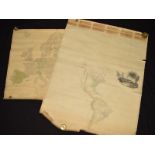
AMERICA AND EUROPE, ARROWSMITH (AARON), 'MAP OF AMERICA by A. Arrowsmith Hydrographer to H.R.H.
AMERICA AND EUROPE, ARROWSMITH (AARON), 'MAP OF AMERICA by A. Arrowsmith Hydrographer to H.R.H. The Prince of Wales 1804', paper laid on linen, ro...
SAXTON/KIP-STAFFORDIAE COMITATUS PARS OLIM Cornaviorum, hand coloured, strapwork title, circa
SAXTON/KIP-STAFFORDIAE COMITATUS PARS OLIM Cornaviorum, hand coloured, strapwork title, circa 1610, approximately 27cm x 38cm, together with three...
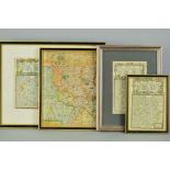
CARY, (JOHN), STAFFORDSHIRE, CHESHIRE AND LEICESTERSHIRE, three county maps from 'New and Correct
CARY, (JOHN), STAFFORDSHIRE, CHESHIRE AND LEICESTERSHIRE, three county maps from 'New and Correct English Atlas', 1787, hand coloured, all framed ...
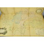
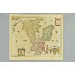
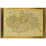
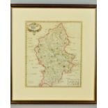
WALKER, J & C, STAFFORDSHIRE, a hand tinted map with dots indicating the 'Places of The Meeting of
WALKER, J & C, STAFFORDSHIRE, a hand tinted map with dots indicating the 'Places of The Meeting of Foxhounds' and named areas of the hunts, circa ...
ANON, 'THE WORLD ACCORDING TO THE LATEST DISCOVERIES', a hand coloured engraving double hemisphere
ANON, 'THE WORLD ACCORDING TO THE LATEST DISCOVERIES', a hand coloured engraving double hemisphere World map, similar to Thomas Jeffries map of th...
JOHN SPEED, 'The Invasions of England and Ireland with al their civill Wars since the Conquest', a
JOHN SPEED, 'The Invasions of England and Ireland with al their civill Wars since the Conquest', a hand coloured engraved double page map, engrave...
STAFFORDSHIRE, PLOT (ROBERT), '..Map of Staffordshire newly delineated after a new manner with all
STAFFORDSHIRE, PLOT (ROBERT), '..Map of Staffordshire newly delineated after a new manner with all imaginable Submission is humbly dedicated by RP...
BRITISH ISLES, (ANON) BRITANNIA PROUT DIVISA SUIT TEMPORIBUS ANGLO-SAXONUM, PRAESERTIM DURANTE
BRITISH ISLES, (ANON) BRITANNIA PROUT DIVISA SUIT TEMPORIBUS ANGLO-SAXONUM, PRAESERTIM DURANTE ILLORUM HEPTARCHIA', a hand coloured engraved map, ...
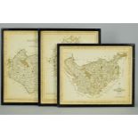
STAFFORDSHIRE, MORDEN (ROBERT), two engraved county maps, one hand coloured, both framed and glazed,
STAFFORDSHIRE, MORDEN (ROBERT), two engraved county maps, one hand coloured, both framed and glazed, approximately 42.5cm x 37cm (2)
WARWICKSHIRE, SELLER (JOHN), an engraved map, hand coloured, taken from the 18th Century book '
WARWICKSHIRE, SELLER (JOHN), an engraved map, hand coloured, taken from the 18th Century book 'Supplement to The Antiquities of England and Wales'...
WARWICKSHIRE, SPEEDE (JOHN), 'THE COUNTI OF WARWICK THE SHIRE TOWNE AND CITIE OF COVENTRE DESCRIBED,
WARWICKSHIRE, SPEEDE (JOHN), 'THE COUNTI OF WARWICK THE SHIRE TOWNE AND CITIE OF COVENTRE DESCRIBED, with plans of 'WARWICKE' and 'COVENTREE' and ...
STAFFORDSHIRE, BOWEN (EMANUEL), a map from 'The Royal Atlas', 'A Corrected MAP of The COUNTY of
STAFFORDSHIRE, BOWEN (EMANUEL), a map from 'The Royal Atlas', 'A Corrected MAP of The COUNTY of STAFFORD divided into HUNDREDS....', hand coloured...
NOTTINGHAMSHIRE, AFTER MORDEN (ROBERT), a hand coloured reprint, approximately 36cm x 42.5cm, 'A
NOTTINGHAMSHIRE, AFTER MORDEN (ROBERT), a hand coloured reprint, approximately 36cm x 42.5cm, 'A View Accurate and Correct Map of Nottinghamshire,...
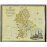
STAFFORDSHIRE, YATES (W), 'The County of Stafford Reduced from the Improved Map in Six Sheets, .....
STAFFORDSHIRE, YATES (W), 'The County of Stafford Reduced from the Improved Map in Six Sheets, ..... Planned by a Scale of Two Miles to an Inch', ...
STAFFORDSHIRE, BOWEN (EMANUEL), 'An IMPROVED MAP of The COUNTY of STAFFORD Divided into its HUNDREDS, Collected from the best materials and Illust...
STAFFORDSHIRE, GREENWOOD (C & J), 'A Map of the County of Stafford from an Actual Survey Made in the
STAFFORDSHIRE, GREENWOOD (C & J), 'A Map of the County of Stafford from an Actual Survey Made in the years 1818 and 1819', published by Greenwood ...
STAFFORDSHIRE, MORDEN (ROBERT), an 18th Century hand coloured engraved map of the county, framed and
STAFFORDSHIRE, MORDEN (ROBERT), an 18th Century hand coloured engraved map of the county, framed and glazed, approximately 43cm x 37cm
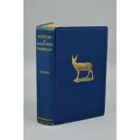
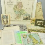
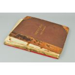
STOREY, HARRY, 'Hunting & Shooting in Ceylon', 2nd edition, 1907, Pub Longmans, Green & Co, 69
STOREY, HARRY, 'Hunting & Shooting in Ceylon', 2nd edition, 1907, Pub Longmans, Green & Co, 69 Illustrations from photographs plus large folding m...
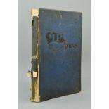
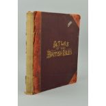
BACON'S NEW LARGE SCALE ATLAS OF THE BRITISH ISLES, with plans of Towns, Copious Letterpress
BACON'S NEW LARGE SCALE ATLAS OF THE BRITISH ISLES, with plans of Towns, Copious Letterpress Descriptions, etc, pub George Bacon, circa 1880 hand-...
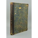
HALL, SIDNEY & HUGHES, WILLIAM, 'General Atlas of The World', containing upwards of seventy maps (
HALL, SIDNEY & HUGHES, WILLIAM, 'General Atlas of The World', containing upwards of seventy maps (hand-coloured) 1st Edition, pub A & C Black, 185...
THE M.P. ATLAS, a collection of maps showing the Commercial and Political Interests of The British
THE M.P. ATLAS, a collection of maps showing the Commercial and Political Interests of The British Isles and Empire, 1st Edition, W & A.K. Johnsto...
'LE SAGE'S HISTORICAL, GENEALOGICAL, CHRONOLOGICAL AND GEOGRAPHICAL ATLAS, 1st Edition, pub Gold &
'LE SAGE'S HISTORICAL, GENEALOGICAL, CHRONOLOGICAL AND GEOGRAPHICAL ATLAS, 1st Edition, pub Gold & Co, 1818 ...[more]
LETTS'S POPULAR COUNTY ATLAS, being a complete series of maps Delineating 'The Whole Surface of
LETTS'S POPULAR COUNTY ATLAS, being a complete series of maps Delineating 'The Whole Surface of England and Wales....', 1st Edition, pub Letts, 18...
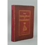
BARTHOLOMEW, J.G., 'The Royal Atlas of England and Wales', 1st Edition, pub Newnes lacks front
BARTHOLOMEW, J.G., 'The Royal Atlas of England and Wales', 1st Edition, pub Newnes lacks front endpapers, otherwise clean and complete
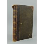
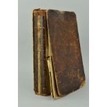
ENCYCLOPAEDIA BRITANNICA TENTH EDITION, VOLUME XXXIV MAPS, pub A & C Black, 1903, half leather
ENCYCLOPAEDIA BRITANNICA TENTH EDITION, VOLUME XXXIV MAPS, pub A & C Black, 1903, half leather binding split at spine and front hinge, but complet...
BACON'S COMMERCIAL AND LIBRARY ATLAS OF THE BRITISH ISLES, 1899
BRYCE, JAMES ET AL, 'The International Atlas and Geography: Modern Historical, Classical and
BRYCE, JAMES ET AL, 'The International Atlas and Geography: Modern Historical, Classical and Physical', pub Collins, 1880, contains 130 maps
DALTON, WILLIAM HUGH, The New and Complete English Traveller, pub Alex Hogg, 1794, distressed, but
DALTON, WILLIAM HUGH, The New and Complete English Traveller, pub Alex Hogg, 1794, distressed, but many interesting late 18th Century maps and pri...