Filtered by:
- Category
- List
- Grid
A subscription to the Price Guide is required to view results for auctions ten days or older. Click here for more information


A COLLECTION OF MAPS, published under The Superintendance of The Society for The Diffusion of useful
A COLLECTION OF MAPS, published under The Superintendance of The Society for The Diffusion of useful Knowledge, comprising The Environs of London,...
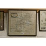
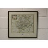
A HAND COLOURED MAP, inscribed Gloucestershire by Robt Morden, approximately 42cm x 47cm
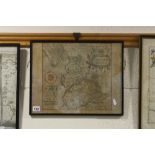
A HAND COLOURED MAP, inscribed Lancastriae Cornitatus Palatinus Olim Pars Brigantum, Chrif Saxton,
A HAND COLOURED MAP, inscribed Lancastriae Cornitatus Palatinus Olim Pars Brigantum, Chrif Saxton, approximately 31.5cm x 39.5cm
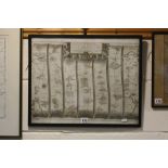
A HAND COLOURED MAP, The Continuation of The Road from London to The Lands Ends, approximately 37.
A HAND COLOURED MAP, The Continuation of The Road from London to The Lands Ends, approximately 37.5cm x 47cm
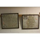
A HAND COLOURED MAP, inscribed Darbiensis Comitatus, Vernacun Darbie Shire with text verso, approximately 39cm x 50cm, together with Leicestershir...
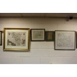
THREE ROBERT MORDEN MAPS, Leicestershire, approximately 37cm x 42.5cm and a partially coloured
THREE ROBERT MORDEN MAPS, Leicestershire, approximately 37cm x 42.5cm and a partially coloured Leicestershire, approximately 37cm x 42.5cm, both i...
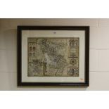
JOHN SPEEDE, after a two page map, Darbieshire having coats of arms, compass points and Buxton and
JOHN SPEEDE, after a two page map, Darbieshire having coats of arms, compass points and Buxton and Darbye Street map details, hand coloured, appro...
THE COUNTY OF MONMOUTH, by Robt Morden sold by Abel Swale Awnsham & Iohn Churchhill, approximately
THE COUNTY OF MONMOUTH, by Robt Morden sold by Abel Swale Awnsham & Iohn Churchhill, approximately 36cm x 43cm
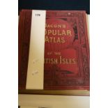
A BOUND VOLUME, Bacon's Popular Atlas of The British Isles reduced from The New Ordnance Survey
A BOUND VOLUME, Bacon's Popular Atlas of The British Isles reduced from The New Ordnance Survey containing sixty four double page maps and plans w...
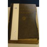
A BOUND VOLUME STIELER'S ATLAS, of Modern Geography 254 maps and inserts on 108 sheets engraved on
A BOUND VOLUME STIELER'S ATLAS, of Modern Geography 254 maps and inserts on 108 sheets engraved on copper, tenth (Centenary) edition completely ra...