2538
Fer, Introduction a la géographie Fer, N. de. Introduction à la géographie. 2e éd. Paris 1717. (20:
1/5


Auctioneer has chosen not to publish the price of this lot
Königstein
Description
Fer, Introduction a la géographie
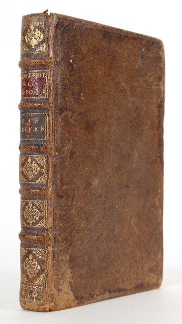
Fer, N. de. Introduction à la géographie. 2e éd. Paris 1717. (20:13 cm). Mit 2 gest. Titeln, 5 gefalt. Kupferkarten und 1 gefalt. Kupfertafel. 197 S., 4 Bll. gest. Text. Ldr. d. Zt. mit 2 Rsch. und Rückenvergold., etwas beschabt und bestoßen, Unterecke und Unterkante des Rückdeckels mit kl. Bezugsfehlstellen.
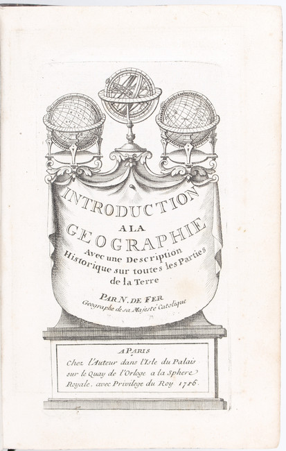
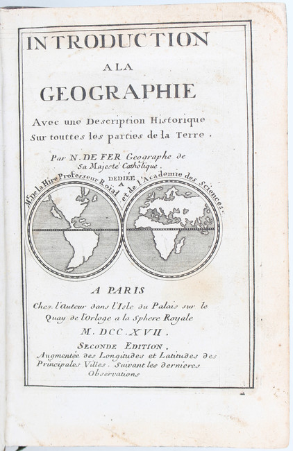
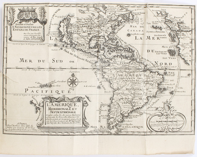
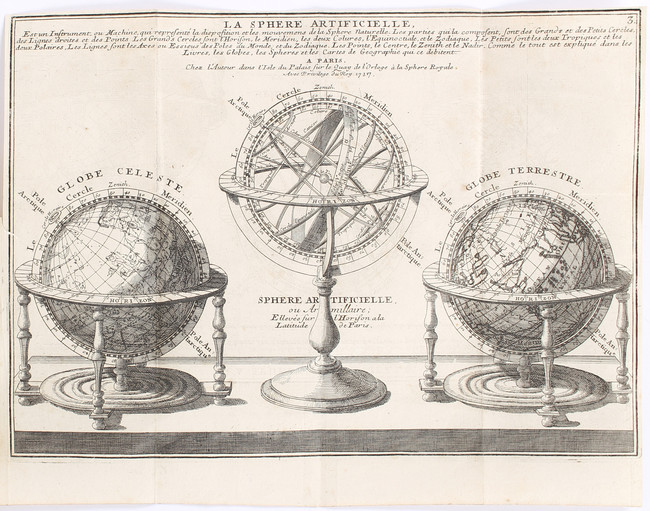
Pastoureau, Fer XI B; Pagliani 28. - Text vollständig in Kupfer gestochen. Mit 1 Weltkarte und 4 Erdteilkarten sowie Tafel mit Globen und Armillarsphäre, alle 1717 datiert. Hier mit den 2 von Pastoureau genannten Titeln von 1717 und 1716 mit kl. Weltkarte in 2 Hemisphären (McLaughlin/M., California, S. 130, Nr. 13) bzw. kl. Globenarrangement. - Leicht fleckig. Tafel und Karten mit kl. Falzeinrissen, bei Amerika etwas länger und oben auch Faltstelleneinriß bis ins Bild, S. 91/2 mit Randeinriß bis in den Text. Ohne vord. freies Vorsatzbl.
With 2 engr. titles, engr. folding plate, 5 engr. folding maps, and entire text engraved. First title with miniature world map in double hemisphere showing California as an island. - Some spotting, small tears to inner margins of maps and plate, a bit longer to map of America, and also tear to folding affecting image. Marginal tear to p. 91/2. Contemp. calf, spine gilt, somewhat worn and rubbed with some exposure to boards.
Auction Details
Shipping
T&Cs & Important Info
Ask seller a question
Fer, Introduction a la géographie
Fer, N. de. Introduction à la géographie. 2e éd. Paris 1717. (20:13 cm). Mit 2 gest. Titeln, 5 gefalt. Kupferkarten und 1 gefalt. Kupfertafel. 197 S., 4 Bll. gest. Text. Ldr. d. Zt. mit 2 Rsch. und Rückenvergold., etwas beschabt und bestoßen, Unterecke und Unterkante des Rückdeckels mit kl. Bezugsfehlstellen.
Pastoureau, Fer XI B; Pagliani 28. - Text vollständig in Kupfer gestochen. Mit 1 Weltkarte und 4 Erdteilkarten sowie Tafel mit Globen und Armillarsphäre, alle 1717 datiert. Hier mit den 2 von Pastoureau genannten Titeln von 1717 und 1716 mit kl. Weltkarte in 2 Hemisphären (McLaughlin/M., California, S. 130, Nr. 13) bzw. kl. Globenarrangement. - Leicht fleckig. Tafel und Karten mit kl. Falzeinrissen, bei Amerika etwas länger und oben auch Faltstelleneinriß bis ins Bild, S. 91/2 mit Randeinriß bis in den Text. Ohne vord. freies Vorsatzbl.
With 2 engr. titles, engr. folding plate, 5 engr. folding maps, and entire text engraved. First title with miniature world map in double hemisphere showing California as an island. - Some spotting, small tears to inner margins of maps and plate, a bit longer to map of America, and also tear to folding affecting image. Marginal tear to p. 91/2. Contemp. calf, spine gilt, somewhat worn and rubbed with some exposure to boards.
Old and Modern LiteratureArt · Philosophy · AutographsRare Books · ManuscriptsGeography · Travel · AtlasesPhotography · Maps · Decorative Prints
Sale Date(s)
Venue Address
Adelheidstr. 2
Königstein
61462
Germany
For Reiss & Sohn, Buch- und Kunstantiquariat, Auktionen delivery information please telephone +49 (0)6174 9272-0.
Important Information
Der Käufer hat auf den Zuschlagspreis ein Aufgeld von 17% zu entrichten; auf den Nettoendbetrag wird Umsatzsteuer zum ermäßigten Satz von zurzeit 7% erhoben. Gegenstände, die dem vollen Umsatzsteuersatz von zurzeit 19% unterliegen, sind mit * gekennzeichnet (Regelbesteuerung).