
Refine your search
Filtered by:
- Category,
- Creator / Brand
- List
- Grid
A subscription to the Price Guide is required to view results for auctions ten days or older. Click here for more information

Fairburn's Map of the country twelve miles around London, first edition pub. 1798, the hand tinted engraved map within glazed birds eye maple fram...
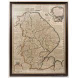
Emanuel Bowen - hand tinted engraved map of Lincolnshire divided into its weapontakes, circa 1760, glazed frame, 71 x 54cm ...[more]
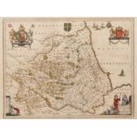
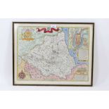
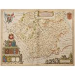
Johannes Blaeu map of Durham, 'Episcopatus Dunelmensis vulgo The Bishoprike of Durham', hand tinted
Johannes Blaeu map of Durham, 'Episcopatus Dunelmensis vulgo The Bishoprike of Durham', hand tinted 17th century engraving, double mounted frame w...
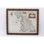
Johannes Blaeu: ' Lancastria Palatinatus Anglis Lancaster et Lancasshire, hand coloured engraved map
Johannes Blaeu: ' Lancastria Palatinatus Anglis Lancaster et Lancasshire, hand coloured engraved map, circa 1645, 40 x 51cm, in gilt frame ...[mo...
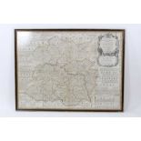
Gerhard Mercator/Hondius Janssan: mid 17th century hand tinted engraved map Eboracum, Lincolnia, Derbia, Staffordia, Nottinghamia, Lecestria, Rutl...
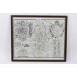
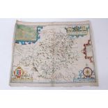
A 17th Century John Speede engraved map of 'The Countie of Nottingham', Sold in Popes head Alley by
A 17th Century John Speede engraved map of 'The Countie of Nottingham', Sold in Popes head Alley by John Sudbury and Greg Humble, 1610, English te...
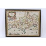
Schenk & Valk, 17th century hand tinted engraved map: 'Comitatus Dorcestria vulgo Anglice Dorset Sh
Schenk & Valk, 17th century hand tinted engraved map: 'Comitatus Dorcestria vulgo Anglice Dorset Shire', circa 1683, 37 x 48cm, glazed frame ...[...
John Speede, 17th century hand coloured engraved map: The Bishoprick and Citie of Durham, published
John Speede, 17th century hand coloured engraved map: The Bishoprick and Citie of Durham, published Thomas Bassett and Chiswell, 37 x 50cm, glazed...
Johannes Blaue hand coloured engraved map: 'Leicestrensis Comitatus. Leicester Shire', 38 x 50cm, La
Johannes Blaue hand coloured engraved map: 'Leicestrensis Comitatus. Leicester Shire', 38 x 50cm, Latin text verso, glazed frame ...[more]
Emmanuel Bowen, hand tinted map: 'An accurate map of Shropshire divided into its Hundreds', publishe
Emmanuel Bowen, hand tinted map: 'An accurate map of Shropshire divided into its Hundreds', published 1751, 53 x 70cm, glazed frame ...[more]
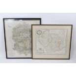
Two engraved maps: Robert Morden - Leicestershire, circa 1695, 35 x 40cm, together with John Cary: A
Two engraved maps: Robert Morden - Leicestershire, circa 1695, 35 x 40cm, together with John Cary: A new map of Wiltshire, pub. 1801, 54 x 48cm, g...
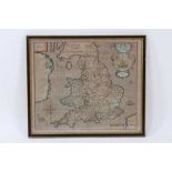
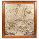
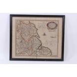
Christopher Saxton and William Hole, hand coloured engraved map: 'Englalond Anglia Anglosaxonum Hept
Christopher Saxton and William Hole, hand coloured engraved map: 'Englalond Anglia Anglosaxonum Heptarchia' 28 x 32cm, glazed frame ...[more]
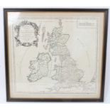
Robert de Vaugondy family and Nicholas Sanson, 1750, Britannicae Insulae, map of British Isles.
Robert de Vaugondy family and Nicholas Sanson, 1750, Britannicae Insulae, engraved map of British Isles, with hand colouring, 49 x 53cm, glazed fr...
John Speede (after Saxton) - Montgomerieshire, hand coloured engraving, 1610 first edition, English descriptive text verso, 39 x 48cm, together wi...