
Filtered by:
- Sale Section,
- Item Type
- List
- Grid
A subscription to the Price Guide is required to view results for auctions ten days or older. Click here for more information
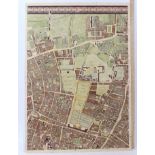

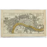
John Rocque 1746 London street map, hand coloured engraved by John Pine and John Tinney, single double page sheet from Rocque's multi sheet large ...
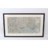
London - Benjamin Rees Davies. 1843 tinted engraved plan of London, 38 x 59cmCondition report: Please note that the map's measurements are 64cm x ...
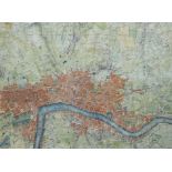
Rocque 1748 hand coloured engraved sheet from his new and accurate survey of the city of London, the central sheet from his map of the environs, s...
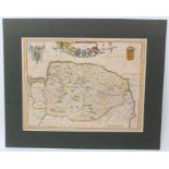
Johannes Blaeu mid 17th century hand coloured engraved map of Norfolk - Nortfolcia, 38 x 49cmCondition report: Margins are intact, there is a litt...
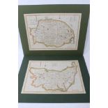
Two late 18th century hand coloured maps, for Suffolk and Norfolk, by Haywood, engraved for J Harrison, 1790. 1789, 35 x 47cm ...[more]
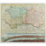
J B Homann - Regionis Londinum quae est circa Londinum, hand coloured engraved map, dated 1741, with Thames panorama, 51 x 58cm, glazed frame ......
Three 18th century hand coloured ward maps of London, including Coleman Street and Bassishaw, Queen Hith and Vintry, and Aldersgate Ward, 1754/55,...
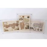
Two 18th century framed plans for rebuilding the City of London after the great fire, taken from Harrison's History of London, each plate 17 x 29c...
Pocket map of London Westminster etc, Thomas Bowles 1743, 26 x 51cm, perspex frame ...[more]
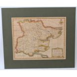
Thomas Bowen 18th century hand coloured map of Essex, 31 x 37cm ...[more]
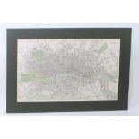
1885 map of London from Bacons Geographical Establishment, 30 x 61cm, glazed frame ...[more]
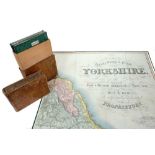
Teesdale's Map of Yorkshire, East, North and West, comprising three large scale hand coloured folding cloth maps, published 1828 in original leath...