
Filtered by:
- Sale Section,
- Item Type
- List
- Grid
A subscription to the Price Guide is required to view results for auctions ten days or older. Click here for more information
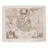

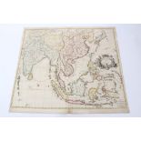
Guiljelmus Blaeu (1571-1638), hand-coloured map - ‘India que Orientalis dicitur et Insulae Adiacentes’, 1635, Dutch text verso, 45cm x 51cmConditi...
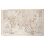
Herman Moll (d. 1732), large hand-coloured map - ‘Asia’, presentation to William, Lord Cowper, Lord
Herman Moll (d. 1732), large hand-coloured map - ‘Asia’, presentation to William, Lord Cowper, Lord High Chancellor of Great Britain’, printed – D...
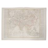
Jean Baptiste Nolin (1657-1725), hand-coloured map - ‘L’Asie’, with updates by L. Denis, 1817, 50cm
Jean Baptiste Nolin (1657-1725), hand-coloured map - ‘L’Asie’, with updates by L. Denis, 1817, 50cm x 67cm.Condition report: minor stains, general...
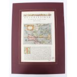
Tomasso Poracchi (1539-1585), hand-coloured map with accompanying Latin text - ‘Descrttione
Tomasso Poracchi (1539-1585), hand-coloured map with accompanying Latin text - ‘Descrttione Dell’Isole Molucca’, 1572, image 11cm x 15cm.Condition...
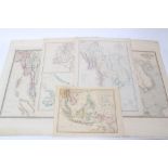
Group of 19th century Far Eastern maps - including two of Burman Empire, by James Wyld; Robert
Group of 19th century Far Eastern maps - including two of Burman Empire, by James Wyld; Robert Wilkinson - ‘The Islands of the East Indies’; two b...
John Senex (d.1740), hand-coloured map - ‘A New Map of India and China’, 1721, 50cm x 59cm.
John Senex (d.1740), hand-coloured map - ‘A New Map of India and China’, 1721, 50cm x 59cm.Condition report: some losses and numerous tape repairs...
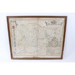
Jan Jansson (1588-1664) hand coloured map - ‘Alsatia Inferior’ published Amsterdam, circa 1640
Jan Jansson (1588-1664) hand coloured map - ‘Alsatia Inferior’ published Amsterdam, circa 1640, 36 x 43cm, glazed frame
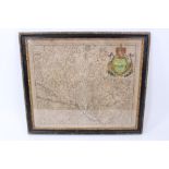
John Speede and John Norden, hand coloured map of Essex, dated 1662, 42 x 52cm, glazed frame
Herman Moll two 18th century hand coloured maps - ‘The South part of Africa and the Island of Madagascar’; ‘Negroland and Guinea’ each 21 x 29cm, ...