
Filtered by:
- Category,
- Item Type
- List
- Grid
A subscription to the Price Guide is required to view results for auctions ten days or older. Click here for more information
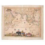

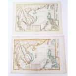
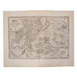
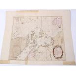
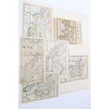
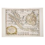
Carel Allard (1648-1709), hand-coloured map - ‘Nova Tabula India Orientalis’, 1697, 45cm x 56cm.
Carel Allard (1648-1709), hand-coloured map - ‘Nova Tabula India Orientalis’, 1697, 45cm x 56cm.Condition report: Overall discoloured-browned, tea...
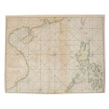
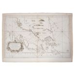
George Anson (1697-1762), engraved chart - ‘A Chart of The Channel in the Philippine Islands
George Anson (1697-1762), engraved chart - ‘A Chart of The Channel in the Philippine Islands through which passes the Manilla Galleon....’ R.W Sea...
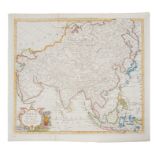
Jean Baptiste Bourguignon d’ Anville (1697-1782), hand-coloured map - ‘Seconde Partie de la Carte
Jean Baptiste Bourguignon d’ Anville (1697-1782), hand-coloured map - ‘Seconde Partie de la Carte d’ Asie continent La Chine, et partie de la Tart...

Jean Baptiste Nicolas Denis Apres de Mannevillette (1707-1780), engraved chart - ‘Carte Plate du
Jean Baptiste Nicolas Denis Apres de Mannevillette (1707-1780), engraved chart - ‘Carte Plate du Golfe de Siam’; 50 x 35cmCondition report: staini...
Jean Baptiste Nicolas Denis Apres de Mannevillette (1707-1780), engraved chart - ‘A plan of the
Jean Baptiste Nicolas Denis Apres de Mannevillette (1707-1780), engraved chart - ‘A plan of the Isles of Mercury / Plan of Junkeylon Island’ dated...
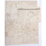
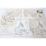
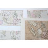
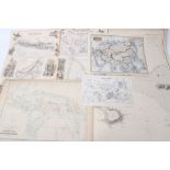
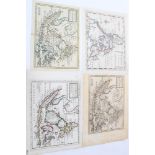
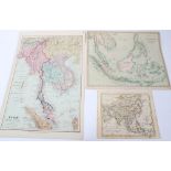
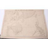
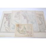
Group of 19th century maps of the Far East - to include Admirality Chart - Ports in the Philippines,
Group of 19th century maps of the Far East - to include Admirality Chart - Ports in the Philippines, 1903; Aaron Arrowsmith - Chart of Philippines...
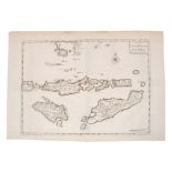
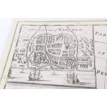
Jan Van Braam (18th century), engraved map - ‘Kaart der Zuyd-Wester Eylanden van Banda’, 1724, 34cm
Jan Van Braam (18th century), engraved map - ‘Kaart der Zuyd-Wester Eylanden van Banda’, 1724, 34cm x 47cm.Condition report: time staining but gen...
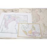
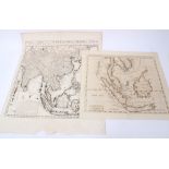
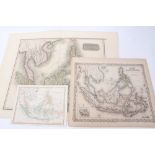
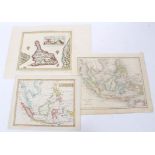
Group of 19th century engraved maps - to include John Bartholomew ‘Malay or Indian Archipelago’;
Group of 19th century engraved maps - to include John Bartholomew ‘Malay or Indian Archipelago’; ‘Indian Archipelago’; Blackie & Son - three mid-1...
Rigobert Bonne (1727-1795), hand-coloured chart - ‘Carte Des Hydro-Geographique Des Indes Orientales’, dated 1771, in four parts, each plate 30cm ...
Rigobert Bonne (1727-1795), group or engraved maps of Far Eastern subjects - some hand-coloured,
Rigobert Bonne (1727-1795), group or engraved maps of Far Eastern subjects - some hand-coloured, various sizes (7).
Rigobert Bonne (1727-1795) hand coloured map - ‘Les Isles Philippine, 23 x 33cm, together with
Rigobert Bonne (1727-1795) hand coloured map - ‘Les Isles Philippine, 23 x 33cm, together with another of the same subject. (2)Condition report: O...
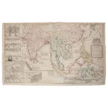
Henry Abraham Chatelain (1684-1743), engraved map - ‘Carte des Indies, de la Chine...’, 1715, 51cm
Henry Abraham Chatelain (1684-1743), engraved map - ‘Carte des Indies, de la Chine....’, 1715, 51cm x 49cm, together with another - ‘La Royaume de...
Thomas Conder (1775-1801), two hand-coloured maps - ‘East India Islands’; ‘Asia’, 1778, 34cm x 39cm.
Thomas Conder (1775-1801), two hand-coloured maps - ‘East India Islands’; ‘Asia’, 1778, 34cm x 39cm.Condition report: minor stains generally good ...
Three 19th century coloured maps of the Far East - Thomas Clerk; Cooper; George Colton.
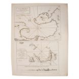
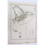
Alexander Dalrymple (1737-1808), engraved chart - ‘Sooloo Archipelago’, 1771, 50cm x 64cm.Condition report: Water stain to margin, minor stains, g...
Samuel Dunn (d. 1794), group of four hand-coloured maps of the Far East, 1786/1789, each approximately 32cm x 45cm.Condition report: Minor marks o...
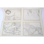
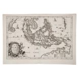
Nicolas de Fer (1646-1720), hand-coloured map - ‘Isles Philippines et la Sonde’ 23 x 35cm, together
Nicolas de Fer (1646-1720), hand-coloured map - ‘Isles Philippines et la Sonde’ 23 x 35cm, together with descriptive text leaf (2).Condition repor...
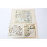
Group of 19th century maps of Far East - including five by Archibald Fullarton & Co., large hand-coloured map of Asia, by William Faden, small map...
Henry Gregory (18th century), engraved chart - ‘Gulph of Siam’, 1787, 53cm x 66cm, together with
Henry Gregory (18th century), engraved chart - ‘Gulph of Siam’, 1787, 53cm x 66cm, together with small hand-coloured map of Asia by John Gibson an...
William Herbert (1718-1795), hand-coloured map - ‘A correct Chart of The China Seas...’, 1758, 59cm
William Herbert (1718-1795), hand-coloured map - ‘A correct Chart of The China Seas...’, 1758, 59cm x 77cmCondition report: Tape top spins, patch ...
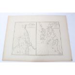
William Herbert (1718-1795), engraved chart, ‘Junk-Seilon’ 76 x 57cm, together with three others by
William Herbert (1718-1795), engraved chart, ‘Junk-Seilon’ 76 x 57cm, together with three others by the same hand. (4)
William Herbert (1718-1795), engraved chart - ‘A plan of the Bay of Manilla’; ‘A plan of Pulo
William Herbert (1718-1795), engraved chart - ‘A plan of the Bay of Manilla’; ‘A plan of Pulo Condore’ two on one sheet, the first 30 x 39cmCondit...
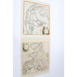
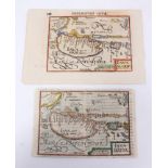
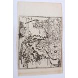
Jan Jansson (1596-1664), engraved miniature map - ‘Die Indianische Insulen’ (Mercator), German text
Jan Jansson (1596-1664), engraved miniature map - ‘Die Indianische Insulen’ (Mercator), German text verso, 1651, together with another from the sa...
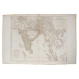
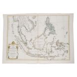
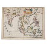
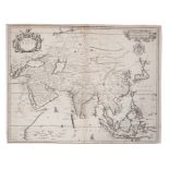
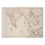
Thomas Jeffreys (c. 1710-1771), engraved chart - ‘A general map of the East Indies’, 1781, 57cm x
Thomas Jeffreys (c. 1710-1771), engraved chart - ‘A general map of the East Indies’, 1781, 57cm x 71cm,Condition report: minor stains generally go...
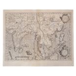
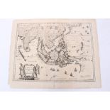
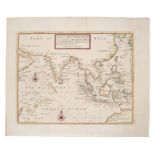
Gerhard Mercator (1512-1594), engraved map - ‘India Orientalis’ (J.Hondius 1609), Latin text verso,
Gerhard Mercator (1512-1594), engraved map - ‘India Orientalis’ (J.Hondius 1609), Latin text verso, 36cm x 48cm.Condition report: Generally good ...
Jacques Nicolas Bellin (1703-1772), engraved chart - ‘Carte Reduite Des Detroits de Malaca, Sincapoera et du Gouverneur’, dated 1755, 58cm x 90cmC...
Abraham Ortelius (1527-1598), engraved map - ‘Indiae Orientalis Insuralarumque Adiacientium Typus’,
Abraham Ortelius (1527-1598), engraved map - ‘Indiae Orientalis Insuralarumque Adiacientium Typus’, 1587, Spanish text verso, 35cm x 49cm.Conditio...
Jan Jansson (1596-1664), hand-coloured map - ‘Sumatrae’ 1657-1658, 42cm x 52cmCondition report: Various tape repairs top margins, creases, stains ...
John Speed (1552-1629), hand-coloured map - ‘A new map of East India’, 1676, English text verso,
John Speed (1552-1629), hand-coloured map - ‘A new map of East India’, 1676, English text verso, 39cm x 49cm.Condition report: Tape repairs to spi...
Johannes Van Keulen (1654-1715), hand-coloured map - ‘Pas Kaart van de Vaar weg van Straat Blanca
Johannes Van Keulen (1654-1715), hand-coloured map - ‘Pas Kaart van de Vaar weg van Straat Blanca af totaan palo Temaon inhoutende de Straaten Dri...
Thomas Kitchin (1718-1784), hand-coloured map - ‘Asia, agreeable to the most approved maps and
Thomas Kitchin (1718-1784), hand-coloured map - ‘Asia, agreeable to the most approved maps and charts’, engraved for Millar’s Complete and Univers...
Thomas Kitchin (1718-1784), engraved map - ‘A general map of the East Indies and that part of China
Thomas Kitchin (1718-1784), engraved map - ‘A general map of the East Indies and that part of China where the Europeans have any settlements or co...
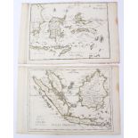
Laurie & Whittle (1794-1818), engraved map - ‘The Coast of India from Pulo Timon to Pulo Cambir
Laurie & Whittle (1794-1818), engraved map - ‘The Coast of India from Pulo Timon to Pulo Cambir comprehending The Malayan Coast, The Gulf of Siam,...
George Le Rouge (fl. 1740-1780), hand-coloured map - ‘Isles Philippines’, 22cm x 28cmCondition report: Stains to margins ...[more]
George Le Rouge (fl. 1740-1780), two hand-coloured maps - ‘Isles de la Sonde ’; ‘Isles Moluques ’,
George Le Rouge (fl. 1740-1780), two hand-coloured maps - ‘Isles de la Sonde ’; ‘Isles Moluques ’, 22cm x 28cm
Gerhard Mercator (1512-1594), two hand-coloured maps - ‘Java Maior’, one with Latin text verso
Gerhard Mercator (1512-1594), two hand-coloured maps - ‘Java Maior’, one with Latin text verso (Benjamin Wright caelevit), the other English text ...
Matthaus Merrian (1593-1650), engraved map - ‘India Orientalis et Insulae Adiecentes’, 1646 (1670-
Matthaus Merrian (1593-1650), engraved map - ‘India Orientalis et Insulae Adiecentes’, 1646 (1670- 1680), 27cm x 36cm.Condition report: small loss...
Alessandro Malaspina (18th/19th Century), engraved map - ‘Plan of the Bay of Manila in the Isle of
Alessandro Malaspina (18th/19th Century), engraved map - ‘Plan of the Bay of Manila in the Isle of Luconia, The Principle of the Philippine Island...
Herman Moll (d. 1732), large hand-coloured map -‘A map of East Indies.... to Ye Directors of Ye Hon.
Herman Moll (d. 1732), large hand-coloured map,‘A map of East Indies.... to Ye Directors of Ye Hon.ble United East-India Company’, 1717, 62cm x 10...
Herman Moll (d. 1732), large hand-coloured map - ‘A map of East Indies.... to Ye Directors of Ye
Herman Moll (d. 1732), large hand-coloured map - ‘A map of East Indies.... to Ye Directors of Ye Hon.ble United East- India Company’, 1717, 62cm x...
Herman Moll (d. 1732), hand-coloured map - ‘ A chart of East-Indies and the Coast of Persia, China,
Herman Moll (d. 1732), hand-coloured map - ‘ A chart of East-Indies and the Coast of Persia, China, also the Philippina, Moluccan and Sunda Island...
Herman Moll (d. 1732), six various hand-coloured and uncoloured small maps - including ‘The East
Herman Moll (d. 1732), six various hand-coloured and uncoloured small maps - including ‘The East part of India’; ‘The Sunday Islands’.; The Strait...
Herman Moll (d. 1732), four various hand-coloured and uncoloured small maps - including ‘The
Herman Moll (d. 1732), four various hand-coloured and uncoloured small maps - including ‘The Philippine Islands and others of the East Indies’ (2)...
John William Norie (1772-1843), engraved map - ‘A new chart of the Straits of Macassar with various
John William Norie (1772-1843), engraved map - ‘A new chart of the Straits of Macassar with various additions and improvements, 1831, 93cm x 68cm....
John Ogilby (1600-1676), engraved map - ‘A new map of Asia’, F. lamb sculpt. 1673, 41cm x 52cm.
John Ogilby (1600-1676), engraved map - ‘A new map of Asia’, F. lamb sculpt. 1673, 41cm x 52cm.Condition report: a little staining, deterioration ...
Ant. F Prevost (1697-1763), hand-coloured engraving - ‘Ile de Baly au Petit Java’, 1761, 19cm x
Ant. F Prevost (1697-1763), hand-coloured engraving - ‘Ile de Baly au Petit Java’, 1761, 19cm x 24cm, together with two 19th century maps of East ...
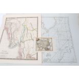
John Blair (d. 1782), engraved map - ‘A Map of the East Indies from the latest Authorities and
John Blair (d. 1782), engraved map - ‘A Map of the East Indies from the latest Authorities and Observations’, 1754, 43cm x 55cm
John Senex (d.1740), hand-coloured map - ‘A New Map of Asia’, 1721, 49cm x 56cmCondition report: old tape repairs to right hand margin, a few mark...
John Russell (18th / 19th century), hand-coloured map - ‘Asia from the best authorities’, 1810,
John Russell (18th / 19th century), hand-coloured map - ‘Asia from the best authorities’, 1810, 19cm x 22cm, together with two late 19th century m...
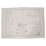
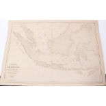
Aime Robiquet (19th century) Large chart - ‘Mer de Chine et Isles Philippines’, dated 1866, image
Aime Robiquet (19th century) Large chart - ‘Mer de Chine et Isles Philippines’, dated 1866, image 67 x 100cm.Condition report: Numerous tape repai...
Aime Robiquet (19th century) large chart - ‘Carte Generale des Isles de la Sonde’ dated 1868,
Aime Robiquet (19th century) large chart - ‘Carte Generale des Isles de la Sonde’ dated 1868,Condition report: Numerous tape repairs to margins, o...
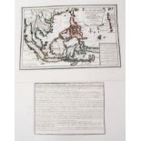
Heinrich Scherer (1628-1704), engraved map - ‘Insulae Indicae cum Terris Circumvivinis’, circa 1700,
Heinrich Scherer (1628-1704), engraved map - ‘Insulae Indicae cum Terris Circumvivinis’, circa 1700, 23cm x 35cm.Condition report: Minor foxing, g...
Robert de Vaugondy (1723-1786), hand-coloured map - ‘L’Asie’ 23cm x 29cm, together with a smaller
Robert de Vaugondy (1723-1786), hand-coloured map - ‘L’Asie’ 23cm x 29cm, together with a smaller variant by the same cartographer and small map o...
Nicholas Sanson (1600-1667), three small hand-coloured maps - ‘Les Isles de la Sonde’, 1683
Nicholas Sanson (1600-1667), small hand-coloured map - ‘Les Isles de la Sonde’, 1683, 19 x 25cmCondition report: Minor marks, overall good ...[mo...
Nicholas Sanson (1600-1667), hand coloured map - ‘ Les Isles Philippines - Islas de Los Ladrones’,
Nicholas Sanson (1600-1667), hand coloured map - ‘ Les Isles Philippines - Islas de Los Ladrones’, 19 x 25cm,Condition report: Minor marks general...
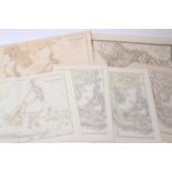
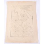
Francois Valentyn (18th century), uncoloured chart - ‘Nieuwe Caart der eylanden van Banda’.
Francois Valentyn (18th century), two uncoloured charts - ‘Nieuwe Caart der eylanden van Banda’; 1724, 32cm x 39cm.Condition report: Tape repair t...
Francois Valentyn (18th century), uncoloured chart - ‘De Landvoogdy van Amboina’, 1724, 32cm x 39cm.
Francois Valentyn (18th century), uncoloured chart - ‘De Landvoogdy van Amboina’, 1724, 32cm x 39cm.Condition report: Tape repairs to top edge, ot...
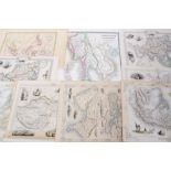
John Tallis (19th century), group of seven small printed maps - ‘Overland route to India’ and
John Tallis (19th century), group of seven small printed maps - ‘Overland route to India’ and others, 32cm x 23cm, together with Henry Teasdale, 1...
Jan Wolters (17th century), engraved map - ‘Indiae Orientalis Insularum Adiacentium’, 1697, 22cm x
Jan Wolters (17th century), engraved map - ‘Indiae Orientalis Insularum Adiacentium’, 1697, 22cm x 27cm.Condition report: trimmed at margins, patc...
Group of 19th century Far Eastern maps - including two of Burman Empire, by James Wyld; Robert
Group of 19th century Far Eastern maps - including two of Burman Empire, by James Wyld; Robert Wilkinson - ‘The Islands of the East Indies’; two b...