
Refine your search
Sale Section
- Books (3)
- Ceramics & Glassware (155)
- Clocks (28)
- Ephemera (9)
- Furniture (144)
- Jewellery (185)
- Maps & Charts (136)
- Miscellaneous (55)
- Musical Instruments (1)
- Oriental (44)
- Pictures (329)
- Royal (185)
- Sculptures (4)
- Silver (157)
- Textiles (16)
- Watches (45)
- Weapons and Militaria (1)
- Wines & Spirits (51)
- Works of Art (129)
Estimate
Category
- Jewellery (194)
- Oil, Acrylic paintings & Mixed Media (175)
- Furniture (145)
- Silver & Silver-plated items (133)
- Ceramics (121)
- Prints (112)
- Collectables (96)
- Maps (89)
- Watercolours (87)
- Wines & Spirits (50)
- Watches & Watch accessories (48)
- Sculpture (43)
- Chinese Works of Art (41)
- Metalware (35)
- Books & Periodicals (32)
- Clocks (32)
- Stamps (31)
- Arms, Armour & Militaria (27)
- Glassware (24)
- Carpets & Rugs (18)
- Kitchenalia (15)
- Models, Toys, Dolls & Games (15)
- Japanese Works of Art (14)
- Textiles (14)
- Salvage & Architectural Antiques (12)
- Drawings & Pastels (11)
- Sporting Memorabilia & Equipment (10)
- Writing Instruments (8)
- Lighting (6)
- Coins (5)
- Taxidermy & Natural History (5)
- Vintage Fashion (5)
- Ethnographica & Tribal Art (4)
- Musical Instruments & Memorabilia (4)
- Photographs (4)
- Scientific Instruments (3)
- Greek, Roman, Egyptian & Other Antiquities (2)
- Islamic Works of Art (2)
- Russian Works of Art (2)
- Barometers (1)
- Classic Cars, Motorcycles & Automobilia (1)
- Tools (1)
Filtered by:
- Item Type
- List
- Grid
A subscription to the Price Guide is required to view results for auctions ten days or older. Click here for more information
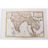

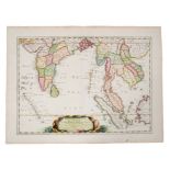
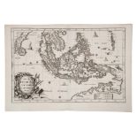
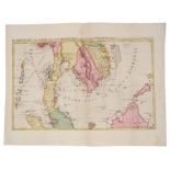
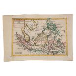
Charles Theodore Middleton, hand-coloured map - ‘An accurate map of the East Indies.’ (1777-1779),
Charles Theodore Middleton, hand-coloured map - ‘An accurate map of the East Indies.’ (1777-1779), from Complete System of Geography, 20cm x 30cm....
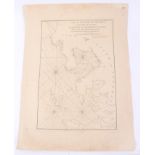
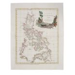
Alessandro Malaspina (18th/19th Century), engraved map - ‘Plan of the Bay of Manila in the Isle of
Alessandro Malaspina (18th/19th Century), engraved map - ‘Plan of the Bay of Manila in the Isle of Luconia, The Principle of the Philippine Island...
J. Migeon, coloured engraving - ‘Indo-Chine et Archipel D’Asie, 1890, 31cm x 42cm, together with
J. Migeon, coloured engraving - ‘Indo-Chine et Archipel D’Asie, 1890, 31cm x 42cm, together with Claudio Montero - ‘Baie de Manille’, 1874 (2).
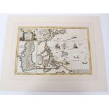
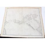
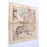
Herman Moll (d. 1732), large hand-coloured map -‘A map of East Indies.... to Ye Directors of Ye Hon.
Herman Moll (d. 1732), large hand-coloured map,‘A map of East Indies.... to Ye Directors of Ye Hon.ble United East-India Company’, 1717, 62cm x 10...
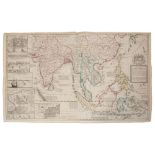
Herman Moll (d. 1732), large hand-coloured map - ‘A map of East Indies.... to Ye Directors of Ye
Herman Moll (d. 1732), large hand-coloured map - ‘A map of East Indies.... to Ye Directors of Ye Hon.ble United East- India Company’, 1717, 62cm x...
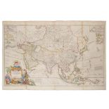
Herman Moll (d. 1732), large hand-coloured map - ‘Asia’ presentation to William, Lord Cowper, Lord
Herman Moll (d. 1732), large hand-coloured map - ‘Asia’ presentation to William, Lord Cowper, Lord High Chancellor of Great Britain’, printed by T...
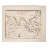
Herman Moll (d. 1732), hand-coloured map - ‘ A chart of East-Indies and the Coast of Persia, China,
Herman Moll (d. 1732), hand-coloured map - ‘ A chart of East-Indies and the Coast of Persia, China, also the Philippina, Moluccan and Sunda Island...
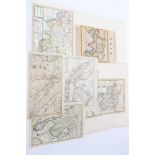
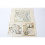
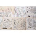
Herman Moll (d. 1732), six various hand-coloured and uncoloured small maps - including ‘The East
Herman Moll (d. 1732), six various hand-coloured and uncoloured small maps - including ‘The East part of India’; ‘The Sunday Islands’.; The Strait...
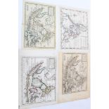
Herman Moll (d. 1732), four various hand-coloured and uncoloured small maps - including ‘The
Herman Moll (d. 1732), four various hand-coloured and uncoloured small maps - including ‘The Philippine Islands and others of the East Indies’ (2)...
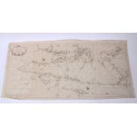
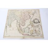
John William Norie (1772-1843), engraved map - ‘A new chart of the Straits of Macassar with various
John William Norie (1772-1843), engraved map - ‘A new chart of the Straits of Macassar with various additions and improvements, 1831, 93cm x 68cm....
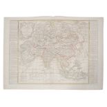
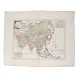
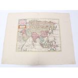
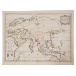
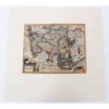
Jean Baptiste Nolin (1657-1725), hand-coloured map - ‘L’Asie’, with updates by L. Denis, 1817, 50cm
Jean Baptiste Nolin (1657-1725), hand-coloured map - ‘L’Asie’, with updates by L. Denis, 1817, 50cm x 67cm.Condition report: minor stains, general...
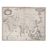
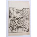
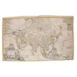
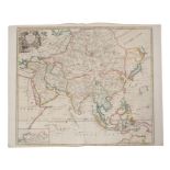
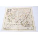
John Ogilby (1600-1676), engraved map - ‘A new map of Asia’, F. lamb sculpt. 1673, 41cm x 52cm.
John Ogilby (1600-1676), engraved map - ‘A new map of Asia’, F. lamb sculpt. 1673, 41cm x 52cm.Condition report: a little staining, deterioration ...
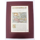
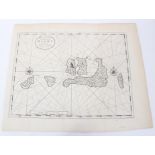
Tomasso Poracchi (1539-1585), hand-coloured map with accompanying Latin text - ‘Descrttione
Tomasso Poracchi (1539-1585), hand-coloured map with accompanying Latin text - ‘Descrttione Dell’Isole Molucca’, 1572, image 11cm x 15cm.Condition...
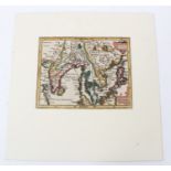
Ant. F Prevost (1697-1763), hand-coloured engraving - ‘Ile de Baly au Petit Java’, 1761, 19cm x
Ant. F Prevost (1697-1763), hand-coloured engraving - ‘Ile de Baly au Petit Java’, 1761, 19cm x 24cm, together with two 19th century maps of East ...
Joachim Ottens (17th / 18th century), hand-coloured map - ‘Le Royaume de Siam Avec Les Royaumes qui
Joachim Ottens (17th / 18th century), hand-coloured map - ‘Le Royaume de Siam Avec Les Royaumes qui Luy sont tributaires’, 1740, 36cm x 46cm.
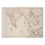
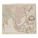
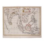
John Blair (d. 1782), engraved map - ‘A Map of the East Indies from the latest Authorities and
John Blair (d. 1782), engraved map - ‘A Map of the East Indies from the latest Authorities and Observations’, 1754, 43cm x 55cm
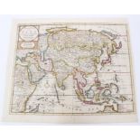
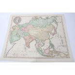
Franz Johann Joseph Von Reilly (1766-1820), hand-coloured map - ‘Karte von Asien’, 51cm x 66cm.
Franz Johann Joseph Von Reilly (1766-1820), hand-coloured map - ‘Karte von Asien’, 51cm x 66cm.Condition report: Some deterioration to margins, ma...
Nicolas Sanson (1600-1667), hand-coloured map - ‘Partie Meridionale de l’Inde’, dated 1654, 38cm x
Nicolas Sanson (1600-1667), hand-coloured map - ‘Partie Meridionale de l’Inde’, dated 1654, 38cm x 52cm.Condition report: Browning at periphery, s...
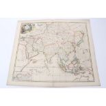
John Senex (d.1740), hand-coloured map - ‘A New Map of Asia’, 1721, 49cm x 56cmCondition report: old tape repairs to right hand margin, a few mark...
John Russell (18th / 19th century), hand-coloured map - ‘Asia from the best authorities’, 1810,
John Russell (18th / 19th century), hand-coloured map - ‘Asia from the best authorities’, 1810, 19cm x 22cm, together with two late 19th century m...
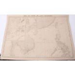
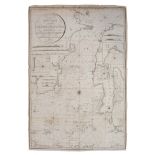
Aime Robiquet (19th century) Large chart - ‘Mer de Chine et Isles Philippines’, dated 1866, image
Aime Robiquet (19th century) Large chart - ‘Mer de Chine et Isles Philippines’, dated 1866, image 67 x 100cm.Condition report: Numerous tape repai...
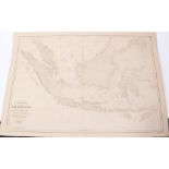
Aime Robiquet (19th century) large chart - ‘Carte Generale des Isles de la Sonde’ dated 1868,
Aime Robiquet (19th century) large chart - ‘Carte Generale des Isles de la Sonde’ dated 1868,Condition report: Numerous tape repairs to margins, o...
Heinrich Scherer (1628-1704), engraved map - ‘Insulae Indicae cum Terris Circumvivinis’, circa 1700,
Heinrich Scherer (1628-1704), engraved map - ‘Insulae Indicae cum Terris Circumvivinis’, circa 1700, 23cm x 35cm.Condition report: Minor foxing, g...
Heinrich Scherer (1628-1704), hand-coloured map - ‘Insularum Marianarum cum Insulis De Pais
Heinrich Scherer (1628-1704), hand-coloured map - ‘Insularum Marianarum cum Insulis De Pais Marianis....’ circa 1700, 23cm x 35cm.Condition report...
Robert de Vaugondy (1723-1786), hand-coloured map - ‘L’Asie’ 23cm x 29cm, together with a smaller
Robert de Vaugondy (1723-1786), hand-coloured map - ‘L’Asie’ 23cm x 29cm, together with a smaller variant by the same cartographer and small map o...
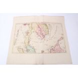
Nicholas Sanson (1600-1667), three small hand-coloured maps - ‘Les Isles de la Sonde’, 1683
Nicholas Sanson (1600-1667), small hand-coloured map - ‘Les Isles de la Sonde’, 1683, 19 x 25cmCondition report: Minor marks, overall good ...[mo...
Nicholas Sanson (1600-1667, hand coloured map ‘Insulae Moluccae’, 1720, 19 x 25cmCondition report: Couple of tape repairs or tears, small tear to ...
Nicholas Sanson (1600-1667), hand coloured map - ‘ Les Isles Philippines - Islas de Los Ladrones’,
Nicholas Sanson (1600-1667), hand coloured map - ‘ Les Isles Philippines - Islas de Los Ladrones’, 19 x 25cm,Condition report: Minor marks general...
Isaak Tirion (d.1769), hand-coloured map - ‘Nieuwe Kaart van Asia’, 28cm x 36cm, 1740Condition report: Minor creases and fox marks ...[more]
Isaak Tirion (d.1769), hand-coloured map - ‘Nieuwe Kaart van Asia’, 28cm x 36cm, 1740Condition report: Trimmed margins, minor marks, generally ok ...
Francois Valentyn (18th century), uncoloured chart - ‘Nieuwe Caart der eylanden van Banda’.
Francois Valentyn (18th century), two uncoloured charts - ‘Nieuwe Caart der eylanden van Banda’; 1724, 32cm x 39cm.Condition report: Tape repair t...
Francois Valentyn (18th century), uncoloured chart - ‘De Landvoogdy van Amboina’, 1724, 32cm x 39cm.
Francois Valentyn (18th century), uncoloured chart - ‘De Landvoogdy van Amboina’, 1724, 32cm x 39cm.Condition report: Tape repairs to top edge, ot...

Nicolas Vischer (1618-1679), hand-coloured map - ‘Asiae Nova Delineato’, 1680, 46cm x 54cm.
Nicolas Vischer (1618-1679), hand-coloured map - ‘Asiae Nova Delineato’, 1680, 46cm x 54cm.Condition report: Minor fox marks, staining, generally ...
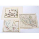
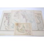
John Tallis (19th century), group of seven small printed maps - ‘Overland route to India’ and
John Tallis (19th century), group of seven small printed maps - ‘Overland route to India’ and others, 32cm x 23cm, together with Henry Teasdale, 1...
Edward Wells (1667-1727), hand-coloured map - ‘Present Asia’, 1701, 37cm x 51cm.Condition report: minor stains, generally good ...[more]
James Wyld the Elder (1790-1836), hand-coloured map - ‘Asia’, 1827, 52cm x 64cm.Condition report: Couple of tape repairs to top edge, minor marks ...
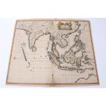
Frederick de Wit (1610-1698), hand-coloured map - ‘Tabula Indiae Orientalis’, dated 1662, 47cm x
Frederick de Wit (1610-1698), hand-coloured map - ‘Tabula Indiae Orientalis’, dated 1662, 47cm x 56cmCondition report: Some losses to margins, bro...
Jan Wolters (17th century), engraved map - ‘Indiae Orientalis Insularum Adiacentium’, 1697, 22cm x
Jan Wolters (17th century), engraved map - ‘Indiae Orientalis Insularum Adiacentium’, 1697, 22cm x 27cm.Condition report: trimmed at margins, patc...

Antonio Zatta (fl. 1757-1797), hand-coloured map - ‘Indie Orientali’, published Venice 1784, 33cm x
Antonio Zatta (fl. 1757-1797), hand-coloured map - ‘Indie Orientali’, published Venice 1784, 33cm x 42cmCondition report: Generally good ...[more]
Antonio Zatta (fl. 1757-1797), hand-coloured map - ‘Isole Filippine’ published Venice 1784, 33cm x
Antonio Zatta (fl. 1757-1797), hand-coloured map - ‘Isole Filippine’ published Venice 1784, 33cm x 42cmCondition report: Generally good ...[more]
Group of 19th century Far Eastern maps - including two of Burman Empire, by James Wyld; Robert
Group of 19th century Far Eastern maps - including two of Burman Empire, by James Wyld; Robert Wilkinson - ‘The Islands of the East Indies’; two b...
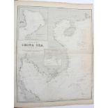
Charles Wilson (19th century) large folding chart - The China Sea, dated 1874, 77 x 65cmCondition report: General detrioration and staining, nothi...
Charles Wilson (19th century), large folding chart of The Philippines, 78 x 65cmCondition report: General detrioration and staining, nothing sever...
Herman Moll (d. 1732), large hand-coloured map - ‘Asia’ presentation to William, Lord Cowper, Lord
Herman Moll (d. 1732), large hand-coloured map - ‘Asia’ presentation to William, Lord Cowper, Lord High Chancellor of Great Britain’, printed D. M...
Gerhard Mercator (1512-1594), hand-coloured map - ‘Asia’, (1607), Latin text verso, 15cm x 19cm.
Gerhard Mercator (1512-1594), hand-coloured map - ‘Asia’, (1607), Latin text verso, 15cm x 19cm.Condition report: Mounted, fox marks to margin, ot...
Gerhard Mercator (1512-1594), hand-coloured map ‘Indiae Orientalis’, (1607), Latin text verso, 15cm
Gerhard Mercator (1512-1594), hand-coloured map ‘Indiae Orientalis’, (1607), Latin text verso, 15cm x 19cm.Condition report: Mounted Fox marks to ...
Gerhard Mercator (1512-1594), hand-coloured map - ‘Insulae Indiae Orientalis’ (1607), Latin text
Gerhard Mercator (1512-1594), hand-coloured map - ‘Insulae Indiae Orientalis’ (1607), Latin text verso, 15cm x 19cm.Condition report: Mounted, fox...
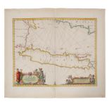
Johannes Van Keulen (1654-1715), engraved map - Sumatra, Malacca, Sincapoera, Banda en Sunda (1753).
Johannes Van Keulen (1654-1715), engraved map - Sumatra, Malacca, Sincapoera, Banda en Sunda (1753). Plate 50cm x 112cm.Condition report: large pa...
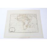
Samuel Dunn (d 1794), hand-coloured map - ‘Africa and its several regions', published Laurie &
Samuel Dunn (d 1794), hand-coloured map - ‘Africa and its several regions', published Laurie & Whittle, 1794, 33cm x 46cm.Condition report: Minor ...
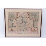
John Speed (1552-1629), hand-coloured map - ‘Stafford Countie and Towne’, sold by Thomas Bassett,
John Speed (1552-1629), hand-coloured map - ‘Stafford Countie and Towne’, sold by Thomas Bassett in Fleet Street and Ric. Chiswell in St. Paul’s C...
John Senex (d.1740), hand-coloured map - ‘A New Map of Asia’, 1721, 50cm x 59cmCondition report: A few tape repairs to top/bottom or spine and low...
John Senex (d.1740), hand-coloured map - ‘A New Map of Asia’, 1721, 50cm x 59cmCondition report: Few tape repairs to margins, damage to corners, g...
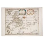
John Senex (d.1740), hand-coloured map - ‘A New Map of India and China’, 1721, 50cm x 59cmCondition report: minor time staining, generally good ....
John Senex (d.1740), hand-coloured map - ‘A New Map of India and China’, 1721, 50cm x 59cm.
John Senex (d.1740), hand-coloured map - ‘A New Map of India and China’, 1721, 50cm x 59cm.Condition report: some losses and numerous tape repairs...
Joachim Ottens (17th/18th century), hand-coloured map - ‘Le Royaume de Siam Avec Les Royaumes gui
Joachim Ottens (17th/18th century), hand-coloured map - ‘Le Royaume de Siam Avec Les Royaumes gui Luy sont tributaires’, 1740, 36cm x 46cm.Conditi...
John Senex (d.1740), hand-coloured map - ‘A New Map of Asia’, 1721, 50cm x 59cm
John Speed (1552-1629), hand-coloured map - ‘A new map of East India’, 1676, English text verso,
John Speed (1552-1629), hand-coloured map - ‘A new map of East India’, 1676, English text verso, 39cm x 49cm.Condition report: Minor damage to per...
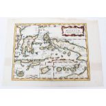
Jan Jansson (1596-1664), hand-coloured map - ‘Insulae Javae....’ 1657-1658, Latin text verso, 41cm
Jan Jansson (1596-1664), hand-coloured map - ‘Insulae Javae....’ 1657-1658, Latin text verso, 41cm x 53cm.Condition report: Repair to tear at foot...
N Visscher - hand coloured map - ‘Asiae Nova Delineatio’, circa 1680, 43 x 54cmCondition report: Significant damp or other stains particularly to ...
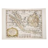
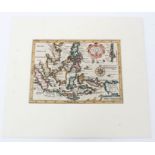
Herman Moll (d. 1732) hand coloured map - ‘The Principle Islands of the East Indies’, 18 x 26
Herman Moll (d. 1732) hand coloured map - ‘The Principle Islands of the East Indies’, 18 x 26Condition report: Minor time stains, generally good ...