
Filtered by:
- Category,
- Item Type
- List
- Grid
This auctioneer has chosen to not publish their results. Please contact them directly for any enquiries.
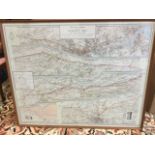

A 1964 framed ordnance survey map of Hadrians Wall, showing individual sections from Newcastle to
A 1964 framed ordnance survey map of Hadrians Wall, showing individual sections from Newcastle to Carlisle. (41in x 33in)
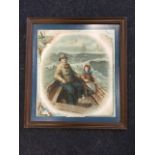
A Victorian romantic coloured print of Grace Darling and her father in boat on choppy seas, titled
A Victorian romantic coloured print of Grace Darling and her father in boat on choppy seas, titled Little Grace Darling, cut & laid down, framed. ...
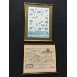
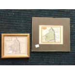
A numbered and signed David Eley map of the River Dee, showing salmon pools, etc., mounted & framed;
A numbered and signed David Eley map of the River Dee, showing salmon pools, etc., mounted & framed; and a framed map of Edinburgh and surrounds, ...
J Cary, a handcoloured nineteenth century print of Northumberland, with verso also glazed with
J Cary, a handcoloured nineteenth century print of Northumberland, with verso also glazed with Northamptonshire, mounted & framed; and a late eigh...
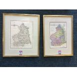
A handcoloured late nineteenth century map of Northumberland after J Wallis, the plate mounted &
A handcoloured late nineteenth century map of Northumberland after J Wallis, the plate mounted & gilt framed; and another in similar frame after J...
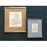
A clip-framed John Sellars eighteenth century handcoloured map of Northumberland; and another
A clip-framed John Sellars eighteenth century handcoloured map of Northumberland; and another uncoloured map of Northumberland in gilt frame. (2)
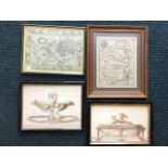
A hand embroidered panel on linen, county down in Ireland, mounted & framed; a hogarth framed map of
A hand embroidered panel on linen, county down in Ireland, mounted & framed; a hogarth framed map of the world after Blaeuw; and two modern classi...