
Filtered by:
- Lots with images only,
- Category,
- Item Type
3 items
- List
- Grid
This auctioneer has chosen to not publish their results. Please contact them directly for any enquiries.
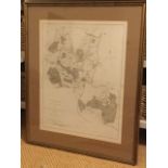

Lot 10
Edward Hasted, map of Brenchley & Horsemonden, drawn by Hasted in 1777, published by Bayley, London,
Edward Hasted, map of Brenchley & Horsemonden, drawn by Hasted in 1777, published by Bayley, London, mounted & framed. (16in x 21in) ...[more]
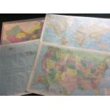
Lot 551
Two Rand McNally 1960s coloured maps - The International World and the United States; a 1972 map
Two Rand McNally 1960s coloured maps - The International World and the United States; a 1972 map of Hawaii; and a 1998 map of The Peoples Republic...

Lot 630
A nineteenth century map of Berwickshire detailing the parishes, laid on cloth; an 1888 plan for
A nineteenth century map of Berwickshire detailing the parishes, laid on cloth; an 1888 plan for Northumberland County Lunatic Asylum; and a milit...