Filtered by:
- Category
- List
- Grid
A subscription to the Price Guide is required to view results for auctions ten days or older. Click here for more information
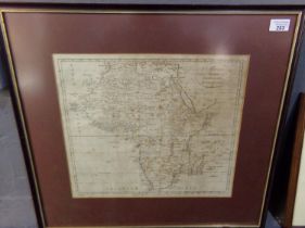

Thomas Kitchen, 'Africa', original uncoloured map engraved by G Terry for John Harrison, dated 1787.
Thomas Kitchen, 'Africa', original uncoloured map engraved by G Terry for John Harrison, dated 1787. 34x39cm approx. Framed. Together with a 19...

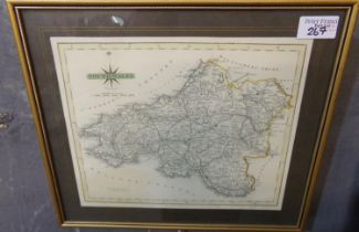
C Smith, 'A New Map of England and Wales, comprehending the whole of the Turnpike roads with the
C Smith, 'A New Map of England and Wales, comprehending the whole of the Turnpike roads with the great rivers and navigable canals'. Originally p...
John Speede, 'Breknoke', an original later coloured map, Framed and glazed, together with John
John Speede, 'Breknoke', an original later coloured map, Framed and glazed, together with John Bleau, 'Glamorganensis', sparsely coloured and doub...
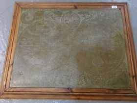
Large framed brass map of the world. (B.P. 21% + VAT)
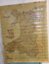
Bacon's Excelsior Map of Wales and Monmouthshire with railways, roads and distances, a wall hanging educational map. Overall 125x100cm approx. ...
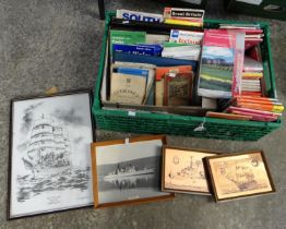
Collection of ordnance survey maps including: Carmarthen, Tenby, Ireland, South Pembrokeshire,
Collection of ordnance survey maps including: Carmarthen, Tenby, Ireland, South Pembrokeshire, motoring maps etc. (B.P. 21% + VAT)
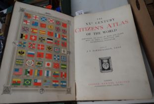
'The XXth Century Citizen's Atlas of the World', containing a 156 pages of maps and plans, edited by
'The XXth Century Citizen's Atlas of the World', containing a 156 pages of maps and plans, edited by G.J Bartholomew, printed by George Newnes Ltd...