Filtered by:
- Category,
- Item Type
- List
- Grid
A subscription to the Price Guide is required to view results for auctions ten days or older. Click here for more information

Sutton Nicholls (1668-1729) - Coloured engraving - 'A New Map of the Land of Canaan', 37cm x 49cm,
Sutton Nicholls (1668-1729) - Coloured engraving - 'A New Map of the Land of Canaan', 37cm x 49cm, in gilt frame and glazed, some creases/fold mar...
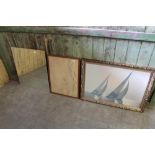
A large modern print, sailing boats, a framed map Firth of Clyde, and a mirror plate.
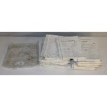
A selection of Ordnance Survey maps, GB 1980's, Landranger series
A bundle of one inch-one mile sheet maps, Scottish Highlands & Islands. ...[more]
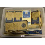
A box of 1940's and later Ordnance Survey maps, various.
A selection of 1960's Ordnance Survey and other vintage maps.
A box of Ordnance Survey and other maps, used but generally good.
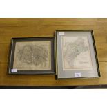
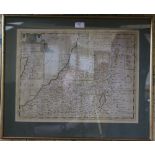
A 19th century map of Cumberland, 29cm x 36cm framed and a 19th century map of Norfolk, by Archer,
A 19th century map of Cumberland, 29cm x 36cm framed and a 19th century map of Norfolk, by Archer, framed 27cm x 32cm framed
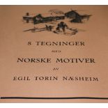
8 Tegninger Med Norske Motiver Av Egil Torin Naesheim, a folio of eight monochrome unframed prints, rolled and contained in a tube. Good condition...