Filtered by:
- Category,
- Item Type
- List
- Grid
A subscription to the Price Guide is required to view results for auctions ten days or older. Click here for more information


Box of Assorted Maps and Books including Ordnance Survey, Motoring & Touring Map, Holiday Haunts
Box of Assorted Maps and Books including Ordnance Survey, Motoring & Touring Map, Holiday Haunts in Southern England, The Shire of the Sea Kings a...

Views of the English Lakes, circa 1850- 70's Book - a 32 page small book with 12 attractive Baxter
Views of the English Lakes, circa 1850- 70's Book - a 32 page small book with 12 attractive Baxter style three colour views of Ulleswater, Winderm...

The Midland Railway By F.S. Williams 1878 - A compendious 678 page publication detailing the then
The Midland Railway By F.S. Williams 1878 - A compendious 678 page publication detailing the then construction, maintenance and present operations...

The Official Guide to the Great Western Railway Circa 1898 Book - A comprehensive 418 page book with
The Official Guide to the Great Western Railway Circa 1898 Book - A comprehensive 418 page book with many maps, Giving in some detail photographs ...
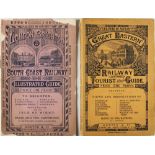
Great Eastern Railway Illustrated Tourist Guide Circa 1880s - A fine 48 page publication with 18
Great Eastern Railway Illustrated Tourist Guide Circa 1880s - A fine 48 page publication with 18 well engraved views of places to visit and a map....

United Air Lines 1936 Time Table - An attractive 12 page time table for the airlines "Overnight
United Air Lines 1936 Time Table - An attractive 12 page time table for the airlines "Overnight Coast to Coast" service with 8 photographs of thei...
United States - Early Large Map Of The Colonies Of The Colonies Of Virginia And Florida By Blaeu
United States - Early Large Map Of The Colonies Of The Colonies Of Virginia And Florida By Blaeu 1646 - Attractively detailing and showing towns, ...
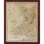
c.1900s Map of North & South Wales with colouring, framed measures 25x30cm approx.
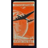
Aviation - Deutsche Lufthansa - Winter Time Table October 1938 - March 1939. Folds out to large
Aviation - Deutsche Lufthansa - Winter Time Table October 1938 - March 1939. Folds out to large poster size showing plan style map of their extens...
19th Century 'Salop' by C. Smith Map - a new map of the County of Salop Divided into Hundreds,
19th Century 'Salop' by C. Smith Map - a new map of the County of Salop Divided into Hundreds, London, printed for C. Smith No172 Strand, January ...
Map - Upper Congo 1935 second Edition Map published at the War Office 1919, a projection of the
Map - Upper Congo 1935 second Edition Map published at the War Office 1919, a projection of the International Map, with folds and creases apparent...
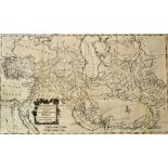
The Expedition of Alexander the Great - Map - 'Alexander's Expedition Drawn for Rollin's Antient
The Expedition of Alexander the Great - Map - 'Alexander's Expedition Drawn for Rollin's Antient History by Mr D'Anville the French King's Geograp...
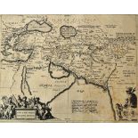
Alexander The Great Map - 'Alexandri Magni Macedonis Expeditio.' - depicting the region covered by
Alexander The Great Map - 'Alexandri Magni Macedonis Expeditio.' - depicting the region covered by Alexander the Great illustrating the region bas...
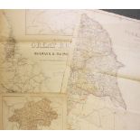
Map of The London Midland and Scottish Railway - and connections, printed McCorquodale & Co,
Map of The London Midland and Scottish Railway - and connections, printed McCorquodale & Co, colour map, framed measures 59x94cm approx. creases p...
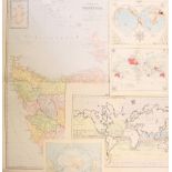
Maps - Assorted Selection to include Australia Tasmania, Oceanica, South Pole, various sizes, plus a
Maps - Assorted Selection to include Australia Tasmania, Oceanica, South Pole, various sizes, plus a few others, A/G worth inspecting (8)
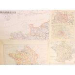
Maps - France Selection of Maps various sizes and covers various parts of France, worth inspecting, F/G (15)
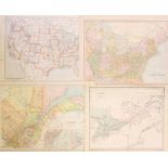
Maps - United States of America, Canada and South America in various sizes, condition mixed F/G (9)
Maps - United States of America, Canada and South America in various sizes, condition mixed F/G (9)
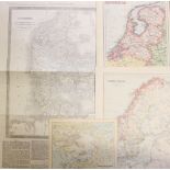
Maps - Norway, Sweden, Holland, Denmark, Jutland a mixed selection in varying sizes, condition F/
Maps - Norway, Sweden, Holland, Denmark, Jutland a mixed selection in varying sizes, condition F/G (9)
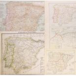
Map Selection to include Italy, Corsica, Sicily, Spain & Portugal - various sizes, condition mixed
Map Selection to include Italy, Corsica, Sicily, Spain & Portugal - various sizes, condition mixed F/G (11)
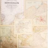
Maps - Germany Selection with 1836 and 1841 Maps included, varying sizes condition F/G (17)
Selection of French Maps to include 1836 Map of Rouen - with French detail, Depot de la Guerre, 1852
Selection of French Maps to include 1836 Map of Rouen - with French detail, Depot de la Guerre, 1852 Map of Paris - scale 1/520,000 with French de...
Railway Maps - Edw' Weller Maps includes an Early Stockton and Darlington 1st Railway Line Map,
Railway Maps - Edw' Weller Maps includes an Early Stockton and Darlington 1st Railway Line Map, Yorkshire, together with 3x other Northern Country...
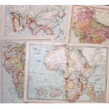
Selection of Maps - Asia, India, Africa - a mixed selection, various sizes, worth inspecting,
Selection of Maps - Asia, India, Africa - a mixed selection, various sizes, worth inspecting, condition mixed A/G (11)
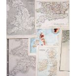
Assorted British Isles Maps - includes Edw Weller, various sizes, with various sections of the
Assorted British Isles Maps - includes Edw Weller, various sizes, with various sections of the country, worth inspecting, condition A/G (29)
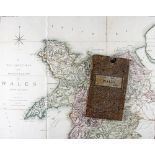
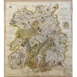
1818 C Smith Map of Wales - A Two Sheet Map of the Principality of Wales divided into counties,
1818 C Smith Map of Wales - A Two Sheet Map of the Principality of Wales divided into counties, London C. Smith No. 172 Strand, 3rd edition, linen...
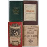
Humphreys Illustrated Map of North Wales printed and published by H. Humphreys, together with
Humphreys Illustrated Map of North Wales printed and published by H. Humphreys, together with Cruchley's New Map of Cornwall, Black's Travelling M...

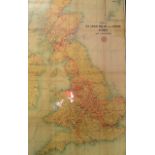
1940 'Operation Sea Lion' - German Invasion Booklet of the South Coast - contains information and
1940 'Operation Sea Lion' - German Invasion Booklet of the South Coast - contains information and maps regarding the region, appears in G condition