Filtered by:
- Category
- List
- Grid
A subscription to the Price Guide is required to view results for auctions ten days or older. Click here for more information
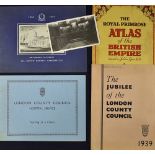

London County Council Pamphlets to include 1939 The Jubilee of the London County Council, London
London County Council Pamphlets to include 1939 The Jubilee of the London County Council, London County Council Nursing as a career, plus 1935 The...
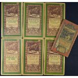
Early 20th Century Ordnance Survey Map Selection to include Brecon and Lampeter, Salisbury, Winchester and Reading, Weymouth, Yeovil and Taunton, ...
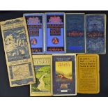
Selection of Maps to include Bartholomew's Surrey, Pembroke, Norfolk and Cumberland, 1929 Wye Valley
Selection of Maps to include Bartholomew's Surrey, Pembroke, Norfolk and Cumberland, 1929 Wye Valley Ordnance survey map, 1924 The Peak District, ...
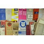
Collection of Various Road Maps including Southern England, Great Britain and Northern Ireland,
Collection of Various Road Maps including Southern England, Great Britain and Northern Ireland, Batchelors Natural History Road Maps of Britain, G...
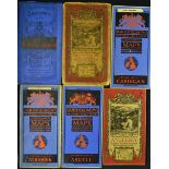
Selection of Maps such as Ordnance Survey Road Map of Anglesey, Northwich and Macclesfield, Bartholomew's map selection including Argyll, Ayrshir...
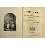
Interesting 1860s Family Bible of the Dowthwaite & Caffry Families of Ambleside Lake District,
Interesting 1860s Family Bible of the Dowthwaite & Caffry Families of Ambleside Lake District, containing a family register, maps, with plate engr...
Book Selection to include 1899 Johnston, W & A.K. 'The World-Wide Atlas of modern geography'
Book Selection to include 1899 Johnston, W & A.K. 'The World-Wide Atlas of modern geography' Edinburgh-London, 4th edition, with an Introduction b...
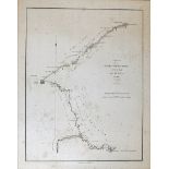
China Map 1793 Sketch of the Pay-Ho or White River and of the road from PEKIN to GEHO taken 1793,
China Map 1793 Sketch of the Pay-Ho or White River and of the road from PEKIN to GEHO taken 1793, engraved by B. Baker, published 12th April 17965...
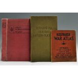
Interesting Selection of Atlases to include 1939 Handatlas for the Hitler Youth, in cloth board,
Interesting Selection of Atlases to include 1939 Handatlas for the Hitler Youth, in cloth board, covers slightly worn otherwise pages are good, a ...
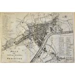
Worcester c.1709 Map depicting a plan of the City and Suburbs of Worcester, appears in good condition, framed, measures 52 x 41cm approx.
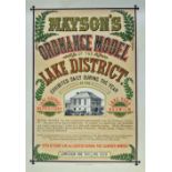
Keswick - c. 1870-90s Impressive Poster Advertising 'Mayson's Ordnance Model of the Lake District'
Keswick - c. 1870-90s Impressive Poster Advertising 'Mayson's Ordnance Model of the Lake District' exhibited at Lake District Repository, Lake Roa...
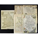
Selection of Mid-19th Century Maps to include England and Wales, Bedfordshire, Huntingdonshire (2)
Selection of Mid-19th Century Maps to include England and Wales, Bedfordshire, Huntingdonshire (2) and Derbyshire, some with minor stains and smal...
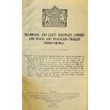
Transport - Roads & Road Transport Book c.1920s an informative book containing reports, fold out
Transport - Roads & Road Transport Book c.1920s an informative book containing reports, fold out maps, financial reports, all bound in cloth board...
1908 Kelly's Directory of Birmingham Book and the counties of Stafford, Warwick and Worcester with
1908 Kelly's Directory of Birmingham Book and the counties of Stafford, Warwick and Worcester with new maps and a plan of Birmingham, a very thick...
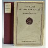
India Punjab Land of the Five Rivers an economic history of the Punjab from the earliest times to
India Punjab Land of the Five Rivers an economic history of the Punjab from the earliest times to the year of grace 1890, by Hugh Kennedy publishe...