
Filtered by:
- Category
- List
- Grid
A subscription to the Price Guide is required to view results for auctions ten days or older. Click here for more information
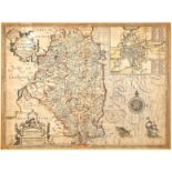

1610 Map of Leinster by John Speed. A hand-coloured, engraved map, "The Countie of Leinster with the
1610 Map of Leinster by John Speed. A hand-coloured, engraved map, "The Countie of Leinster with the Citie Dublin Described", "...to be sold by Ro...
1627 Munster and Leinster by Peter van der Keere, two small hand-coloured engraved maps, each 3½"
1627 Munster and Leinster by Peter van der Keere, two small hand-coloured engraved maps, each 3½" x 5" (9 x 12.5cm) mounted; together with a 19th ...
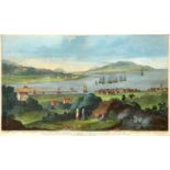
Giles King (fl.1732?1746) after William Jones (d.1747) Irish. A View of Ringsend, Irish Town, The
Giles King (fl.1732?1746) after William Jones (d.1747) Irish. A View of Ringsend, Irish Town, The Harbour of Dublin, The Hill of Howth... Lambay o...
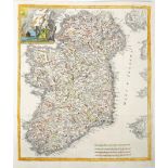
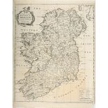
1743 Map of Ireland, by Guillaume de Lisle. A hand-coloured, engraved map of Ireland, 'Irlanda',
1743 Map of Ireland, by Guillaume de Lisle. A hand-coloured, engraved map of Ireland, 'Irlanda', from 'Storio Moderna overo lo Stao Presentedi tut...
1744 A Map of the Kingdom of Ireland, by Richard W Seale. From ye. latest & best Observations, for
1744 A Map of the Kingdom of Ireland, by Richard W Seale. From ye. latest & best Observations, for Mr. Tindal's Continuation of Mr. Rapin's Histor...
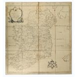
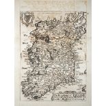
1777 Map of Ireland by Charles O'Conor, an engraved map, Ortelius Improved or a New Map of Ireland
1777 Map of Ireland by Charles O'Conor, an engraved map, Ortelius Improved or a New Map of Ireland wherein are inserted the Principal Families of ...
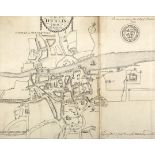
1780 Map of Dublin by Pool and Cash, engraved map, 12" x 15" (31 x 38cm) mounted, as published in
1780 Map of Dublin by Pool and Cash, engraved map, 12" x 15" (31 x 38cm) mounted, as published in Pool, Robert and Cash, John. Views of the Public...
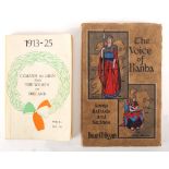
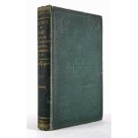
Conlon, Lil. Cumann na mBan and Women of Ireland 1913-25, Kilkenny People, 1969, first edition,
Conlon, Lil. Cumann na mBan and Women of Ireland 1913-25, Kilkenny People, 1969, first edition, printed paper wrappers. Cover slightly soiled, oth...
Cooke, Thomas Lalor, The Early History of the Town of Birr, or Parsonstown, 8vo Dublin 1875, first
Cooke, Thomas Lalor, The Early History of the Town of Birr, or Parsonstown, 8vo Dublin 1875, first edition, publisher's cloth, foxing to the preli...
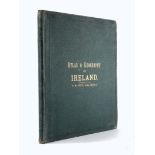
Joyce, P. W. Atlas and Geography of Ireland, Dublin, circa 1900 4to. with the thirty three coloured maps. A few maps with repairs to the margins, ...
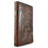
Taylor, George and Skinner, Andrew. The Roads of Ireland, surveyed 1777, Dublin 1778, first edition,
Taylor, George and Skinner, Andrew. The Roads of Ireland, surveyed 1777, Dublin 1778, first edition, 8vo. contemporary leather binding, maps hand-...
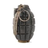
1914-1918 Inert ordnance, British Mills bomb No.5 MkI.
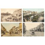
Postcards. Co. Cork: Sixty topographical cards, mainly towns and villages, with harbours, street
Postcards. Co. Cork: Sixty topographical cards, mainly towns and villages, with harbours, street scenes and markets, nice collection.