Filtered by:
- Category,
- Item Type
- List
- Grid
A subscription to the Price Guide is required to view results for auctions ten days or older. Click here for more information
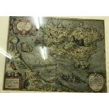

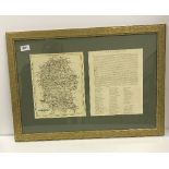
AFTER GIULIO LASOLINO "Ischia Quiae Olim Aenaria", a black and white engraved map, later coloured,
AFTER GIULIO LASOLINO "Ischia Quiae Olim Aenaria", a black and white engraved map, later coloured, dated 1590 to the cartouche by Abraham Orlelius...
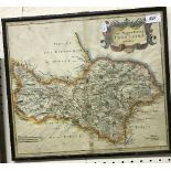
AFTER ROBERT MORDEN "The North Riding of Yorkshire", map later hand-coloured, 37 cm x 42 cm
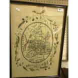
An early 19th Century silk needlework map of England and Wales by Rebecca Simons, 1803, approx 55 cm x 39.5 cm including frame
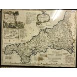
AFTER THOMAS KITCHIN "A new and improved map of Cornwall….", published by T Bowles of London, image approx 54 cm x 71 cm
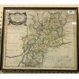
AFTER ROBERT MORDEN "Gloucestershire", engraved map, later hand-coloured, approx 38 cm x 45.
AFTER ROBERT MORDEN "Gloucestershire", engraved map, later hand-coloured, approx 38 cm x 45.5 cm including frame
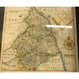
AFTER CHRISTOPHER SAXTON "Northumbriae", a black and white engraved map, by William Hole, visible image approx 29 cm x 30.5 cm
AFTER JOHN CAREY "Glocestershire", coloured engraved map, published 1793, together with AFTER JOHN CAREY "Wiltshire", coloured engraved map, publi...
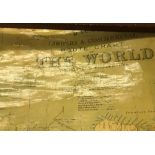
"Bacon's Library and Commercial Route Chart of the World Mercator's Projection", published by GW Bacon & Co. Limited London, 155 cm x 80 cm ...[m...