Filtered by:
- Sale Section,
- Category
- List
- Grid
A subscription to the Price Guide is required to view results for auctions ten days or older. Click here for more information
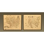

Two John Blaeu antiquarian maps, Scotland circa 1654 "Clyds-dail" and "Galloway". Largest 51 cm x 61 cm, both in double sided frame.
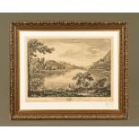
After William Bellers, an antiquarian print "A View of Haws-water", a lake near Banton in Westmoreland. 41 cm x 55 cm, framed.
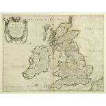
Nicholas Sanson and Melchior Tavernier, Britinnicae Insulae, 1641, double page engraved map of Great Britain, framed and mounted. 39 cm x 51.5 cm.
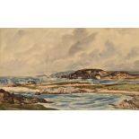
Claude Muncaster (1903-1974),
Claude Muncaster (1903-1974), watercolour view of The Western Isles "Breezy on the West Coast of Scotland", signed and dated 1937, Abbot and Holde...
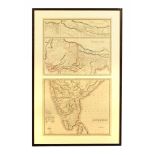
Antiquarian framed maps of British India and Hindustan, pair in one frame. Each 52 cm x 62 cm.
Antiquarian framed maps of British India and Hindustan, pair in one frame. Each 52 cm x 62 cm.
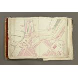
Two portfolios of Ordnance Survey maps, circa 1863, mostly West Cumbria, Egremont, Cleator Moor,
Two portfolios of Ordnance Survey maps, circa 1863, mostly West Cumbria, Egremont, Cleator Moor, Beckermet, Frizington, Whitehaven, St Bees, Enner...