Filtered by:
- Category,
- Creator / Brand
- List
- Grid
A subscription to the Price Guide is required to view results for auctions ten days or older. Click here for more information
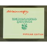

Alfred Wainwright (1907-1991), Westmorland Heritage, first edition of the popular edition.
GUILLIM.
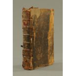
GUILLIM. JOHN, "A Display of Heraldry", London 1724, sixth edition, title page printed in black and red, many full page engraved plates.
Atlas de Joan Martinez 1587, 1973 facsimile of The Martinez Atlas, limited edition 2011, 19 double page maps.
"The Survey Atlas of England and Wales", published by Bartholomew in 1939, red boards with half leather binding, 81 plates. 45.5 cm x 32.5 cm.
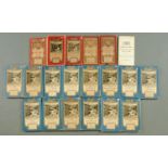
Twenty early 20th century 1" ordnance survey maps.
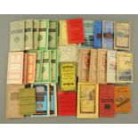
Thirty four early 20th century ordnance survey map, mostly 1", Bartholomews 1/4" maps of Ireland,
Thirty four early 20th century ordnance survey map, mostly 1", Bartholomews 1/4" maps of Ireland, Cruchleys county maps, Bacon's tourist map of Le...
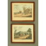
After C B Newhouse,
After C B Newhouse, a pair of prints "A False Alarm on the Road to Gretna" and "One Mile from Gretna". 35 cm x 46 cm, framed.
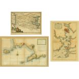
Two antiquarian maps,
Two antiquarian maps, Plan of the Harbours of Port-Louis and L'Orient and Geometrical Survey of the Gulf of Naples, the first printed by W Fayden....
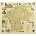
Alfred Wainwright (1907-1991), handcoloured map of the County of Westmorland in 1974. 60 cm x 52 cm, framed. ARR
An Ernest Clegg 1940's map of the Battle of Britain, Kent. 44 cm x 57 cm, framed.
An antiquarian map,
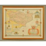
An antiquarian map, "A New Map of the Counties of Cumberland and Westmorland Divided into Their Respective Wards" 1760. 70 cm x 54 cm.
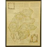
An antiquarian "A New General Atlas" by John Thomson 1817, consisting of "A series of Geographical Designs, on various projections, exhibiting the...
42 Bartholomews 1/2" maps of the UK, mounted on cloth.