Filtered by:
- Category,
- Creator / Brand
- List
- Grid
A subscription to the Price Guide is required to view results for auctions ten days or older. Click here for more information


A box of 23 Scottish topography and history books and maps, to include Archaeological Light on The Early Christianisation of Scotland, 2 volumes, ...
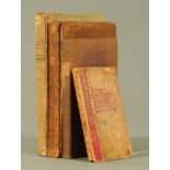
West Guide to The Lakes, second edition (1821), by Jonathan Otley, A Guide to The Lakes in Cumberland, Westmorland & Lancashire (1796), A Guide to...
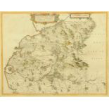
A Blaeu antiquarian map, "The Middle Part of Galloway", circa 1654. 44 cm x 56 cm, framed.
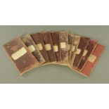
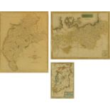
Twelve 1868 ordnance survey maps of Cumberland, scale 6"-1 mile, various (see illustration).
Twelve 1868 ordnance survey maps of Cumberland, scale 6"-1 mile, various (see illustration).
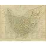
A new map of Amsterdam engraved on canvas "Nouveau Plan D'Amsterdam 1857", after Willem Cornelis Van Baarsel and Petrus Nicolai Tuyn. 42 cm x 52 ...
Seutter.
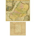
Seutter. Regio Canaan seu Terra Promissionis, early 18th century hand coloured engraved map, with large vignette of Christ driving out evil spirit...
A 17th century map of Ireland, attributed to A M Mallet (1630-1706), "Isle D Irland", hand tinted.
A 17th century map of Ireland, attributed to A M Mallet (1630-1706), "Isle D Irland", hand tinted. 15.5 cm x 10 cm, a John Cary hand tinted engra...
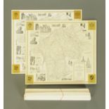
Alfred Wainwright (1907-1991), eight maps of the County of Westmorland 1974, six loose, two card mounted, and an antiquarian map of Cumbria. ARR
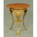
A Victorian Britannia pub table, with oak top and cast iron base. Diameter 65 cm.