Filtered by:
- Category
- List
- Grid
A subscription to the Price Guide is required to view results for auctions ten days or older. Click here for more information
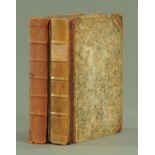

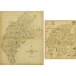
"The History & Antiquities of The Counties of Westmorland & Cumberland", by Joseph Nicholson and Richard Burn (1777), set of 2 volumes, with 2 fol...
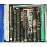
Nineteen books on caving, to include "Limestones & Caves of The Mendip Hills" by D.I. Smith, "The Descent of Pierre Saint-Martin" by Norbert Caste...
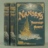
Volumes 1 and 2 of Nansens "Farthest North" (1898), with decorative boards, full page and numerous text illustrations and maps.
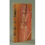
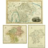
Jollies "Cumberland Guide & Directory" published 1811 (see illustration). CONDITION REPORT: All three plans & maps are present. The city map of Ca...
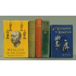
Five books on The Sudan, Savile Frank., "The River of the Giraffe" (1925), "Game Animals of The Sudan" by Capt. H.C. Brocklehurst (1931), "Service...
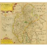
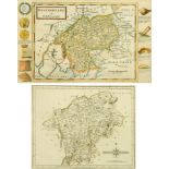
Christopher Saxton, an antiquarian map of Cumbria, circa 1700, hand coloured, and a smaller engraved map of Cumberland and Westmoreland, 30.5 cm x...
Two 18th century hand engraved maps of Cumberland, one by J Cary 1787, the other from the latest authorities, smallest 19 cm x 15.5 cm.
Three antique hand coloured engraved maps of Westmorland, to include J Cary, 1792, John Owen and Emmanuel Bowen, 1720 and another unnamed, largest...
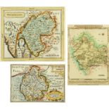
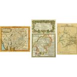
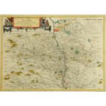
Three antique hand coloured engraved maps, to include Westmorland and Cumberland by Pieter Van Den Keere circa 1627, map of Westmorland by John Se...
Three hand coloured engraved maps of Westmorland, to include Thomas Kitchin, circa 1786, John Cowley, circa 1744 and another engraved by Sidney Ha...
William Kip (engraver), Christopher Saxton (illustrator), a copper plated engraved map of Westmorland, circa 1637, framed and mounted under glass,...
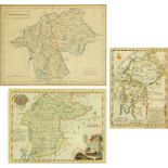
Three antique hand coloured engraved maps of Westmorland, to include Pigot & Co,, circa 1829,
Three antique hand coloured engraved maps of Westmorland, to include Pigot & Co,, circa 1829, after R Creighton, circa 1849, and after J Roper, ci...
Herman Moll, a hand coloured engraved map of Westmorland, circa 1724, and a further hand coloured engraved map of Westmorland by John Cary, circa ...
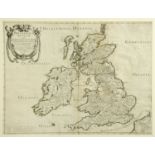
Nicholas Sanson and Melchior Tavernier, Britinnicae Insulae, 1641, double page engraved map of Great Britain, framed and mounted, 39 cm x 51.5 cm.
Thomas Dix a hand coloured engraved map of Westmoreland, 1820, mounted and framed, 36 cm x 44.5 cm.
Thomas Dix a hand coloured engraved map of Westmoreland, 1820, mounted and framed, 36 cm x 44.5 cm.
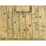
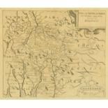
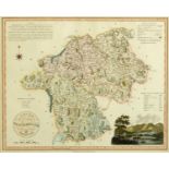
Ogilby (John), "The roads from Kendal to Cockermouth .... Egremond (sic) to the city of Carlisle", late 17th century handcoloured engraved map pla...
An antiquarian map "Glottiano Prefectvra Inferior", 1654, by Blaew, depicting Scotland, Glasgow,
An antiquarian map "Glottiano Prefectvra Inferior", 1654, by Blaew, depicting Scotland, Glasgow, etc. 39 cm x 52 cm, framed.