Filtered by:
- Category,
- Item Type
- List
- Grid
A subscription to the Price Guide is required to view results for auctions ten days or older. Click here for more information
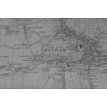

An early 20th Century Ordnance Survey map of Northumberland
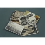
A quantity of late 19th / early 20th Century postcards depicting British views including Pine
A quantity of late 19th / early 20th Century postcards depicting British views including Pine Walks Silloth, Hayton, Pierrott's Happy Valley, Sill...
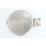
A late 19th Century Troughton & Simms field survey prismatic compass in anodised brass, 7.5 cm
A late 19th Century Troughton & Simms field survey prismatic compass in anodised brass, 7.5 cm ...[more]
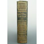
Whellan, "The History and Topography of the Counties of Cumberland and Westmorland", Whellan et
Whellan, "The History and Topography of the Counties of Cumberland and Westmorland", Whellan et al, 1860
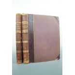
Picturesque Europe, the British Isles, Cassell, Petter & Galpin, nd, circa 1860, two volumes, half
Picturesque Europe, the British Isles, Cassell, Petter & Galpin, nd, circa 1860, two volumes, half calf ...[more]
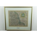
Mercator, "Eboracum Lincolnia, Derbia, Staffordia, Notinghamia, Lecestria, Rutlandia, et Norfolcia",
Mercator, "Eboracum Lincolnia, Derbia, Staffordia, Notinghamia, Lecestria, Rutlandia, et Norfolcia", from the "Atlas Sive Cosmographia", first pub...
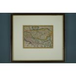
Pieter van den Keere (1571 - circa 1646) "Daciarum, Moesiarumque, Vetus Descriptio", a watercolour-
Pieter van den Keere (1571 - circa 1646) "Daciarum, Moesiarumque, Vetus Descriptio", a watercolour-tinted engraved map of Bulgaria and Romania, to...