Refine your search
Filtered by:
- Category,
- Item Type
- List
- Grid
A subscription to the Price Guide is required to view results for auctions ten days or older. Click here for more information
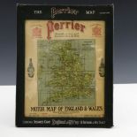

A George V advertising Perrier Motor Map of England & Wales, in celluloid fronted slip case ...[more]
Warwickshire, a collection of thirty-one 17th to 19th century maps, including an engraved miniature map by T. Jenner/Jacob Van Langeren, 1643, 10....
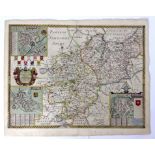
John Speed, Worcestershire Described, London: Thomas Bassett & Richard Chiswell, circa 1676, hand-
John Speed, Worcestershire Described, London: Thomas Bassett & Richard Chiswell, circa 1676, hand-coloured engraved map, inset town plan of Worces...
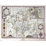
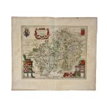
Christopher Saxton and Philip Lea, Warwickshire and Leicestershire, circa 1693, hand-coloured
Christopher Saxton and Philip Lea, Warwickshire and Leicestershire, circa 1693, hand-coloured engraved map, inset town plans of Warwick, Coventry ...
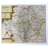
Saxton & Kip, Warwickshire, circa 1637, hand-coloured engraved map on laid paper, 30cm x 36cm,
Saxton & Kip, Warwickshire, circa 1637, hand-coloured engraved map on laid paper, 30cm x 36cm, unframed ...[more]
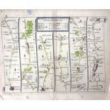
John Senex, The Road from Glocester to Coventry, The Road from Hereford to Leicester, The Road
John Senex, The Road from Glocester to Coventry, The Road from Hereford to Leicester, The Road from Bristol to Banbury, The Road from Bristol to W...
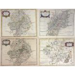
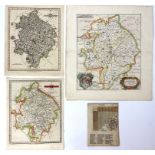
Robert Morden, Oxfordshire, 1722, 42cm x 36cm; Warwickshire, 1722, 36.5cm x 42cm; Worcestershire,
Robert Morden, Oxfordshire, 1722, 42cm x 36cm; Warwickshire, 1722, 36.5cm x 42cm; Worcestershire, 1722, 36cm x 42cm; Gloucestershire, 1722, 35cm x...
Johannes Blaeu, Wigorniensis Comitatus et Comitatus Warwicensis; nec non Coventrae Libertas,
Johannes Blaeu, Wigorniensis Comitatus et Comitatus Warwicensis; nec non Coventrae Libertas, Worcester, Warwik Shire and the Liberty of Coventre, ...
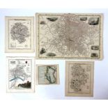
English counties, a collection of thirteen 18th to 19th century maps, including A Mappe of the
English counties, a collection of thirteen 18th to 19th century maps, including A Mappe of the County of Worcester by Richard Blome/Thomas Taylor,...
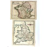
British Isles and France, a collection of four 18th to 19th century maps, including a New Map of
British Isles and France, a collection of four 18th to 19th century maps, including a New Map of England and Wales by Thomas Kitchin, 1764, 50cm x...