Refine your search
Estimate
Category
- Books & Periodicals (386)
- Maps (47)
- Prints (13)
- Clocks (11)
- Arms, Armour & Militaria (8)
- Ceramics (8)
- Stamps (8)
- Furniture (5)
- Models, Toys, Dolls & Games (5)
- Sporting Memorabilia & Equipment (5)
- Taxidermy & Natural History (5)
- Collectables (4)
- Greek, Roman, Egyptian & Other Antiquities (3)
- Textiles (3)
- Watercolours (3)
- Coins (2)
- Photographs (2)
- Scientific Instruments (2)
- Bank notes (1)
- Cameras & Camera Equipment (1)
- Chinese Works of Art (1)
- Classic Cars, Motorcycles & Automobilia (1)
- Entertainment Memorabilia (1)
- Glassware (1)
- Kitchenalia (1)
- Oil, Acrylic paintings & Mixed Media (1)
- Silver & Silver-plated items (1)
- Wines & Spirits (1)
Filtered by:
- Creator / Brand
- List
- Grid
A subscription to the Price Guide is required to view results for auctions ten days or older. Click here for more information
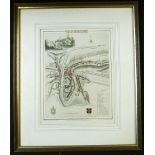
![ROBERT MORDEN: SHROPSHIRE, engraved hand coloured map [1695], approx 360 x 420mm, framed and glazed](https://portal-images.azureedge.net/auctions-2021/srkey10517/images/abeba422-27b8-4336-8126-ad4700f7a084.jpg?w=155&h=155)

ROBERT MORDEN: SHROPSHIRE, engraved hand coloured map [1695], approx 360 x 420mm, framed and glazed
ROBERT MORDEN: SHROPSHIRE, engraved hand coloured map [1695], approx 360 x 420mm, framed and glazed* vat on buyers premium for this lot * ...[mor...
![ROBERT MORDEN: DEVONSHIRE, engraved hand coloured map [1695], approx 355 x 410mm, framed and glazed](https://portal-images.azureedge.net/auctions-2021/srkey10517/images/649ae120-f87b-4e9d-8e21-ad4700f7a1b3.jpg?w=155&h=155)
ROBERT MORDEN: DEVONSHIRE, engraved hand coloured map [1695], approx 355 x 410mm, framed and glazed
ROBERT MORDEN: DEVONSHIRE, engraved hand coloured map [1695], approx 355 x 410mm, framed and glazed* vat on buyers premium for this lot * ...[mor...
![ROBERT MORDEN: SUFFOLK, engraved hand coloured map [1695], approx 360 x 420mm, framed and glazed](https://portal-images.azureedge.net/auctions-2021/srkey10517/images/d529fe01-bcca-4e7d-be1b-ad4700f7a2a4.jpg?w=155&h=155)
ROBERT MORDEN: SUFFOLK, engraved hand coloured map [1695], approx 360 x 420mm, framed and glazed
ROBERT MORDEN: SUFFOLK, engraved hand coloured map [1695], approx 360 x 420mm, framed and glazed* vat on buyers premium for this lot * ...[more]
![ROBERT MORDEN: BARKSHIRE, engraved hand coloured map [1695], approx 355 x 420mm, framed and glazed](https://portal-images.azureedge.net/auctions-2021/srkey10517/images/924b6c5e-fc40-4658-994d-ad4700f7a389.jpg?w=155&h=155)
ROBERT MORDEN: BARKSHIRE, engraved hand coloured map [1695], approx 355 x 420mm, framed and glazed
ROBERT MORDEN: BARKSHIRE, engraved hand coloured map [1695], approx 355 x 420mm, framed and glazed* vat on buyers premium for this lot * ...[more]
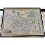
JOHN SPEED: THE WEST RIDINGE OF YORKESHYRE WITH THE MOST FAMOUS AND FAYRE CITIE YORKE DESCRIBED,
JOHN SPEED: THE WEST RIDINGE OF YORKESHYRE WITH THE MOST FAMOUS AND FAYRE CITIE YORKE DESCRIBED, engraved hand coloured map [1616], Latin text ver...
![ROBERT MORDEN: 2 engraved hand coloured maps comprising NORTHAMPTONSHIRE [1695], approx 355 x 415mm,](https://portal-images.azureedge.net/auctions-2021/srkey10517/images/682fb702-09a6-4b30-8af3-ad4700f7a59e.jpg?w=155&h=155)
ROBERT MORDEN: 2 engraved hand coloured maps comprising NORTHAMPTONSHIRE [1695], approx 355 x 415mm,
ROBERT MORDEN: 2 engraved hand coloured maps comprising NORTHAMPTONSHIRE [1695], approx 355 x 415mm, framed and glazed, LEICESTERSHIRE, [1695], ap...
![ROBERT MORDEN: BUCKINGHAM SHIRE, engraved hand coloured map, [1695], approx 420 x 345mm, framed](https://portal-images.azureedge.net/auctions-2021/srkey10517/images/81df622c-d2fa-4cc1-bc34-ad4700f7a68b.jpg?w=155&h=155)
ROBERT MORDEN: BUCKINGHAM SHIRE, engraved hand coloured map, [1695], approx 420 x 345mm, framed
ROBERT MORDEN: BUCKINGHAM SHIRE, engraved hand coloured map, [1695], approx 420 x 345mm, framed and glazed* vat on buyers premium for this lot * ...
![PLAN OF THE BATTLE OF OUDENARD FOUGHT JULY 11TH 1708, engraved hand coloured plan [1751], approx 390](https://portal-images.azureedge.net/auctions-2021/srkey10517/images/ba754048-49a0-4e35-8eff-ad4700f7a770.jpg?w=155&h=155)
PLAN OF THE BATTLE OF OUDENARD FOUGHT JULY 11TH 1708, engraved hand coloured plan [1751], approx 390
PLAN OF THE BATTLE OF OUDENARD FOUGHT JULY 11TH 1708, engraved hand coloured plan [1751], approx 390 x 470mm, framed and glazed* vat on buyers pre...
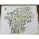
JOHN CARY: A MAP OF WESTMORLAND FROM THE BEST AUTHORITIES, engraved hand coloured map, 1806,
JOHN CARY: A MAP OF WESTMORLAND FROM THE BEST AUTHORITIES, engraved hand coloured map, 1806, approx 390 x 480mm, framed and glazed* vat on buyers ...
![ROBERT MORDEN: NORTHUMBERLAND, engraved hand coloured map [1695], approx 415 x 350mm, framed and](https://portal-images.azureedge.net/auctions-2021/srkey10517/images/62471f45-b00b-4283-9f86-ad4700f7a92b.jpg?w=155&h=155)
ROBERT MORDEN: NORTHUMBERLAND, engraved hand coloured map [1695], approx 415 x 350mm, framed and
ROBERT MORDEN: NORTHUMBERLAND, engraved hand coloured map [1695], approx 415 x 350mm, framed and glazed* vat on buyers premium for this lot * ......
![ROBERT MORDEN: THE COUNTY OF MONMOUTH, engraved map [1695], approx 345 x 450mm + HERMAN MOLL:](https://portal-images.azureedge.net/auctions-2021/srkey10517/images/5d5457a0-c6f9-412b-a6e9-ad4700f7aa1d.jpg?w=155&h=155)
ROBERT MORDEN: THE COUNTY OF MONMOUTH, engraved map [1695], approx 345 x 450mm + HERMAN MOLL:
ROBERT MORDEN: THE COUNTY OF MONMOUTH, engraved map [1695], approx 345 x 450mm + HERMAN MOLL: MONMOUTHSHIRE, engraved map [1724], approx 190 x 250...
![ROBERT MORDEN: SHROP SHIRE, engraved hand coloured map [1695], approx 355 x 420mm, framed and](https://portal-images.azureedge.net/auctions-2021/srkey10517/images/512c096e-b9d3-4acf-bc53-ad4700f475a0.jpg?w=155&h=155)
ROBERT MORDEN: SHROP SHIRE, engraved hand coloured map [1695], approx 355 x 420mm, framed and
ROBERT MORDEN: SHROP SHIRE, engraved hand coloured map [1695], approx 355 x 420mm, framed and glazed* vat on buyers premium for this lot * ...[mo...
![RICHARD BLOME: A GENERAL MAPP OF THE COUNTY OF HEREFORD, engraved hand coloured map [1673], approx](https://portal-images.azureedge.net/auctions-2021/srkey10517/images/7f18497b-705c-446a-a4f2-ad4700f7abd4.jpg?w=155&h=155)
RICHARD BLOME: A GENERAL MAPP OF THE COUNTY OF HEREFORD, engraved hand coloured map [1673], approx
RICHARD BLOME: A GENERAL MAPP OF THE COUNTY OF HEREFORD, engraved hand coloured map [1673], approx 310 x 285mm, laid down, framed but not glazed* ...

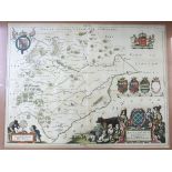
JOAN BLAUE: COMITATUS SALOPIENSIS..., engraved hand coloured map, circa 1645, approx 375 x 490mm,
JOAN BLAUE: COMITATUS SALOPIENSIS..., engraved hand coloured map, circa 1645, approx 375 x 490mm, double glazed* vat on buyers premium for this lo...
![ROBERT MORDEN: 2 engraved hand coloured maps comprising THE WEST RIDING OF YORKSHIRE, [1695], approx](https://portal-images.azureedge.net/auctions-2021/srkey10517/images/d8715c0e-d8c8-41d7-8b45-ad4700f7ad70.jpg?w=155&h=155)
ROBERT MORDEN: 2 engraved hand coloured maps comprising THE WEST RIDING OF YORKSHIRE, [1695], approx
ROBERT MORDEN: 2 engraved hand coloured maps comprising THE WEST RIDING OF YORKSHIRE, [1695], approx 355 x 420mm, framed and glazed: THE EAST RIDI...
OWEN/BOWEN, 2 hand coloured engraved road maps, 1736, printed recto and verso, comprising THE ROAD
OWEN/BOWEN, 2 hand coloured engraved road maps, 1736, printed recto and verso, comprising THE ROAD FROM YORK TO WHITBY AND SCARBOROUGH, inset map ...
![ROBERT MORDEN: 2 engraved hand coloured maps comprising LEICESTER SHIRE [1695], approx 355 x](https://portal-images.azureedge.net/auctions-2021/srkey10517/images/f3a666a5-4ad0-44d0-ba93-ad4700f7aff2.jpg?w=155&h=155)
ROBERT MORDEN: 2 engraved hand coloured maps comprising LEICESTER SHIRE [1695], approx 355 x
ROBERT MORDEN: 2 engraved hand coloured maps comprising LEICESTER SHIRE [1695], approx 355 x 420mm, framed and glazed; WARWICK SHIRE [1695], appro...
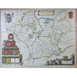
JOAN BLAEU: RUTLANDIA COMITATUS, engraved hand coloured map circa 1646, French text verso, approx
JOAN BLAEU: RUTLANDIA COMITATUS, engraved hand coloured map circa 1646, French text verso, approx 375 x 495mm, double * vat on buyers premium for ...
JOAN BLAUE: LEICENTRENSIS COMITATUS, engraved hand coloured map circa 1645, approx 380 x 500mm,
JOAN BLAUE: LEICENTRENSIS COMITATUS, engraved hand coloured map circa 1645, approx 380 x 500mm, framed and glazed* vat on buyers premium for this ...
![JOHN SPEED: DENBIGHSHIRE, engraved hand coloured map [1611], approx 380 x 510mm, framed and glazed](https://portal-images.azureedge.net/auctions-2021/srkey10517/images/984cb834-580b-4128-a71b-ad4700f7c95c.jpg?w=155&h=155)
JOHN SPEED: DENBIGHSHIRE, engraved hand coloured map [1611], approx 380 x 510mm, framed and glazed
JOHN SPEED: DENBIGHSHIRE, engraved hand coloured map [1611], approx 380 x 510mm, framed and glazed* vat on buyers premium for this lot * ...[more]
GILLES ROBERT DE VAUGONDY: LE ROYAUM D'ANGLETERRE..., engraved outline coloured map, circa 1753,
GILLES ROBERT DE VAUGONDY: LE ROYAUM D'ANGLETERRE..., engraved outline coloured map, circa 1753, approx 475 x 510mm, framed and glazed* vat on buy...
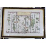
OWEN/BOWEN: 3 hand coloured engraved road maps circa 1736, printed recto and verso, comprising THE
OWEN/BOWEN: 3 hand coloured engraved road maps circa 1736, printed recto and verso, comprising THE ROAD FROM BRISTOL TO WESTCHESTER..., inset map ...
![ROBERT MORDEN: STAFFORD SHIRE, engraved hand coloured map [1695], approx 430 x 365mm, framed and](https://portal-images.azureedge.net/auctions-2021/srkey10517/images/0634fec2-0a2f-4de6-82d8-ad4700f7cb91.jpg?w=155&h=155)
ROBERT MORDEN: STAFFORD SHIRE, engraved hand coloured map [1695], approx 430 x 365mm, framed and
ROBERT MORDEN: STAFFORD SHIRE, engraved hand coloured map [1695], approx 430 x 365mm, framed and glazed* vat on buyers premium for this lot * ......
CHRISTOPHER SAXTON/WILLIAM KIP: WESTMORLANDIAE COMITATUS..., engraved hand coloured map circa
CHRISTOPHER SAXTON/WILLIAM KIP: WESTMORLANDIAE COMITATUS..., engraved hand coloured map circa 1697, approx 260 x 310mm, framed and glazed + ROBERT...
![ROBERT MORDEN: ENGLAND, engraved hand coloured map [1695], approx 365 x 425mm, framed and glazed](https://portal-images.azureedge.net/auctions-2021/srkey10517/images/697b1c40-7e3a-4171-9b4b-ad4700f7ccff.jpg?w=155&h=155)
ROBERT MORDEN: ENGLAND, engraved hand coloured map [1695], approx 365 x 425mm, framed and glazed
ROBERT MORDEN: ENGLAND, engraved hand coloured map [1695], approx 365 x 425mm, framed and glazed* vat on buyers premium for this lot * ...[more]
Box: A & C Black "Peeps at" Series, 50+ assorted titles ...[more]
Box:, Devon and Cornwall interest
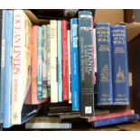
from Box: Mixed including Art and Architecture from the collectionªof Derek Cottam
Box: Mixed, including modern foreign topography, from the collection of Derek Cottam
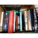
Box: mixed, from the collection of Derek Cottam
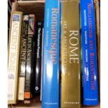
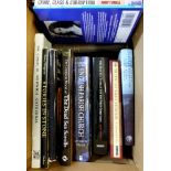
Box: mixed, including Ancient Rome, from the collection of Derek Cottam
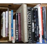
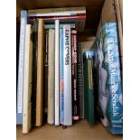
Box: mixed, mainly coffee table titles, from the collection of Derek Cottam
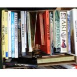
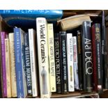
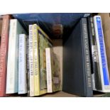
Box: Art, from the collection of Derek Cottam
Box: Art, from the collection of Derek Cottam
Box: mixed, from the collection of Derek Cottam
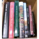
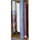
Box:, UK travel and topography, from the collection of Derek Cottam
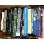
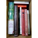
Box: mixed, including Natural History, from the collection of Derek Cottam
Box:, Egypt and Tutankhamun interest, from the collection of Derek Cottam
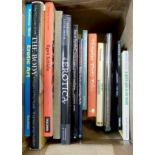
Box: Erotica, from the collection of Derek Cottam
Box: mixed, from the collection of Derek Cottam

Box: mixed, from the collection of Derek Cottam
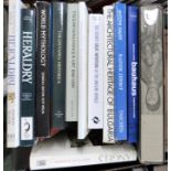
Box: Antiques and collecting, from the collection of Derek Cottam
Box: mixed, from the collection of Derek Cottam
Box: mixed, from the collection of Derek Cottam
Box: modern atlases etc, from the collection of Derek Cottam
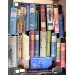
Box: mixed, mainly pictorial cloth