
Refine your search
Sale Section
Remove filter- Ephemera, Items of Historical Interest & Printed Collectables (4)
- Maps, Atlases, Prints etc. (30)
- Miscellaneous Collections (2)
- Mixed Subjects Inc. Transport, Military, Antiquarian, Science etc. (1)
- Modern First Editions inc. Science Fiction, Literature, Poetry & Detec (1)
- Travel & Topography inc. Local Interest (4)
Estimate
Category
Remove filter- Maps (42)
Filtered by:
- Sale Section,
- Category
- List
- Grid
This auctioneer has chosen to not publish their results. Please contact them directly for any enquiries.
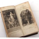

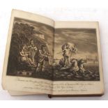
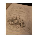
HENRY MACKENZIE: THE WORKS, London for J Walker, 1816, added engraved vignette title, frontis, 12mo,
HENRY MACKENZIE: THE WORKS, London for J Walker, 1816, added engraved vignette title, frontis, 12mo, contemporary calf worn
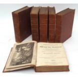
MATTHEW HENRY: AN EXPOSITION OF THE OLD AND NEW TESTAMENT, Edited George Burder and Joseph Hughes,
MATTHEW HENRY: AN EXPOSITION OF THE OLD AND NEW TESTAMENT, Edited George Burder and Joseph Hughes, London, for Samuel Bagster, 1811, new edition, ...
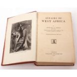
EDMUND D MOREL: AFFAIRS OF WEST AFRICA, London, William Heinemann, 1902, 1st edition, 3 maps (of
EDMUND D MOREL: AFFAIRS OF WEST AFRICA, London, William Heinemann, 1902, 1st edition, 3 maps (of which one folding) + 36 full page plates (plate f...
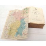
KELLY'S DIRECTORY OF THE COUNTIES OF CAMBRIDGE, NORFOLK AND SUFFOLK, 1912, 3 folding maps as
KELLY'S DIRECTORY OF THE COUNTIES OF CAMBRIDGE, NORFOLK AND SUFFOLK, 1912, 3 folding maps as called for, (map of Norfolk with tape repair verso), ...
HENRY SKRINE: A GENERAL ACCOUNT OF ALL THE RIVERS OF NOTE IN GREAT BRITAIN ..., London, T Bensley
HENRY SKRINE: A GENERAL ACCOUNT OF ALL THE RIVERS OF NOTE IN GREAT BRITAIN ..., London, T Bensley for P Elmsly, 1801, 1st edition, double page aqu...
KELLY'S DIRECTORY OF THE COUNTIES OF NORFOLK AND SUFFOLK 1937, 2 folding coloured maps, original
KELLY'S DIRECTORY OF THE COUNTIES OF NORFOLK AND SUFFOLK 1937, 2 folding coloured maps, original cloth gilt, original cardboard box packaging dire...
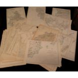
One box: good quantity vintage folding maps including Ordnance Survey 1ins circa 1950s etc, housed
One box: good quantity vintage folding maps including Ordnance Survey 1ins circa 1950s etc, housed in 4 box files
Two boxes: Vintage folding maps, travel guides, travel and topography etc
THOMAS COOK & SON, 2 titles: COOK'S TOURS AND EXCURSIONS BY ALL ROUTES, New York 1874, 2 folding
THOMAS COOK & SON, 2 titles: COOK'S TOURS AND EXCURSIONS BY ALL ROUTES, New York 1874, 2 folding maps, original wraps; COLORADO, NEW MEXICO AND CA...
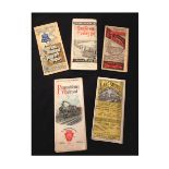
CHICAGO, ROCK ISLAND AND PACIFIC RAILWAY, 2 folding timetables, 1885 and 1890, each with a large
CHICAGO, ROCK ISLAND AND PACIFIC RAILWAY, 2 folding timetables, 1885 and 1890, each with a large coloured map, each original wraps plus CHICAGO AN...
RICHELIEU AND ONTARIO NAVIGATION COMPANY: THROUGH THE 1000 ISLANDS AND RAPIDS OF ST LAWRENCE, 1890
RICHELIEU AND ONTARIO NAVIGATION COMPANY: THROUGH THE 1000 ISLANDS AND RAPIDS OF ST LAWRENCE, 1890 folding timetable/guide, 3 maps and 1 large she...
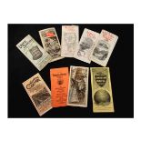
DELAWARE AND HUDSON RAILROAD, folding guide, SUMMER RESORTS IN NEW YORK, circa 1891, 3 maps on 1
DELAWARE AND HUDSON RAILROAD, folding guide, SUMMER RESORTS IN NEW YORK, circa 1891, 3 maps on 1 large sheet, original pictorial wraps, plus SAME ...

EMANUEL BOWEN: AN ACCURATE MAP OF THE COUNTY OF NORFOLK ..., engraved hand coloured folding map,
EMANUEL BOWEN: AN ACCURATE MAP OF THE COUNTY OF NORFOLK ..., engraved hand coloured folding map, 1749, 16 sections backed onto linen, some heavy ...
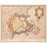
J BASIRE: MENIN, A VERY STRONG TOWN IN THE EARLDOM OF FLANDERS TAKEN BY YE ALLIES IN THE YEAR 1706
J BASIRE: MENIN, A VERY STRONG TOWN IN THE EARLDOM OF FLANDERS TAKEN BY YE ALLIES IN THE YEAR 1706 AND RETAKEN BY YE FRENCH IN 1744, hand coloured...
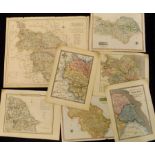
![R MORDEN: KENT, engraved hand coloured map [1695], approx 350 x 630mm framed and glazed](https://portal-images.azureedge.net/auctions-2017/srkey10163/images/d0bd2133-6767-4309-c8fe-a08ed497be71.jpg?w=155&h=155)
R MORDEN: KENT, engraved hand coloured map [1695], approx 350 x 630mm framed and glazed
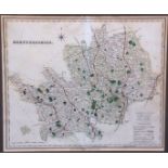
H TEESDALE: HERTFORDSHIRE, engraved hand coloured map circa 1832, approx 335 x 405mm framed and
H TEESDALE: HERTFORDSHIRE, engraved hand coloured map circa 1832, approx 335 x 405mm framed and glazed
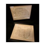
![JOHN SPEED: YORKSHIRE, engraved hand coloured map, [1710], faults (A/F), approx size 370 x 580mm,](https://portal-images.azureedge.net/auctions-2017/srkey10163/images/28b3d592-9695-46ea-8994-6abf0e6a2609.jpg?w=155&h=155)
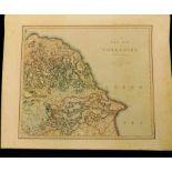
JOHN SPEED: YORKSHIRE, engraved hand coloured map, [1710], faults (A/F), approx size 370 x 580mm,
JOHN SPEED: YORKSHIRE, engraved hand coloured map, [1710], faults (A/F), approx size 370 x 580mm, framed and glazed
J CARY: NORFOLK, engraved hand coloured map circa 1818, approx 210 x 260mm framed and glazed plus
J CARY: NORFOLK, engraved hand coloured map circa 1818, approx 210 x 260mm framed and glazed plus J ARCHER: DORSETSHIRE, engraved hand coloured ma...
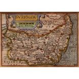
P VAN DEN KEERE: SUFFOLCK, engraved hand coloured map circa 1627, approx 85 x 120mm framed and
P VAN DEN KEERE: SUFFOLCK, engraved hand coloured map circa 1627, approx 85 x 120mm framed and glazed
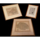
S LEWIS: NORFOLK - SUFFOLK, 2 engraved hand coloured maps circa 1840 each approx 235 x 325mm, framed
S LEWIS: NORFOLK - SUFFOLK, 2 engraved hand coloured maps circa 1840 each approx 235 x 325mm, framed and glazed (2)
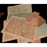
JOHN BARTHOLOMEW: THE IMPERIAL MAP OF ENGLAND AND WALES ACCORDING TO THE ORDNANCE SURVEY WITH THE
JOHN BARTHOLOMEW: THE IMPERIAL MAP OF ENGLAND AND WALES ACCORDING TO THE ORDNANCE SURVEY WITH THE LATEST ADDITIONS SHEWING CLEARLY EVERY FEATURE O...
Packet: circa 95 hand coloured engraved world maps 1860s
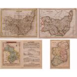
T T ARCHER: SUFFOLK, engraved hand coloured map circa 1848, approx 165 x 220mm, together with
T T ARCHER: SUFFOLK, engraved hand coloured map circa 1848, approx 165 x 220mm, together with JAMES S VERTUE: SUFFOLK, engraved hand coloured map ...
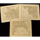
J ROPER: YORKSHIRE, WEST RIDING, PART OF THE NORTH RIDING, PARTS OF THE EAST AND WEST RIDING, 3
J ROPER: YORKSHIRE, WEST RIDING, PART OF THE NORTH RIDING, PARTS OF THE EAST AND WEST RIDING, 3 engraved hand coloured maps, circa 1809, each appr...
![J AITKEN: YORKSHIRE, hand coloured engraved map [1790], approx 115 x 200m + 5 other hand coloured](https://portal-images.azureedge.net/auctions-2017/srkey10163/images/78259cd1-2d97-4e33-9d57-471ca3ffdfbb.jpg?w=155&h=155)
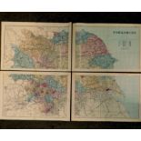
J AITKEN: YORKSHIRE, hand coloured engraved map [1790], approx 115 x 200m + 5 other hand coloured
J AITKEN: YORKSHIRE, hand coloured engraved map [1790], approx 115 x 200m + 5 other hand coloured engraved Yorkshire maps - G KEMP: WEST RIDING, p...
Packet: 6 assorted 19th century Yorkshire engraved hand coloured maps (6)
WALLACE?: INDEX MAP TO YORKSHIRE, engraved hand coloured map, circa 1825, approx 145 x 150mm plus
WALLACE?: INDEX MAP TO YORKSHIRE, engraved hand coloured map, circa 1825, approx 145 x 150mm plus P MARTIN: YORKSHIRE, engraved hand coloured map,...
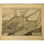
KIP/KNYFF: HAMPTON COURT, engraved bird's eye view circa 1724, approx 335 x 480mm + THE HOUSE AT
KIP/KNYFF: HAMPTON COURT, engraved bird's eye view circa 1724, approx 335 x 480mm + THE HOUSE AT CHISWICK IN THE COUNTY OF MIDDLESEX..., engraved ...
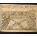
Packet: 3 engraved London views, ex-Stow's Survey circa 1720, Charterhouse Square, Grosvenor
Packet: 3 engraved London views, ex-Stow's Survey circa 1720, Charterhouse Square, Grosvenor Square and Leicester Square, each laid down, approx 3...
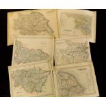
NEELE: NORTH RIDING - WEST RIDING OF YORKSHIRE, 2 engraved hand coloured maps, circa 1818, each
NEELE: NORTH RIDING - WEST RIDING OF YORKSHIRE, 2 engraved hand coloured maps, circa 1818, each approx 210 x 265mm plus COOPER: YORKSHIRE, engrave...
J CARY: A MAP OF GLOCESTERSHIRE FROM THE BEST AUTHORITIES, engraved hand coloured map, 1805,
J CARY: A MAP OF GLOCESTERSHIRE FROM THE BEST AUTHORITIES, engraved hand coloured map, 1805, approx size 470 x 400mm, closed tear bottom left corn...
C SMITH: A NEW MAP OF YORKSHIRE DIVIDED INTO RIDINGS &c, engraved hand coloured map, 1801, 4
C SMITH: A NEW MAP OF YORKSHIRE DIVIDED INTO RIDINGS &c, engraved hand coloured map, 1801, 4 sections, each approx 420 x 500mm (4)
J & C WALKER: NORTH RIDING - WEST RIDING OF YORKSHIRE, 2 engraved hand coloured maps, 1838 and 1839,
J & C WALKER: NORTH RIDING - WEST RIDING OF YORKSHIRE, 2 engraved hand coloured maps, 1838 and 1839, each approx 340 x 415mm plus LETTS SON & CO L...

R CREIGHTON: YORKSHIRE, engraved hand coloured map circa 1842, approx 420 x 520mm plus G PHILIP &
R CREIGHTON: YORKSHIRE, engraved hand coloured map circa 1842, approx 420 x 520mm plus G PHILIP & SON (PUBLISHED): YORKSHIRE, coloured map circa 1...
A SCOBEL (ED): ANDREES ALLGEMEINER HANDATLAS ...,1899, 186 mainly double page maps as list, fo
A SCOBEL (ED): ANDREES ALLGEMEINER HANDATLAS ...,1899, 186 mainly double page maps as list, fo contemporary half calf disbound plus GEORGE PHILIP ...
WILLIAM AND ROBERT CHAMBERS: CHAMBERS'S ATLAS ..., 1855, 36 engraved coloured maps including some
WILLIAM AND ROBERT CHAMBERS: CHAMBERS'S ATLAS ..., 1855, 36 engraved coloured maps including some double page, as called for, 4to contemporary hal...
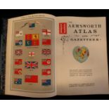
THE HARMSWORTH ATLAS AND GAZETTEER, London, Carmelite House, circa 1910, coloured frontis, 119
THE HARMSWORTH ATLAS AND GAZETTEER, London, Carmelite House, circa 1910, coloured frontis, 119 maps on 210 sheets as called for, fo, original half...
![[JOHN AIKIN]: ENGLAND DELINEATED OR A GEOGRAPHICAL DESCRIPTION OF EVERY COUNTY IN ENGLAND AND](https://portal-images.azureedge.net/auctions-2017/srkey10163/images/d02453c1-fdda-479b-de1e-785ed168ce84.jpg?w=155&h=155)
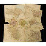
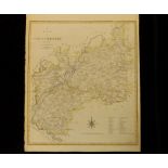
[JOHN AIKIN]: ENGLAND DELINEATED OR A GEOGRAPHICAL DESCRIPTION OF EVERY COUNTY IN ENGLAND AND
[JOHN AIKIN]: ENGLAND DELINEATED OR A GEOGRAPHICAL DESCRIPTION OF EVERY COUNTY IN ENGLAND AND WALES ..., Lonond, 1803, 5th edition, engraved front...
A & C BLACK: BLACK'S SCHOOL ATLAS ..., Edinburgh, 1879, 41 coloured maps including one double
A & C BLACK: BLACK'S SCHOOL ATLAS ..., Edinburgh, 1879, 41 coloured maps including one double page, 4to, original cloth gilt worn plus HERMANN J K...
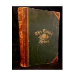
THE TIMES ATLAS, 1895, 117 coloured maps Western/Eastern hemispheres map, reinforced with clear
THE TIMES ATLAS, 1895, 117 coloured maps Western/Eastern hemispheres map, reinforced with clear adhesive tape, fo, original half calf gilt very wo...
ALEXANDER KEITH JOHNSTON: THE ROYAL ATLAS OF MODERN GEOGRAPHY ..., 1875, 48 double page maps as
ALEXANDER KEITH JOHNSTON: THE ROYAL ATLAS OF MODERN GEOGRAPHY ..., 1875, 48 double page maps as called for, large fo, original half crimson mor gi...
Packet: circa 50 engraved prints mainly 19th century, some earlier including 2 UK county maps
Packet: circa 50 engraved prints mainly 19th century, some earlier including 2 UK county maps